| Well Information Table |
|---|
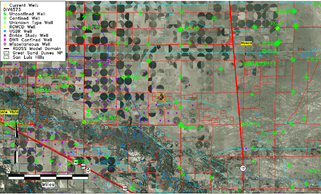
| Common Well ID | DIV6573 |
| USGS Site Use Information | Unknown |
| USGS Groundwater Use Information | Unknown |
| Data Source(s) | Divide Study |
| Location Data |
|---|
| Longitude/Latitude (NAD83) | -105.95176101 , 37.59976469 |
| Longitude/Latitude Data Source | Divide Study |
| Easting, Northing RGDSS-NAD83 (US ft) | 119578.74 , 219949.21 |
| Elevation and Depth Data |
|---|
| Ground Elevation (ft NAVD88) | 7576.89 |
| Elevation Data Source | Divide study surveying by Davis Engineering |
| 1/3-Arc Second NED Ground Elevation (ft NAVD88) | 7579.25 |
| 1-Arc Second NED Ground Elevation (ft NAVD88) | 7576.96 |
| SRTM Ground Elevation (ft NAVD88) | 7583.18 |
| Model Layer | 1 |
| Model Layer Source | Aquifer Type |
| Depth of Bottom of Layer 1 | 82 |
| Depth of Bottom of Layer 2 | 273 |
| Depth of Bottom of Layer 3 | 782 |
| Depth of Bottom of Layer 4 | 1778 |
| Additional Well Information | NONE |
| Aquifer Information |
|---|
| Aquifer Type | Unconfined |
| Aquifer Type Source | DIV_AQ |
| Water-level Database Information |
|---|
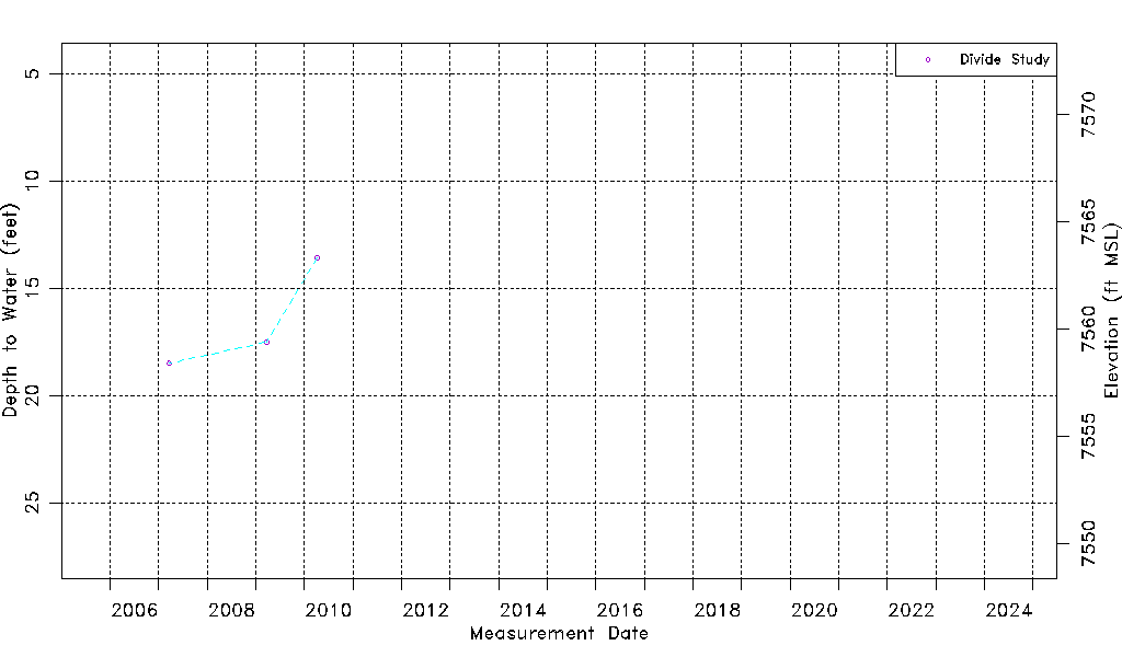
| Water-level Count | 3 |
| Water-level Date Range | 03/20/2007 thru 04/07/2010 |
| Monitored within the last 18 months | No, most recently on 04/07/2010 |
| Depth-to-Water Range (ft) | 13.58 to 18.50 |
| Water Table Elevation Range (ft NAVD88) | 7558.39 to 7563.31 |
| Water-Level-Source:Number-of-Measurements | Divide Study:3 |