Home | Well Information | Hydrograph | Water Level Data Table
| RGWCD Unconfined Wells: | Map | List |
| RGWCD Confined Wells: | Map | List |
| Baca Grant Wells: | Map | List |
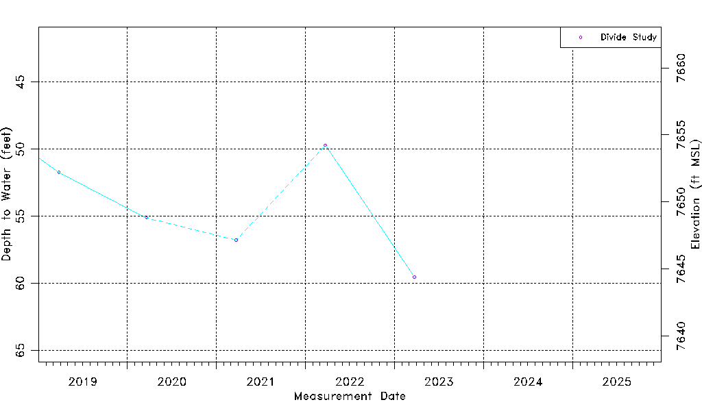
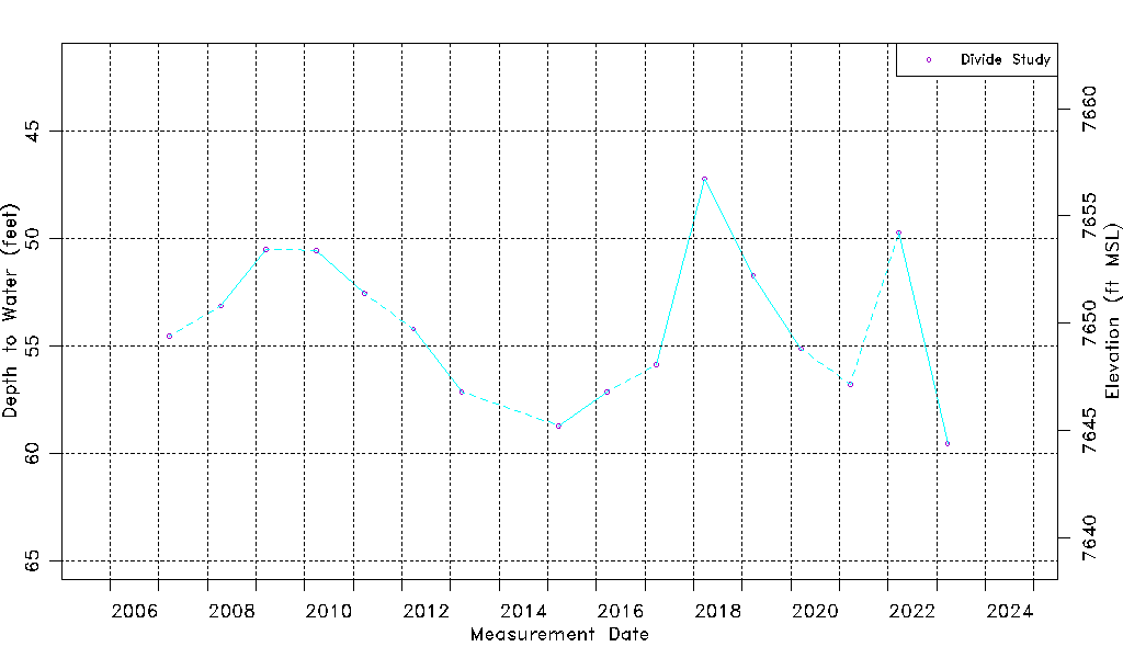
| Divide Study Wells: | Map | List |
| Upper Rio Grande Wells: | Map | List |
| DWR Confined Wells: | Map | List |
| CWCD Wells: | Map | List |
| USBR Wells: | Map | List |
| USGS Wells: | Map | List |
| Dunes Hydro Study Wells: | Map | List |
| GSDNP Boundary Wells: | Map | List |
| Recently Monitored Wells: | Map | List |
| Unconfined Wells: | Map | List |
| Confined Wells: | Map | List |
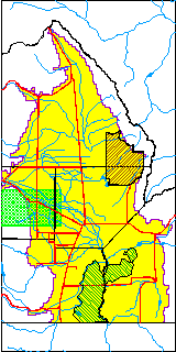
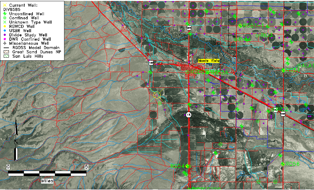
model domain.
Green shaded area
enlarged below.
Click on map
to quickly move to
another location.