| Well Information Table |
|---|
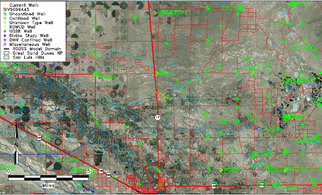
| Common Well ID | DIV9099443 |
| USGS Site Use Information | Unknown |
| USGS Groundwater Use Information | Unknown |
| Data Source(s) | Divide Study |
| Location Data |
|---|
| Longitude/Latitude (NAD83) | -105.85402717 , 37.55344962 |
| Longitude/Latitude Data Source | Divide Study |
| Easting, Northing RGDSS-NAD83 (US ft) | 147852.08 , 203019.31 |
| Elevation and Depth Data |
|---|
| Ground Elevation (ft NAVD88) | 7548.61 |
| Elevation Data Source | Divide study surveying by Davis Engineering |
| 1/3-Arc Second NED Ground Elevation (ft NAVD88) | 7548.04 |
| 1-Arc Second NED Ground Elevation (ft NAVD88) | 7548.58 |
| SRTM Ground Elevation (ft NAVD88) | 7542.65 |
| Model Layer | 1 |
| Model Layer Source | Aquifer Type |
| Depth of Bottom of Layer 1 | 53 |
| Depth of Bottom of Layer 2 | 514 |
| Depth of Bottom of Layer 3 | 935 |
| Depth of Bottom of Layer 4 | 2518 |
| Additional Well Information | NONE |
| Aquifer Information |
|---|
| Aquifer Type | Unconfined |
| Aquifer Type Source | DIV_AQ |
| Water-level Database Information |
|---|
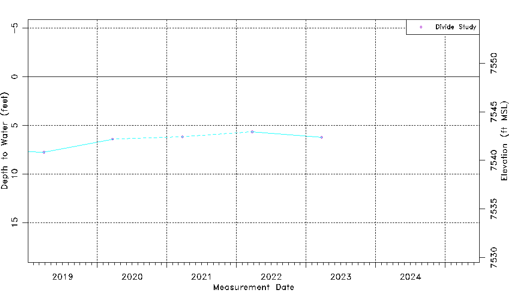
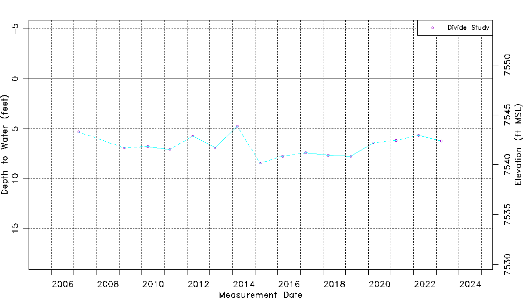
| Water-level Count | 16 |
| Water-level Date Range | 03/20/2007 thru 03/24/2023 |
| Monitored within the last 18 months | No, most recently on 03/24/2023 |
| Depth-to-Water Range (ft) | 4.75 to 8.46 |
| Water Table Elevation Range (ft NAVD88) | 7540.15 to 7543.86 |
| Water-Level-Source:Number-of-Measurements | Divide Study:16 |