| Well Information Table |
|---|
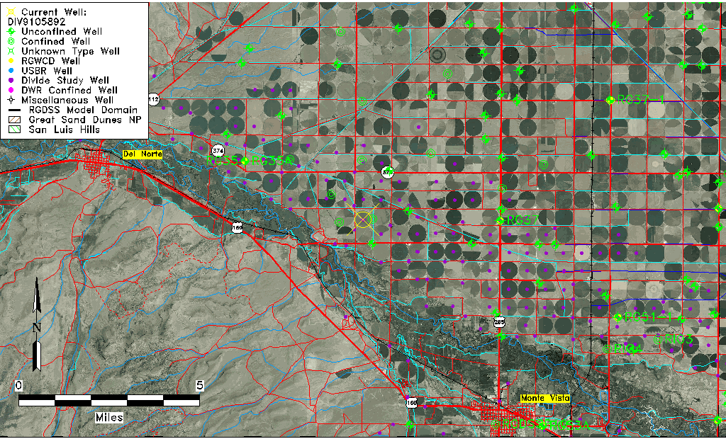
| Common Well ID | DIV9105892 |
| USGS Site Use Information | Unknown |
| USGS Groundwater Use Information | Unknown |
| Data Source(s) | Divide Study |
| Location Data |
|---|
| Longitude/Latitude (NAD83) | -106.21787078 , 37.65667407 |
| Longitude/Latitude Data Source | Divide Study |
| Easting, Northing RGDSS-NAD83 (US ft) | 42624.90 , 241007.90 |
| Elevation and Depth Data |
|---|
| Ground Elevation (ft NAVD88) | 7748.39 |
| Elevation Data Source | Divide study surveying by Davis Engineering |
| 1/3-Arc Second NED Ground Elevation (ft NAVD88) | 7748.14 |
| 1-Arc Second NED Ground Elevation (ft NAVD88) | 7747.41 |
| SRTM Ground Elevation (ft NAVD88) | 7759.19 |
| Model Layer | 1 |
| Model Layer Source | Aquifer Type |
| Depth of Bottom of Layer 1 | 47 |
| Depth of Bottom of Layer 2 | 178 |
| Depth of Bottom of Layer 3 | 313 |
| Depth of Bottom of Layer 4 | 930 |
| Additional Well Information | NONE |
| Aquifer Information |
|---|
| Aquifer Type | Unconfined |
| Aquifer Type Source | DIV_AQ |
| Water-level Database Information |
|---|
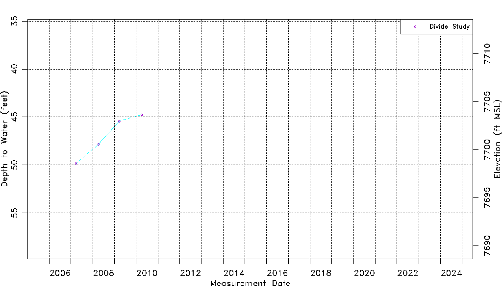
| Water-level Count | 4 |
| Water-level Date Range | 03/27/2007 thru 04/05/2010 |
| Monitored within the last 18 months | No, most recently on 04/05/2010 |
| Depth-to-Water Range (ft) | 44.75 to 49.83 |
| Water Table Elevation Range (ft NAVD88) | 7698.56 to 7703.64 |
| Water-Level-Source:Number-of-Measurements | Divide Study:4 |