| Well Information Table |
|---|
| Common Well ID | DUN113t |
| GSDNP Well Name | 113t |
| USGS Site Use Information | Unknown |
| USGS Groundwater Use Information | Unknown |
| Data Source(s) | HRS |
| Location Data |
|---|
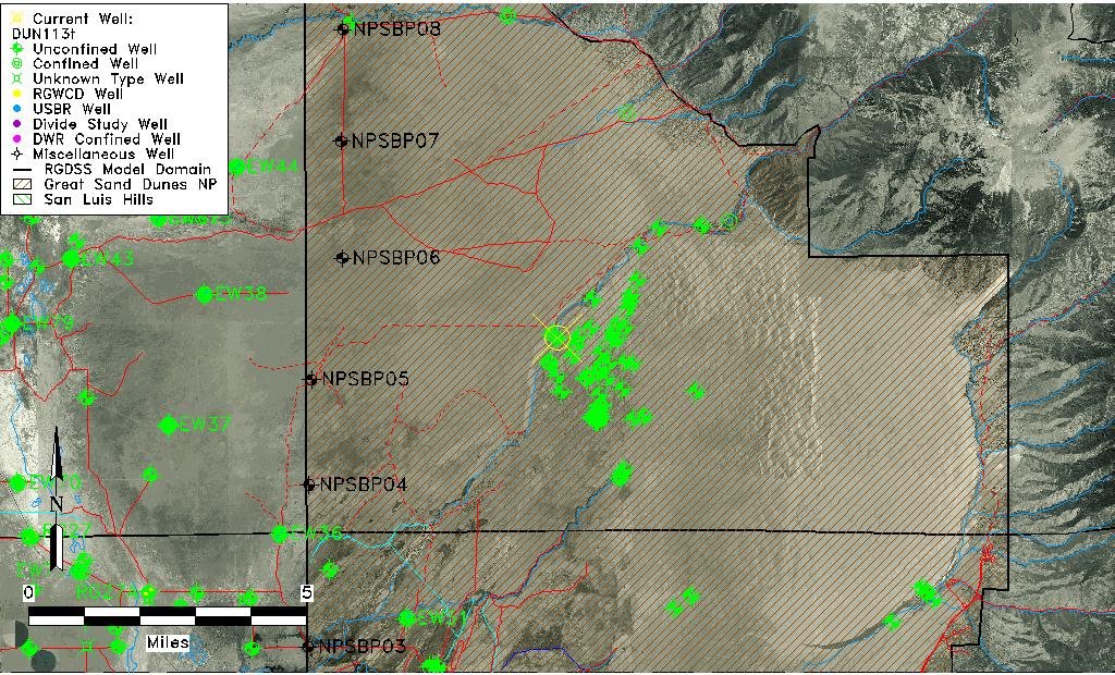
| Longitude/Latitude (NAD83) | -105.64555516 , 37.80240950 |
| Longitude/Latitude Data Source | HRS Dunes database |
| Easting, Northing RGDSS-NAD83 (US ft) | 208246.33 , 293591.55 |
| Elevation and Depth Data |
|---|
| Ground Elevation (ft NAVD88) | 7703.23 |
| Elevation Data Source | HRS Dunes database |
| HRS Dunes Well database (ft NGVD29) | 7699.00000 |
| 1/3-Arc Second NED Ground Elevation (ft NAVD88) | 7703.17 |
| 1-Arc Second NED Ground Elevation (ft NAVD88) | 7715.38 |
| SRTM Ground Elevation (ft NAVD88) | 7706.70 |
| Model Layer | 1 |
| Model Layer Source | Aquifer Type |
| Depth of Bottom of Layer 1 | 255 |
| Depth of Bottom of Layer 2 | 638 |
| Depth of Bottom of Layer 3 | 1281 |
| Depth of Bottom of Layer 4 | 2488 |
| Additional Well Information | NONE |
| Aquifer Information |
|---|
| Aquifer Type | Unconfined |
| Aquifer Type Source | HRS_AQUIFER |
| Water-level Database Information |
|---|
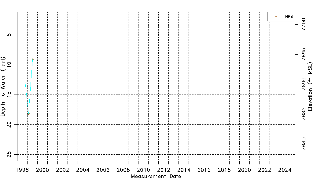
| Water-level Count | 3 |
| Water-level Date Range | 10/23/1998 thru 07/15/1999 |
| Monitored within the last 18 months | No, most recently on 07/15/1999 |
| Depth-to-Water Range (ft) | 9.10 to 18.16 |
| Water Table Elevation Range (ft NAVD88) | 7685.07 to 7694.13 |
| Water-Level-Source:Number-of-Measurements | HRS:3 |