| Well Information Table |
|---|
| Common Well ID | DUN29 |
| GSDNP Well Name | 29 |
| USGS Site Use Information | Unknown |
| USGS Groundwater Use Information | Unknown |
| Data Source(s) | HRS |
| Location Data |
|---|
| Longitude/Latitude (NAD83) | -105.72922617 , 37.69945928 |
| Longitude/Latitude Data Source | HRS Dunes database |
| Easting, Northing RGDSS-NAD83 (US ft) | 184054.30 , 256121.39 |
| Elevation and Depth Data |
|---|
| Ground Elevation (ft NAVD88) | 7528.20 |
| Elevation Data Source | CSU well databse |
| CSU Dunes Well database (ft NGVD29) | 7524.14 |
| HRS Dunes Well database (ft NGVD29) | 7524.14014 |
| 1/3-Arc Second NED Ground Elevation (ft NAVD88) | 7533.84 |
| 1-Arc Second NED Ground Elevation (ft NAVD88) | 7533.04 |
| SRTM Ground Elevation (ft NAVD88) | 7536.09 |
| Model Layer | 1 |
| Model Layer Source | Aquifer Type |
| Depth of Bottom of Layer 1 | 139 |
| Depth of Bottom of Layer 2 | 442 |
| Depth of Bottom of Layer 3 | 1633 |
| Depth of Bottom of Layer 4 | 3354 |
| Additional Well Information | NONE |
| Aquifer Information |
|---|
| Aquifer Type | Unconfined |
| Aquifer Type Source | HRS_AQUIFER |
| Water-level Database Information |
|---|
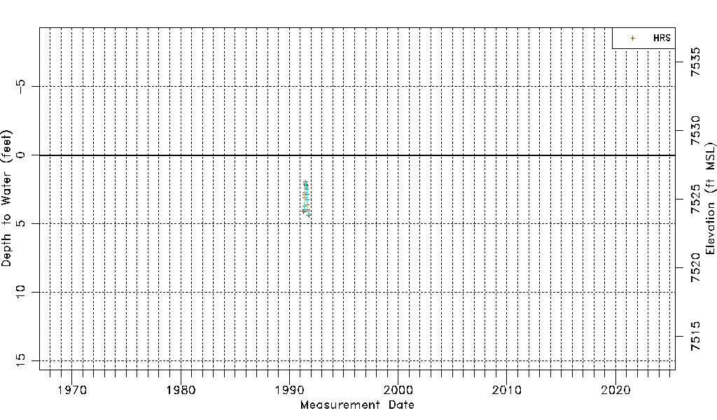
| Water-level Count | 21 |
| Water-level Date Range | 04/30/1991 thru 10/14/1991 |
| Monitored within the last 18 months | No, most recently on 10/14/1991 |
| Depth-to-Water Range (ft) | 1.95 to 4.39 |
| Water Table Elevation Range (ft NAVD88) | 7523.81 to 7526.25 |
| Water-Level-Source:Number-of-Measurements | HRS:21 |