| Well Information Table |
|---|
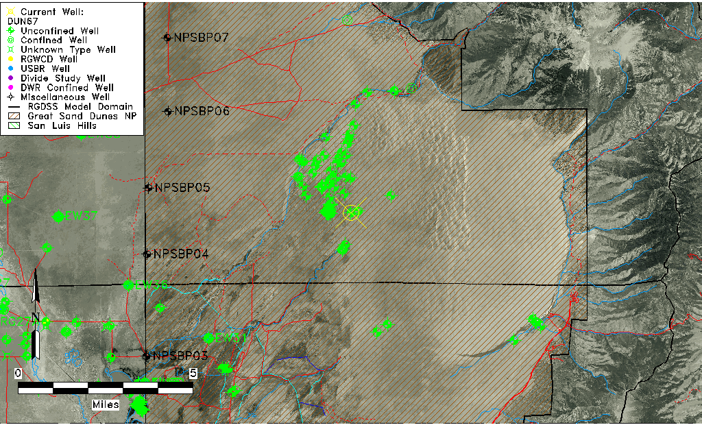
| Common Well ID | DUN67 |
| GSDNP Well Name | 67 |
| USGS Site Use Information | Unknown |
| USGS Groundwater Use Information | Unknown |
| Data Source(s) | HRS |
| Location Data |
|---|
| Longitude/Latitude (NAD83) | -105.62071412 , 37.78124471 |
| Longitude/Latitude Data Source | HRS Dunes database |
| Easting, Northing RGDSS-NAD83 (US ft) | 215424.91 , 285889.73 |
| Elevation and Depth Data |
|---|
| Ground Elevation (ft NAVD88) | 7715.07 |
| Elevation Data Source | NED3 data |
| 1/3-Arc Second NED Ground Elevation (ft NAVD88) | 7715.07 |
| 1-Arc Second NED Ground Elevation (ft NAVD88) | 7704.95 |
| SRTM Ground Elevation (ft NAVD88) | 7703.12 |
| Model Layer | 1 |
| Model Layer Source | Aquifer Type |
| Depth of Bottom of Layer 1 | 275 |
| Depth of Bottom of Layer 2 | 670 |
| Depth of Bottom of Layer 3 | 1217 |
| Depth of Bottom of Layer 4 | 2271 |
| Additional Well Information | NONE |
| Aquifer Information |
|---|
| Aquifer Type | Unconfined |
| Aquifer Type Source | HRS_AQUIFER |
| Water-level Database Information |
|---|
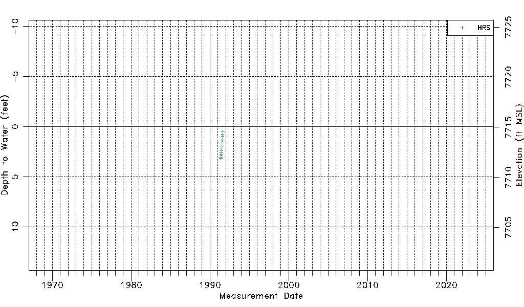
| Water-level Count | 14 |
| Water-level Date Range | 05/17/1991 thru 08/21/1991 |
| Monitored within the last 18 months | No, most recently on 08/21/1991 |
| Depth-to-Water Range (ft) | 0.53 to 3.18 |
| Water Table Elevation Range (ft NAVD88) | 7711.89 to 7714.54 |
| Water-Level-Source:Number-of-Measurements | HRS:14 |