| Well Information Table |
|---|
| Common Well ID | DUNDW11 |
| GSDNP Well Name | DUNDW11 |
| USGS Site Use Information | Unknown |
| USGS Groundwater Use Information | Unknown |
| Data Source(s) | HRS, HRS |
| Location Data |
|---|
| Longitude/Latitude (NAD83) | -105.62262545 , 37.86094652 |
| Longitude/Latitude Data Source | HRS Dunes database |
| Easting, Northing RGDSS-NAD83 (US ft) | 214859.40 , 314902.33 |
| Elevation and Depth Data |
|---|
| Ground Elevation (ft NAVD88) | 7959.28 |
| Elevation Data Source | BACA well (Halepaska) |
| BACA Well database (Halapaska & Assoc, ft NGVD29) | 7955 |
| HRS Dunes Well database (ft NGVD29) | 7955.00000 |
| 1/3-Arc Second NED Ground Elevation (ft NAVD88) | 7960.29 |
| 1-Arc Second NED Ground Elevation (ft NAVD88) | 7963.35 |
| SRTM Ground Elevation (ft NAVD88) | 7970.90 |
| Total Depth (ft) | 349.00 |
| Model Layer | 2 |
| Model Layer Source | Aquifer Type |
| Depth of Bottom of Layer 1 | 477 |
| Depth of Bottom of Layer 2 | 873 |
| Depth of Bottom of Layer 3 | 1226 |
| Depth of Bottom of Layer 4 | 1742 |
| Additional Well Information | NONE |
| Aquifer Information |
|---|
| Aquifer Type | Confined |
| Aquifer Type Source | HRS_AQUIFER |
| Water-level Database Information |
|---|
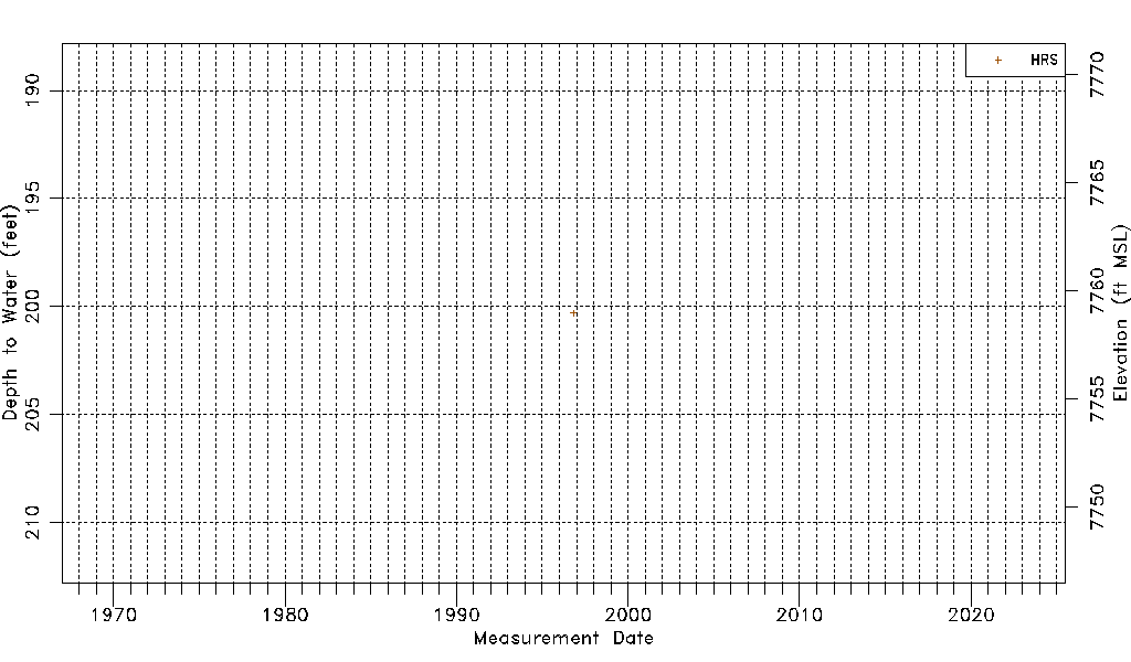
| Water-level Count | 1 |
| Water-level Date Range | 10/29/1996 thru 10/29/1996 |
| Monitored within the last 18 months | No, most recently on 10/29/1996 |
| Depth-to-Water Range (ft) | 200.30 to 200.30 |
| Water Table Elevation Range (ft NAVD88) | 7758.98 to 7758.98 |
| Water-Level-Source:Number-of-Measurements | HRS:1 |