| Well Information Table |
|---|
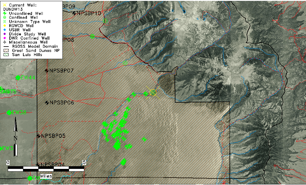
| Common Well ID | DUNDW13 |
| GSDNP Well Name | DW-13 |
| USGS Site Use Information | Unknown |
| USGS Groundwater Use Information | Unknown |
| Data Source(s) | HRS |
| Location Data |
|---|
| Longitude/Latitude (NAD83) | -105.58926356 , 37.83282038 |
| Longitude/Latitude Data Source | BACA wells reported by Halepaska |
| Halapaska & Assoc. Easting/Northing (CO-S) | 1974383.86766613 , 424621.837332131 |
| Easting, Northing RGDSS-NAD83 (US ft) | 224496.00 , 304670.00 |
| Elevation and Depth Data |
|---|
| Ground Elevation (ft NAVD88) | 7929.30 |
| Elevation Data Source | BACA well (Halepaska) |
| BACA Well database (Halapaska & Assoc, ft NGVD29) | 7925 |
| HRS Dunes Well database (ft NGVD29) | 7925.00000 |
| 1/3-Arc Second NED Ground Elevation (ft NAVD88) | 7915.52 |
| 1-Arc Second NED Ground Elevation (ft NAVD88) | 7927.98 |
| SRTM Ground Elevation (ft NAVD88) | 7955.36 |
| Total Depth (ft) | 320.00 |
| Model Layer | 2 |
| Model Layer Source | Aquifer Type |
| Depth of Bottom of Layer 1 | 439 |
| Depth of Bottom of Layer 2 | 847 |
| Depth of Bottom of Layer 3 | 997 |
| Additional Well Information | NONE |
| Aquifer Information |
|---|
| Aquifer Type | Confined |
| Aquifer Type Source | HRS_AQUIFER |
| Water-level Database Information |
|---|
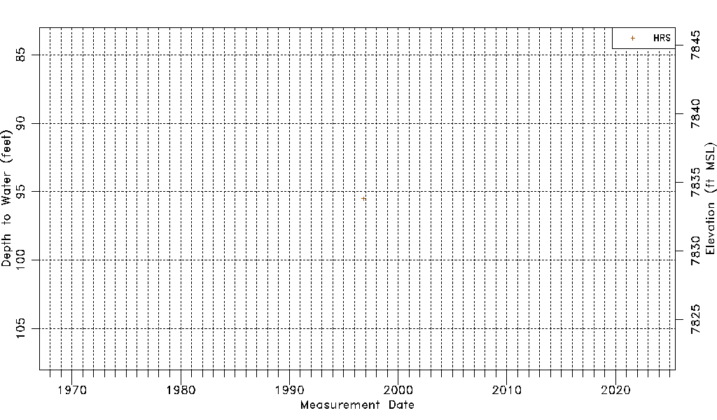
| Water-level Count | 1 |
| Water-level Date Range | 10/29/1996 thru 10/29/1996 |
| Monitored within the last 18 months | No, most recently on 10/29/1996 |
| Depth-to-Water Range (ft) | 95.50 to 95.50 |
| Water Table Elevation Range (ft NAVD88) | 7833.80 to 7833.80 |
| Water-Level-Source:Number-of-Measurements | HRS:1 |