| Well Information Table |
|---|
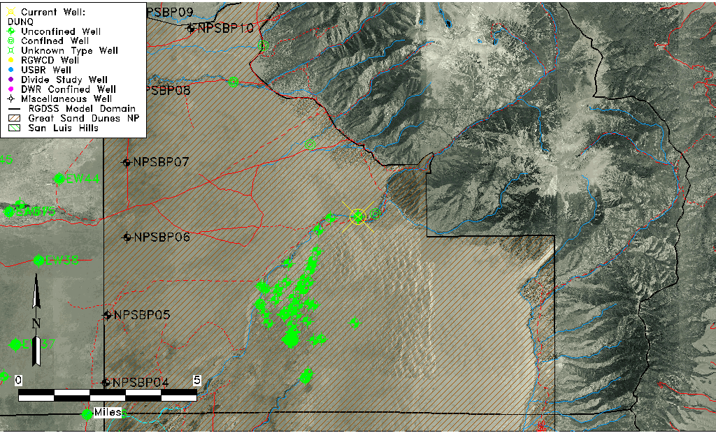
| Common Well ID | DUNQ |
| GSDNP Well Name | Q |
| USGS Site Use Information | Unknown |
| USGS Groundwater Use Information | Unknown |
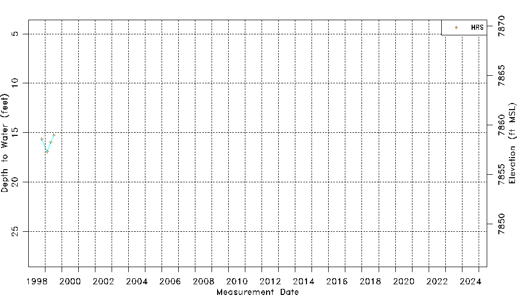
| Data Source(s) | HRS |
| Location Data |
|---|
| Longitude/Latitude (NAD83) | -105.59812229 , 37.83157432 |
| Longitude/Latitude Data Source | HRS Dunes database |
| Easting, Northing RGDSS-NAD83 (US ft) | 221938.72 , 304214.45 |
| Elevation and Depth Data |
|---|
| Ground Elevation (ft NAVD88) | 7874.23 |
| Elevation Data Source | HRS Dunes database |
| HRS Dunes Well database (ft NGVD29) | 7870.00000 |
| 1/3-Arc Second NED Ground Elevation (ft NAVD88) | 7878.49 |
| 1-Arc Second NED Ground Elevation (ft NAVD88) | 7879.31 |
| SRTM Ground Elevation (ft NAVD88) | 7886.87 |
| Model Layer | 1 |
| Model Layer Source | Aquifer Type |
| Depth of Bottom of Layer 1 | 399 |
| Depth of Bottom of Layer 2 | 806 |
| Depth of Bottom of Layer 3 | 1012 |
| Depth of Bottom of Layer 4 | 1494 |
| Additional Well Information | NONE |
| Aquifer Information |
|---|
| Aquifer Type | Unconfined |
| Aquifer Type Source | HRS_AQUIFER |
| Water-level Database Information |
|---|
| Water-level Count | 4 |
| Water-level Date Range | 10/23/1998 thru 07/15/1999 |
| Monitored within the last 18 months | No, most recently on 07/15/1999 |
| Depth-to-Water Range (ft) | 15.22 to 16.92 |
| Water Table Elevation Range (ft NAVD88) | 7857.31 to 7859.01 |
| Water-Level-Source:Number-of-Measurements | HRS:4 |