| Well Information Table |
|---|
| Common Well ID | DUNSW13 |
| GSDNP Well Name | DUNSW13 |
| USGS Site Use Information | Unknown |
| USGS Groundwater Use Information | Unknown |
| Data Source(s) | HRS, HRS |
| Location Data |
|---|
| Longitude/Latitude (NAD83) | -105.72852520 , 38.02030122 |
| Longitude/Latitude Data Source | HRS Dunes database |
| Easting, Northing RGDSS-NAD83 (US ft) | 184336.68 , 372915.71 |
| Elevation and Depth Data |
|---|
| Ground Elevation (ft NAVD88) | 7854.49 |
| Elevation Data Source | BACA well (Halepaska) |
| BACA Well database (Halapaska & Assoc, ft NGVD29) | 7850 |
| 1/3-Arc Second NED Ground Elevation (ft NAVD88) | 7883.94 |
| 1-Arc Second NED Ground Elevation (ft NAVD88) | 7874.74 |
| SRTM Ground Elevation (ft NAVD88) | 7886.30 |
| Total Depth (ft) | 170.00 |
| Model Layer | 1 |
| Model Layer Source | Aquifer Type |
| Depth of Bottom of Layer 1 | 358 |
| Depth of Bottom of Layer 2 | 552 |
| Depth of Bottom of Layer 3 | 872 |
| Depth of Bottom of Layer 4 | 1160 |
| Additional Well Information | NONE |
| Aquifer Information |
|---|
| Aquifer Type | Unconfined |
| Aquifer Type Source | HRS_AQUIFER |
| Water-level Database Information |
|---|
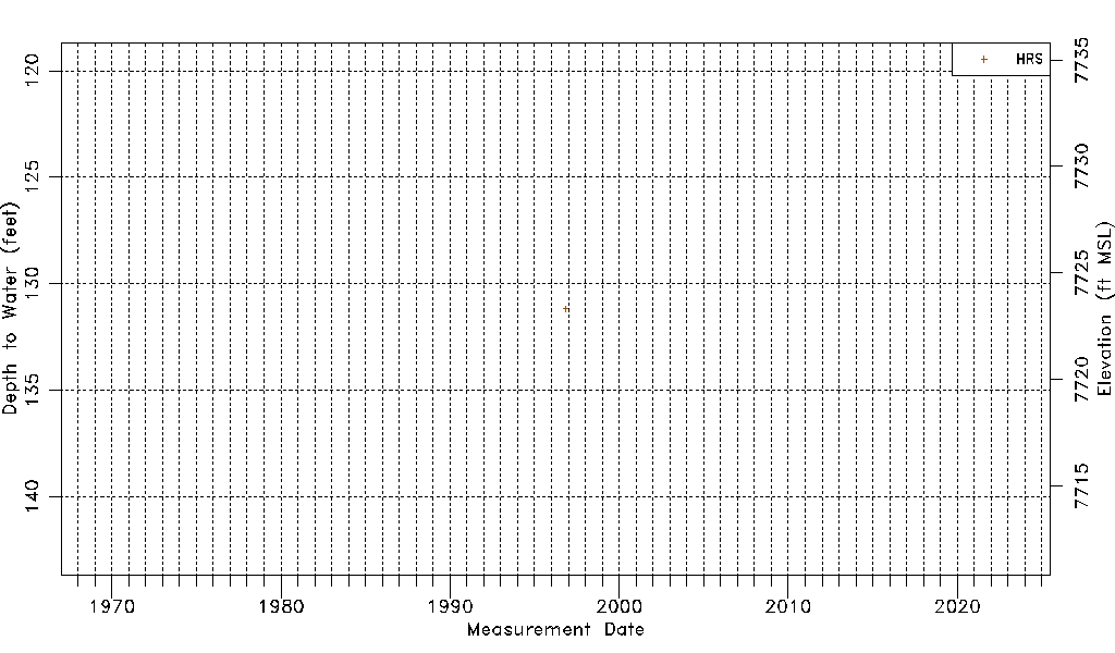
| Water-level Count | 1 |
| Water-level Date Range | 11/07/1996 thru 11/07/1996 |
| Monitored within the last 18 months | No, most recently on 11/07/1996 |
| Depth-to-Water Range (ft) | 131.17 to 131.17 |
| Water Table Elevation Range (ft NAVD88) | 7723.32 to 7723.32 |
| Water-Level-Source:Number-of-Measurements | HRS:1 |