| Well Information Table |
|---|
| Common Well ID | DUNWELL_D1 |
| GSDNP Well Name | WELL_D1 |
| USGS Site Use Information | Unknown |
| USGS Groundwater Use Information | Unknown |
| Data Source(s) | HRS |
| Location Data |
|---|
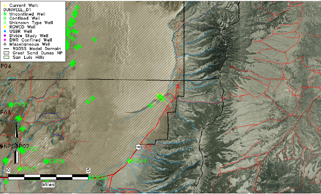
| Longitude/Latitude (NAD83) | -105.52450497 , 37.73604195 |
| Longitude/Latitude Data Source | HRS Dunes database |
| Easting, Northing RGDSS-NAD83 (US ft) | 243245.73 , 269463.28 |
| Elevation and Depth Data |
|---|
| Ground Elevation (ft NAVD88) | 8023.41 |
| Elevation Data Source | Dunes GRSA data |
| GRSA Dunes Well database (ft NGVD29) | 8019.04 |
| 1/3-Arc Second NED Ground Elevation (ft NAVD88) | 8011.19 |
| 1-Arc Second NED Ground Elevation (ft NAVD88) | 8018.33 |
| SRTM Ground Elevation (ft NAVD88) | 8014.62 |
| Total Depth (ft) | 98.00 |
| Depth to Top of Screen (ft) | 78.0 |
| Depth to Bottom of Screen (ft) | 98.00 |
| Model Layer | 1 |
| Model Layer Source | Dunes Layer |
| Depth of Bottom of Layer 1 | 504 |
| Depth of Bottom of Layer 2 | 974 |
| Depth of Bottom of Layer 3 | 1131 |
| Depth of Bottom of Layer 4 | 1277 |
| Additional Well Information | NONE |
| Aquifer Information |
|---|
| Aquifer Type | Unconfined |
| Aquifer Type Source | GRSA_AQUFR |
| Water-level Database Information |
|---|
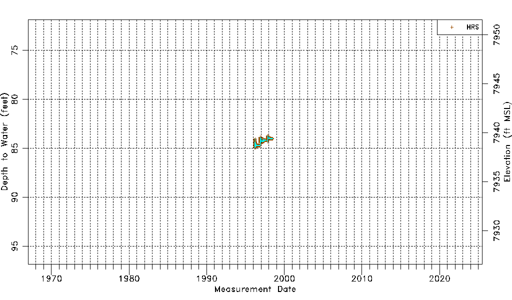
| Water-level Count | 2231 |
| Water-level Date Range | 03/19/1996 thru 06/26/1998 |
| Monitored within the last 18 months | No, most recently on 06/26/1998 |
| Depth-to-Water Range (ft) | 83.71 to 84.98 |
| Water Table Elevation Range (ft NAVD88) | 7938.43 to 7939.70 |
| Water-Level-Source:Number-of-Measurements | HRS:2231 |