| Well Information Table |
|---|
| Common Well ID | DUNWELL_Z |
| GSDNP Well Name | WELL_Z |
| USGS Site Use Information | Unknown |
| USGS Groundwater Use Information | Unknown |
| Data Source(s) | HRS |
| Location Data |
|---|
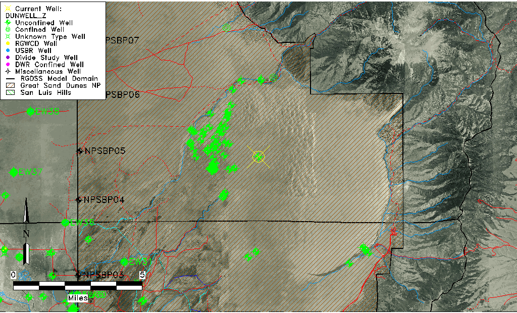
| Longitude/Latitude (NAD83) | -105.59990559 , 37.78840552 |
| Longitude/Latitude Data Source | Davis Engineering Survey |
| Easting, Northing RGDSS-NAD83 (US ft) | 221434.90 , 288499.96 |
| Elevation and Depth Data |
|---|
| Ground Elevation (ft NAVD88) | 7803.60 |
| Elevation Data Source | Davis Engineering Survey |
| GRSA Dunes Well database (ft NGVD29) | 7791.18 |
| 1/3-Arc Second NED Ground Elevation (ft NAVD88) | 7804.14 |
| 1-Arc Second NED Ground Elevation (ft NAVD88) | 7800.36 |
| SRTM Ground Elevation (ft NAVD88) | 7812.58 |
| Total Depth (ft) | 94.00 |
| Depth to Top of Screen (ft) | 89.0 |
| Depth to Bottom of Screen (ft) | 94.00 |
| Model Layer | 1 |
| Model Layer Source | Dunes Layer |
| Depth of Bottom of Layer 1 | 356 |
| Depth of Bottom of Layer 2 | 767 |
| Depth of Bottom of Layer 3 | 1164 |
| Depth of Bottom of Layer 4 | 1878 |
| Additional Well Information | NONE |
| Aquifer Information |
|---|
| Aquifer Type | Unconfined |
| Aquifer Type Source | GRSA_AQUFR |
| Water-level Database Information |
|---|
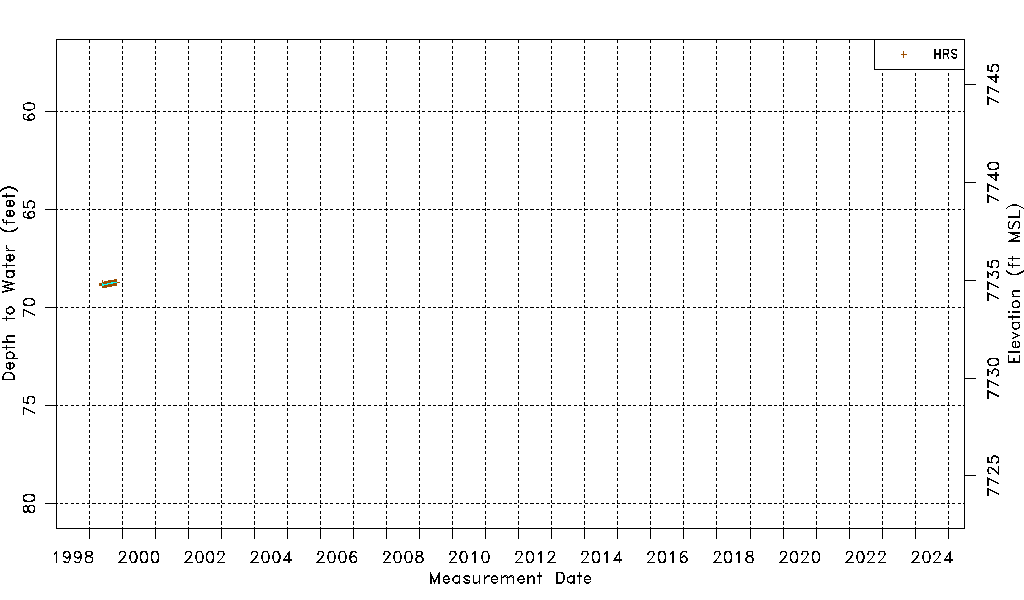
| Water-level Count | 503 |
| Water-level Date Range | 05/24/1999 thru 11/03/1999 |
| Monitored within the last 18 months | No, most recently on 11/03/1999 |
| Depth-to-Water Range (ft) | 68.70 to 68.86 |
| Water Table Elevation Range (ft NAVD88) | 7734.74 to 7734.90 |
| Water-Level-Source:Number-of-Measurements | HRS:503 |