| Well Information Table |
|---|
| Common Well ID | DWR4865F |
| USGS Site Use Information | Unknown |
| USGS Groundwater Use Information | Unknown |
| Data Source(s) | DWR |
| Location Data |
|---|
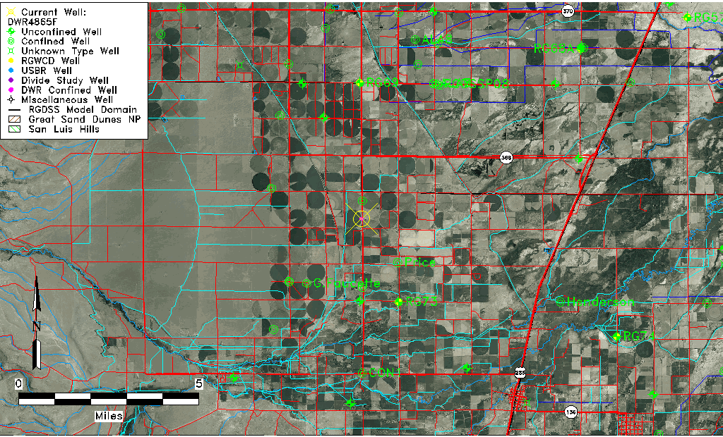
| Longitude/Latitude (NAD83) | -106.03852820 , 37.34609785 |
| Longitude/Latitude Data Source | DWR Confined |
| DWR Longitude/Latitude (NAD83) | -106.0385282 , 37.34609785 |
| Easting, Northing RGDSS-NAD83 (US ft) | 94087.45 , 127697.35 |
| Elevation and Depth Data |
|---|
| Ground Elevation (ft NAVD88) | 7659.20 |
| Elevation Data Source | DWR data |
| DWR Confined wells (ft NAVD88) | 7659.20 |
| 1/3-Arc Second NED Ground Elevation (ft NAVD88) | 7659.40 |
| 1-Arc Second NED Ground Elevation (ft NAVD88) | 7658.91 |
| SRTM Ground Elevation (ft NAVD88) | 7657.53 |
| Depth to Top of Screen (ft) | 40.0 |
| Depth to Bottom of Screen (ft) | 340.00 |
| Model Layer | 3 |
| Model Layer Source | DWR |
| Depth of Bottom of Layer 1 | 34 |
| Depth of Bottom of Layer 2 | 263 |
| Depth of Bottom of Layer 3 | 404 |
| Depth of Bottom of Layer 4 | 2023 |
| Additional Well Information | NONE |
| Aquifer Information |
|---|
| Aquifer Type | Confined |
| Aquifer Type Source | TD Elevation/Model Layer |
| Water-level Database Information |
|---|
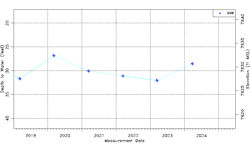
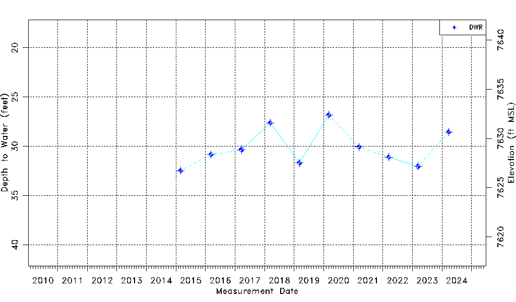
| Water-level Count | 10 |
| Water-level Date Range | 02/27/2015 thru 03/26/2024 |
| Monitored within the last 18 months | No, most recently on 03/26/2024 |
| Depth-to-Water Range (ft) | 26.82 to 32.47 |
| Water Table Elevation Range (ft NAVD88) | 7626.73 to 7632.38 |
| Water-Level-Source:Number-of-Measurements | DWR:10 |