| Well Information Table |
|---|
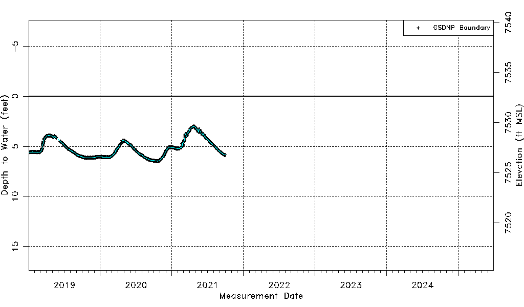
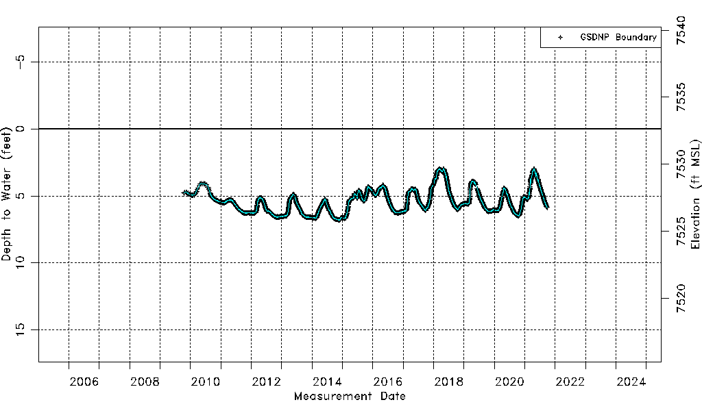
| Common Well ID | NPSBP02 |
| USGS Site Use Information | Unknown |
| USGS Groundwater Use Information | Unknown |
| Data Source(s) | GSDNP Boundary |
| Location Data |
|---|
| Longitude/Latitude (NAD83) | -105.70622589 , 37.69149268 |
| Longitude/Latitude Data Source | NPS Sand Dunes database |
| Easting, Northing RGDSS-NAD83 (US ft) | 190705.57 , 253217.85 |
| Elevation and Depth Data |
|---|
| Ground Elevation (ft NAVD88) | 7532.64 |
| Elevation Data Source | NPS Sand Dunes database |
| 1/3-Arc Second NED Ground Elevation (ft NAVD88) | 7538.54 |
| 1-Arc Second NED Ground Elevation (ft NAVD88) | 7539.62 |
| SRTM Ground Elevation (ft NAVD88) | 7545.68 |
| Total Depth (ft) | 70.00 |
| Depth to Top of Screen (ft) | 20.0 |
| Depth to Bottom of Screen (ft) | 70.00 |
| Model Layer | 1 |
| Model Layer Source | Aquifer Type |
| Depth of Bottom of Layer 1 | 183 |
| Depth of Bottom of Layer 2 | 481 |
| Depth of Bottom of Layer 3 | 1652 |
| Depth of Bottom of Layer 4 | 3902 |
| Additional Well Information | NONE |
| Aquifer Information |
|---|
| Aquifer Type | Unconfined |
| Aquifer Type Source | NPS_AQFR |
| Water-level Database Information |
|---|
| Water-level Count | 4194 |
| Water-level Date Range | 10/15/2009 thru 09/30/2021 |
| Monitored within the last 18 months | No, most recently on 09/30/2021 |
| Depth-to-Water Range (ft) | 2.97 to 6.79 |
| Water Table Elevation Range (ft NAVD88) | 7525.85 to 7529.67 |
| Water-Level-Source:Number-of-Measurements | GSDNP Boundary:4194 |