| Well Information Table |
|---|
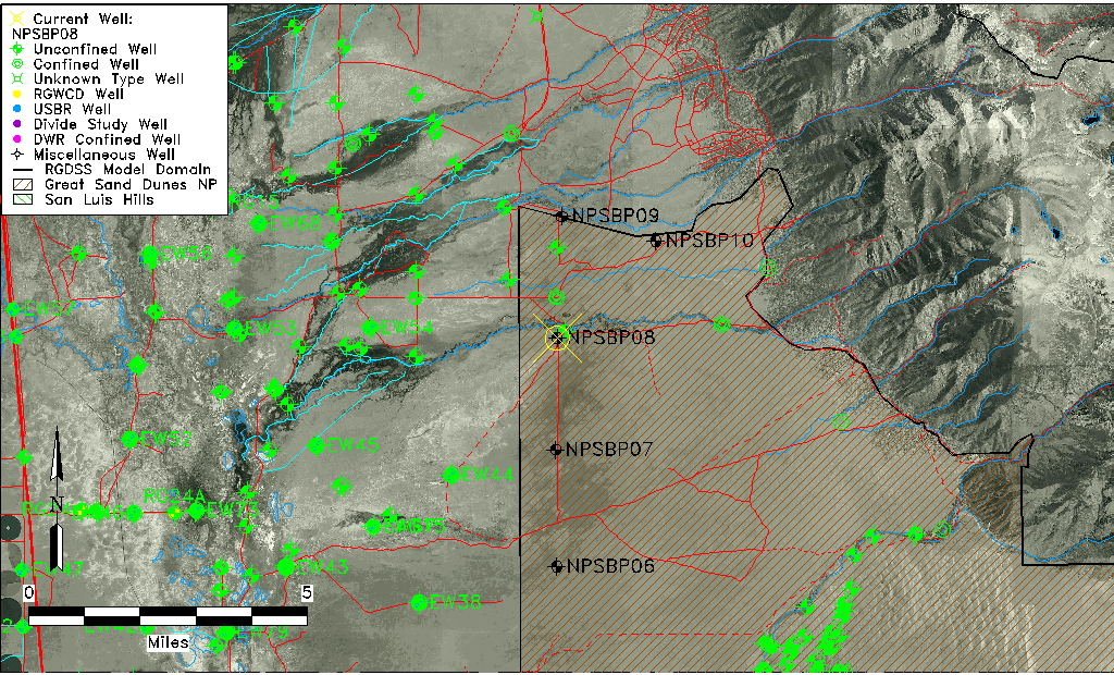
| Common Well ID | NPSBP08 |
| USGS Site Use Information | Unknown |
| USGS Groundwater Use Information | Unknown |
| Data Source(s) | GSDNP Boundary |
| Location Data |
|---|
| Longitude/Latitude (NAD83) | -105.71609997 , 37.88279820 |
| Longitude/Latitude Data Source | NPS Sand Dunes database |
| Easting, Northing RGDSS-NAD83 (US ft) | 187886.68 , 322858.19 |
| Elevation and Depth Data |
|---|
| Ground Elevation (ft NAVD88) | 7636.15 |
| Elevation Data Source | NPS Sand Dunes database |
| 1/3-Arc Second NED Ground Elevation (ft NAVD88) | 7636.12 |
| 1-Arc Second NED Ground Elevation (ft NAVD88) | 7637.11 |
| SRTM Ground Elevation (ft NAVD88) | 7641.09 |
| Total Depth (ft) | 295.00 |
| Depth to Top of Screen (ft) | 25.0 |
| Depth to Bottom of Screen (ft) | 295.00 |
| Model Layer | 1 |
| Model Layer Source | Aquifer Type |
| Depth of Bottom of Layer 1 | 213 |
| Depth of Bottom of Layer 2 | 608 |
| Depth of Bottom of Layer 3 | 1473 |
| Depth of Bottom of Layer 4 | 3906 |
| Additional Well Information | NONE |
| Aquifer Information |
|---|
| Aquifer Type | Unconfined |
| Aquifer Type Source | NPS_AQFR |
| Water-level Database Information |
|---|
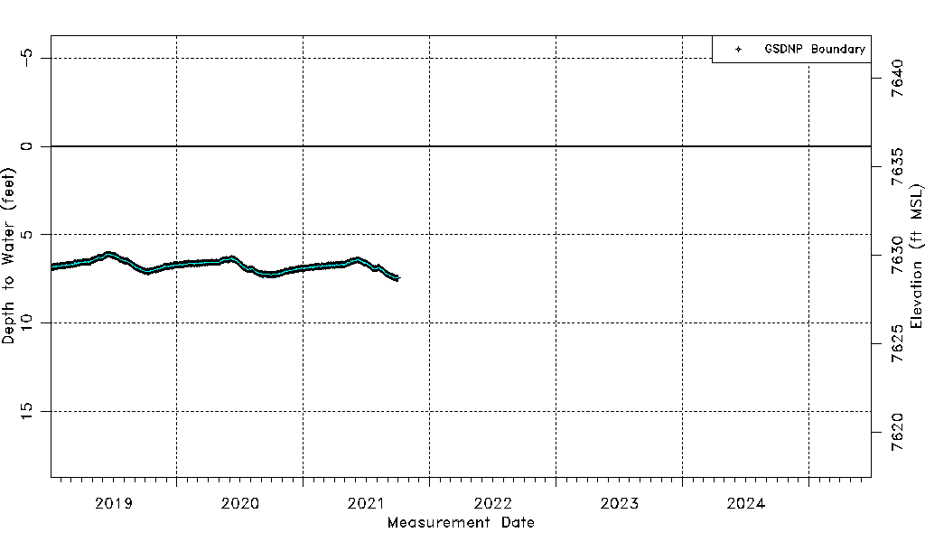
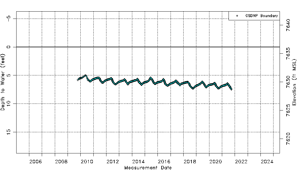
| Water-level Count | 4182 |
| Water-level Date Range | 10/15/2009 thru 09/30/2021 |
| Monitored within the last 18 months | No, most recently on 09/30/2021 |
| Depth-to-Water Range (ft) | 4.98 to 7.45 |
| Water Table Elevation Range (ft NAVD88) | 7628.70 to 7631.17 |
| Water-Level-Source:Number-of-Measurements | GSDNP Boundary:4182 |