| Well Information Table |
|---|
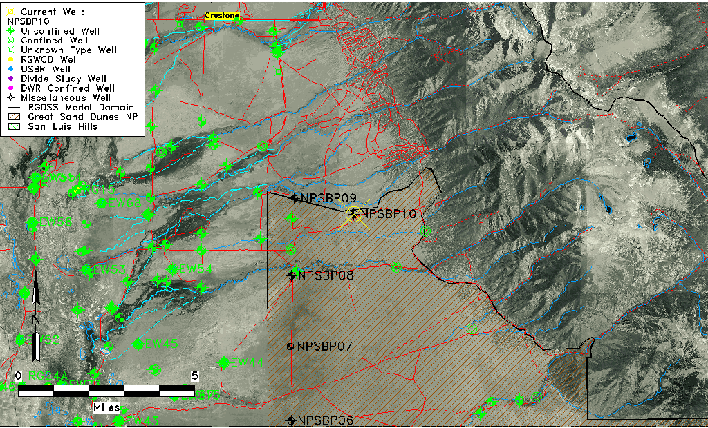
| Common Well ID | NPSBP10 |
| USGS Site Use Information | Unknown |
| USGS Groundwater Use Information | Unknown |
| Data Source(s) | GSDNP Boundary |
| Location Data |
|---|
| Longitude/Latitude (NAD83) | -105.68367461 , 37.90808290 |
| Longitude/Latitude Data Source | NPS Sand Dunes database |
| Easting, Northing RGDSS-NAD83 (US ft) | 197243.94 , 332058.91 |
| Elevation and Depth Data |
|---|
| Ground Elevation (ft NAVD88) | 7712.95 |
| Elevation Data Source | NPS Sand Dunes database |
| 1/3-Arc Second NED Ground Elevation (ft NAVD88) | 7718.52 |
| 1-Arc Second NED Ground Elevation (ft NAVD88) | 7712.27 |
| SRTM Ground Elevation (ft NAVD88) | 7712.05 |
| Total Depth (ft) | 296.00 |
| Depth to Top of Screen (ft) | 16.0 |
| Depth to Bottom of Screen (ft) | 296.00 |
| Model Layer | 1 |
| Model Layer Source | Aquifer Type |
| Depth of Bottom of Layer 1 | 250 |
| Depth of Bottom of Layer 2 | 639 |
| Depth of Bottom of Layer 3 | 1304 |
| Depth of Bottom of Layer 4 | 2695 |
| Additional Well Information | NONE |
| Aquifer Information |
|---|
| Aquifer Type | Unconfined |
| Aquifer Type Source | NPS_AQFR |
| Water-level Database Information |
|---|
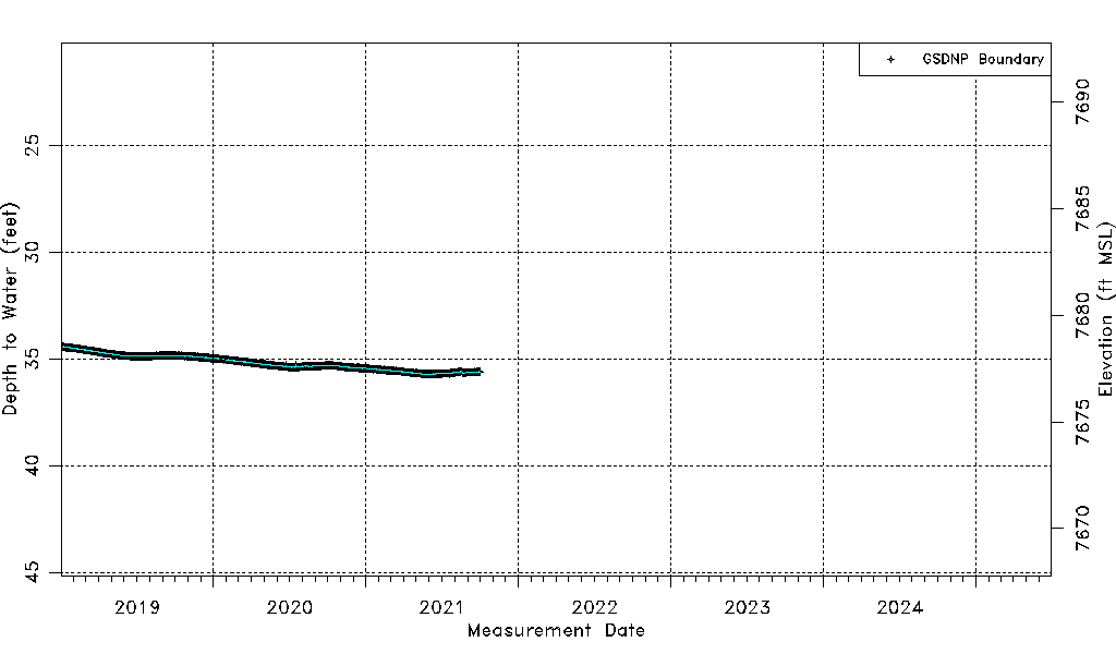
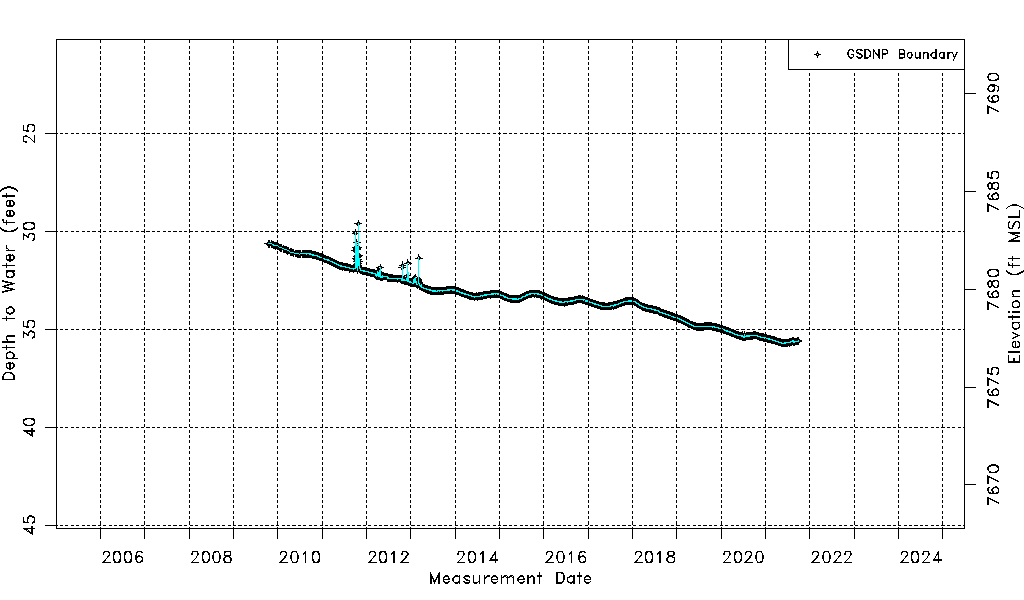
| Water-level Count | 4194 |
| Water-level Date Range | 10/15/2009 thru 09/30/2021 |
| Monitored within the last 18 months | No, most recently on 09/30/2021 |
| Depth-to-Water Range (ft) | 29.61 to 35.73 |
| Water Table Elevation Range (ft NAVD88) | 7677.22 to 7683.34 |
| Water-Level-Source:Number-of-Measurements | GSDNP Boundary:4194 |