| Well Information Table |
|---|
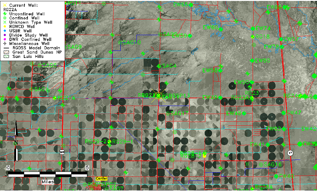
| Common Well ID | RG22A |
| RGWCD Well ID | RG22A |
| USGS Site Use Information | Unknown |
| USGS Groundwater Use Information | Unknown |
| Data Source(s) | RGWCD |
| Location Data |
|---|
| Longitude/Latitude (NAD83) | -106.03675278 , 37.83769167 |
| Longitude/Latitude Data Source | RGWCD/Davis Engineering |
| RGWCD Longitude/Latitude (NAD83) | -106:02:12.31 , 37:50:15.69 |
| Easting, Northing RGDSS-NAD83 (US ft) | 95304.37 , 306647.69 |
| Elevation and Depth Data |
|---|
| Ground Elevation (ft NAVD88) | 7581.79 |
| Elevation Data Source | NED3 data |
| RGWCD Well Riser Height (ft) | 2.500 |
| 1/3-Arc Second NED Ground Elevation (ft NAVD88) | 7581.79 |
| 1-Arc Second NED Ground Elevation (ft NAVD88) | 7580.72 |
| SRTM Ground Elevation (ft NAVD88) | 7590.93 |
| Total Depth (ft) | 43.00 |
| Model Layer | 1 |
| Model Layer Source | RGWCD |
| Depth of Bottom of Layer 1 | 104 |
| Depth of Bottom of Layer 2 | 220 |
| Depth of Bottom of Layer 3 | 673 |
| Depth of Bottom of Layer 4 | 2437 |
| Additional Well Information | NONE |
| Aquifer Information |
|---|
| Aquifer Type | Unconfined |
| Aquifer Type Source | RGWCD_AQ |
| Water-level Database Information |
|---|
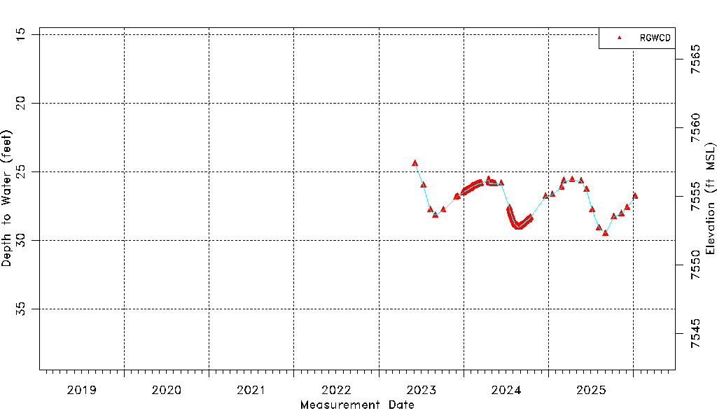
| Water-level Count | 434 |
| Water-level Date Range | 06/05/2023 thru 05/11/2026 |
| Monitored within the last 18 months | Yes, most recently on 05/11/2026 |
| Depth-to-Water Range (ft) | 24.41 to 29.50 |
| Water Table Elevation Range (ft NAVD88) | 7552.29 to 7557.38 |
| Water-Level-Source:Number-of-Measurements | RGWCD:434 |