| Well Information Table |
|---|
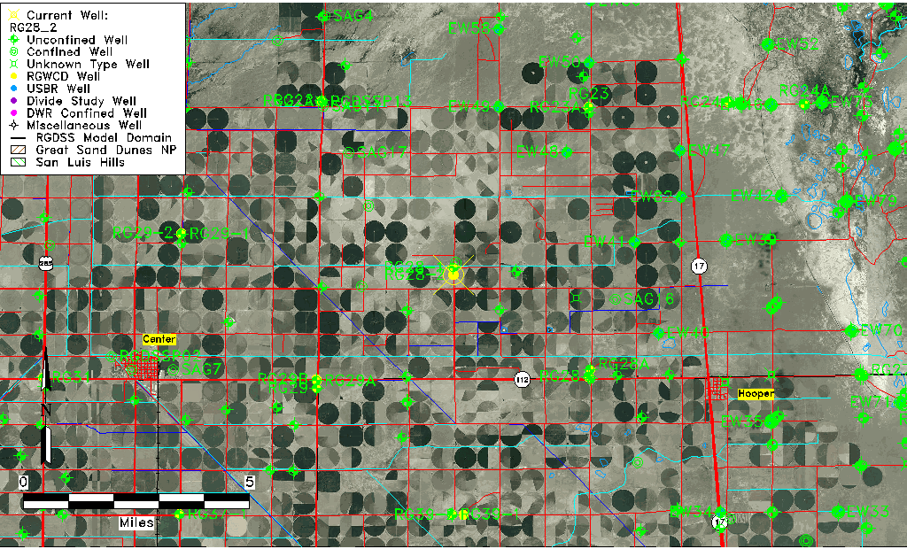
| Common Well ID | RG28_2 |
| RGWCD Well ID | RG28-2 |
| USGS Site Use Information | Unknown |
| USGS Groundwater Use Information | Unknown |
| Data Source(s) | RGWCD |
| Location Data |
|---|
| Longitude/Latitude (NAD83) | -105.98340556 , 37.78216667 |
| Longitude/Latitude Data Source | RGWCD/Davis Engineering |
| RGWCD Longitude/Latitude (NAD83) | -105:59:00.26 , 37:46:55.80 |
| Easting, Northing RGDSS-NAD83 (US ft) | 110637.41 , 286377.77 |
| Elevation and Depth Data |
|---|
| Ground Elevation (ft NAVD88) | 7578.39 |
| Elevation Data Source | NED3 data |
| RGWCD Well Riser Height (ft) | 2.500 |
| 1/3-Arc Second NED Ground Elevation (ft NAVD88) | 7578.39 |
| 1-Arc Second NED Ground Elevation (ft NAVD88) | 7578.29 |
| SRTM Ground Elevation (ft NAVD88) | 7587.93 |
| Total Depth (ft) | 72.00 |
| Model Layer | 1 |
| Model Layer Source | RGWCD |
| Depth of Bottom of Layer 1 | 100 |
| Depth of Bottom of Layer 2 | 183 |
| Depth of Bottom of Layer 3 | 1054 |
| Depth of Bottom of Layer 4 | 2615 |
| Additional Well Information | NONE |
| Aquifer Information |
|---|
| Aquifer Type | Unconfined |
| Aquifer Type Source | RGWCD_AQ |
| Water-level Database Information |
|---|
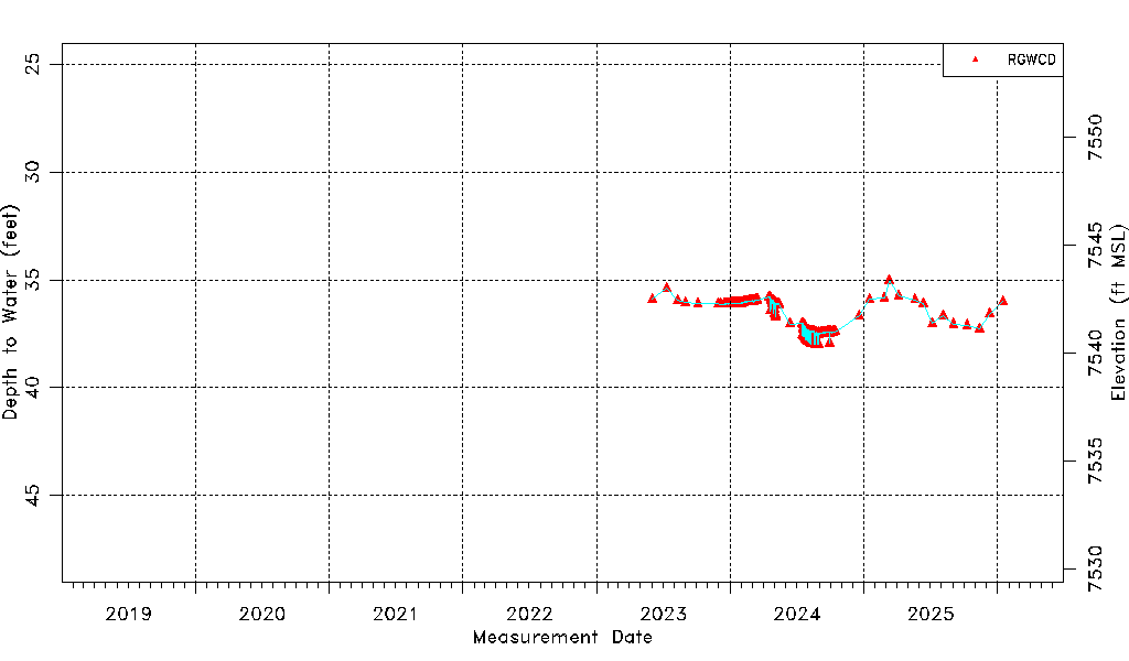
| Water-level Count | 465 |
| Water-level Date Range | 06/02/2023 thru 05/12/2026 |
| Monitored within the last 18 months | Yes, most recently on 05/12/2026 |
| Depth-to-Water Range (ft) | 35.02 to 38.01 |
| Water Table Elevation Range (ft NAVD88) | 7540.38 to 7543.37 |
| Water-Level-Source:Number-of-Measurements | RGWCD:465 |