| Well Information Table |
|---|
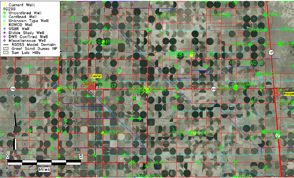
| Common Well ID | RG29B |
| RGWCD Well ID | RG29B |
| USGS Site Use Information | Unknown |
| USGS Groundwater Use Information | Unknown |
| Data Source(s) | RGWCD |
| Location Data |
|---|
| Longitude/Latitude (NAD83) | -106.03863611 , 37.74849722 |
| Longitude/Latitude Data Source | RGWCD/Davis Engineering |
| RGWCD Longitude/Latitude (NAD83) | -106:02:19.09 , 37:44:54.59 |
| Easting, Northing RGDSS-NAD83 (US ft) | 94631.16 , 274179.77 |
| Elevation and Depth Data |
|---|
| Ground Elevation (ft NAVD88) | 7609.33 |
| Elevation Data Source | NED3 data |
| RGWCD Well Riser Height (ft) | 2.500 |
| 1/3-Arc Second NED Ground Elevation (ft NAVD88) | 7609.33 |
| 1-Arc Second NED Ground Elevation (ft NAVD88) | 7610.69 |
| SRTM Ground Elevation (ft NAVD88) | 7613.66 |
| Total Depth (ft) | 65.00 |
| Model Layer | 1 |
| Model Layer Source | RGWCD |
| Depth of Bottom of Layer 1 | 97 |
| Depth of Bottom of Layer 2 | 168 |
| Depth of Bottom of Layer 3 | 897 |
| Depth of Bottom of Layer 4 | 2417 |
| Additional Well Information | NONE |
| Aquifer Information |
|---|
| Aquifer Type | Unconfined |
| Aquifer Type Source | RGWCD_AQ |
| Water-level Database Information |
|---|
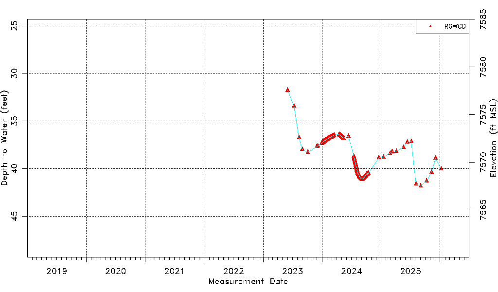
| Water-level Count | 434 |
| Water-level Date Range | 06/02/2023 thru 05/12/2026 |
| Monitored within the last 18 months | Yes, most recently on 05/12/2026 |
| Depth-to-Water Range (ft) | 31.76 to 41.81 |
| Water Table Elevation Range (ft NAVD88) | 7567.52 to 7577.57 |
| Water-Level-Source:Number-of-Measurements | RGWCD:434 |