| Well Information Table |
|---|
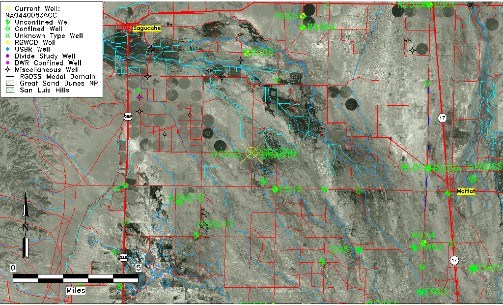
| Common Well ID | NA04400836CC |
| RGWCD Confined Aquifer Well ID | RGDSSP01 |
| USGS Site Use Information | Unknown |
| USGS Groundwater Use Information | Unknown |
| Data Source(s) | RGWCD |
| Location Data |
|---|
| TRS | NA04400836CC |
| Longitude/Latitude (NAD83) | -106.05113333 , 38.01475000 |
| Longitude/Latitude Data Source | RGDSS Piezometers (well completion reports) |
| RGDSS Longitude/Latitude (NAD83) | -106.051133333333 , 38.0147500000000 |
| Easting, Northing RGDSS-NAD83 (US ft) | 91420.37 , 371121.87 |
| Elevation and Depth Data |
|---|
| Ground Elevation (ft NAVD88) | 7598.32 |
| Elevation Data Source | RGDSS piezometer database |
| RGDSS Piezometer Database (ft NAVD88) | 7598.32 |
| 1/3-Arc Second NED Ground Elevation (ft NAVD88) | 7598.20 |
| 1-Arc Second NED Ground Elevation (ft NAVD88) | 7598.18 |
| SRTM Ground Elevation (ft NAVD88) | 7604.75 |
| Total Depth (ft) | 575.00 |
| Model Layer | 3 |
| Model Layer Source | RGDSS Piezometer |
| Depth of Bottom of Layer 1 | 77 |
| Depth of Bottom of Layer 2 | 152 |
| Depth of Bottom of Layer 3 | 583 |
| Depth of Bottom of Layer 4 | 1791 |
| Additional Well Information | NONE |
| Aquifer Information |
|---|
| Aquifer Type | Confined |
| Aquifer Type Source | RGDSS_AQFR |
| Water-level Database Information |
|---|
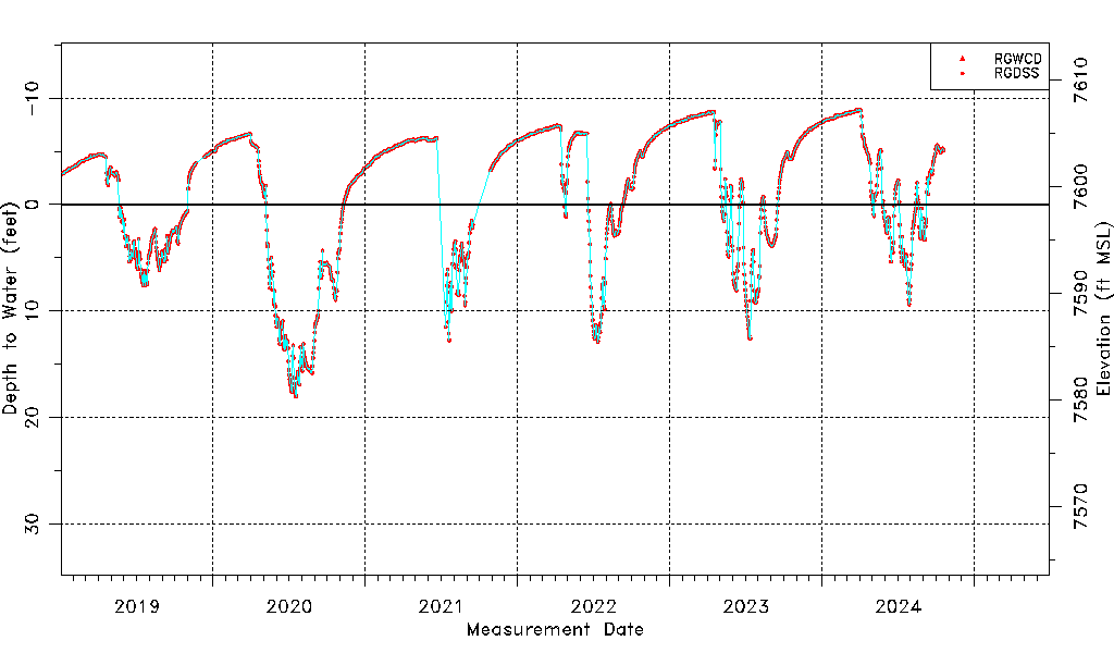
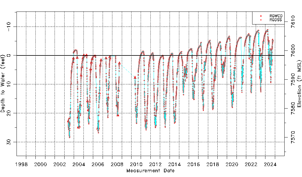
| Water-level Count | 7063 |
| Water-level Date Range | 05/30/2003 thru 09/16/2025 |
| Monitored within the last 18 months | Yes, most recently on 09/16/2025 |
| Depth-to-Water Range (ft) | -9.80 to 28.46 |
| Water Table Elevation Range (ft NAVD88) | 7569.86 to 7608.12 |
| Water-Level-Source:Number-of-Measurements | RGWCD:338 RGDSS:6725 |