| Well Information Table |
|---|
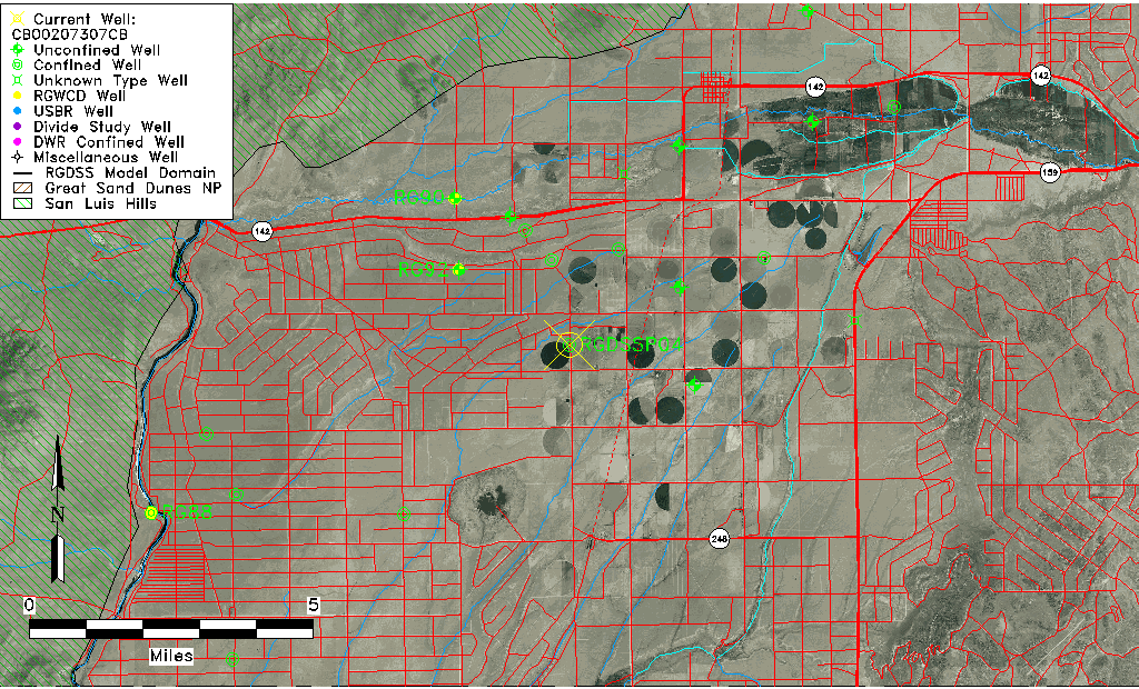
| Common Well ID | CB00207307CB |
| RGWCD Confined Aquifer Well ID | RGDSSP04 |
| USGS Site Use Information | Unknown |
| USGS Groundwater Use Information | Unknown |
| Data Source(s) | RGWCD |
| Location Data |
|---|
| TRS | CB00207307CB |
| Longitude/Latitude (NAD83) | -105.61208333 , 37.14778333 |
| Longitude/Latitude Data Source | RGDSS Piezometers (well completion reports) |
| RGDSS Longitude/Latitude (NAD83) | -105.612083333333 , 37.1477833333333 |
| Easting, Northing RGDSS-NAD83 (US ft) | 218062.32 , 55314.15 |
| Elevation and Depth Data |
|---|
| Ground Elevation (ft NAVD88) | 7704.58 |
| Elevation Data Source | RGDSS piezometer database |
| RGDSS Piezometer Database (ft NAVD88) | 7704.58 |
| 1/3-Arc Second NED Ground Elevation (ft NAVD88) | 7705.38 |
| 1-Arc Second NED Ground Elevation (ft NAVD88) | 7704.99 |
| SRTM Ground Elevation (ft NAVD88) | 7711.58 |
| Total Depth (ft) | 305.00 |
| Model Layer | 2 |
| Model Layer Source | RGDSS Piezometer |
| Depth of Bottom of Layer 1 | 291 |
| Depth of Bottom of Layer 2 | 391 |
| Depth of Bottom of Layer 3 | 676 |
| Depth of Bottom of Layer 4 | 1073 |
| Additional Well Information | NONE |
| Aquifer Information |
|---|
| Aquifer Type | Confined |
| Aquifer Type Source | RGDSS_AQFR |
| Water-level Database Information |
|---|
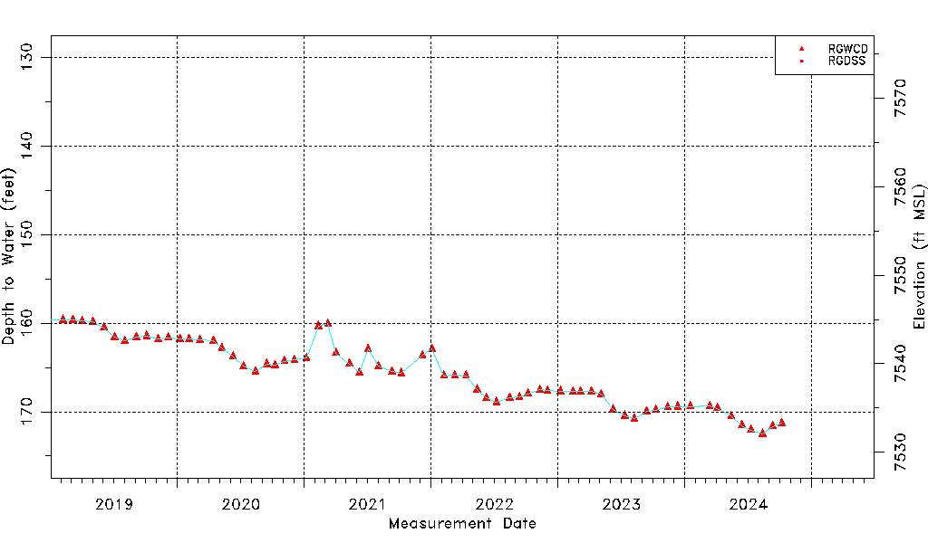
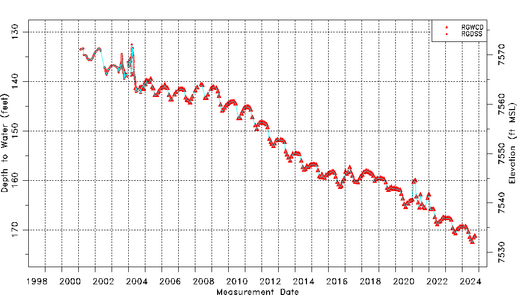
| Water-level Count | 1527 |
| Water-level Date Range | 02/14/2001 thru 03/04/2026 |
| Monitored within the last 18 months | Yes, most recently on 03/04/2026 |
| Depth-to-Water Range (ft) | 132.52 to 173.58 |
| Water Table Elevation Range (ft NAVD88) | 7531.00 to 7572.06 |
| Water-Level-Source:Number-of-Measurements | RGWCD:242 RGDSS:1285 |