| Well Information Table |
|---|
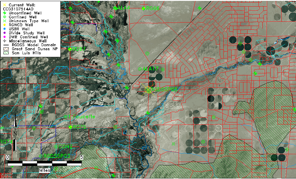
| Common Well ID | CC03107514AD |
| RGWCD Confined Aquifer Well ID | RGDSSP05 |
| USGS Site Use Information | Unknown |
| USGS Groundwater Use Information | Unknown |
| Data Source(s) | RGWCD |
| Location Data |
|---|
| TRS | CC03107514AD |
| Longitude/Latitude (NAD83) | -105.72406667 , 37.35063333 |
| Longitude/Latitude Data Source | RGDSS Piezometers (well completion reports) |
| RGDSS Longitude/Latitude (NAD83) | -105.724066666667 , 37.3506333333333 |
| Easting, Northing RGDSS-NAD83 (US ft) | 185473.52 , 129146.34 |
| Elevation and Depth Data |
|---|
| Ground Elevation (ft NAVD88) | 7545.12 |
| Elevation Data Source | RGDSS piezometer database |
| RGDSS Piezometer Database (ft NAVD88) | 7545.12 |
| 1/3-Arc Second NED Ground Elevation (ft NAVD88) | 7545.03 |
| 1-Arc Second NED Ground Elevation (ft NAVD88) | 7545.11 |
| SRTM Ground Elevation (ft NAVD88) | 7542.39 |
| Total Depth (ft) | 730.00 |
| Model Layer | 3 |
| Model Layer Source | RGDSS Piezometer |
| Depth of Bottom of Layer 1 | 48 |
| Depth of Bottom of Layer 2 | 220 |
| Depth of Bottom of Layer 3 | 645 |
| Depth of Bottom of Layer 4 | 1981 |
| Additional Well Information | NONE |
| Aquifer Information |
|---|
| Aquifer Type | Confined |
| Aquifer Type Source | RGDSS_AQFR |
| Water-level Database Information |
|---|
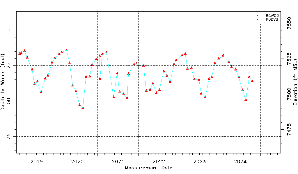
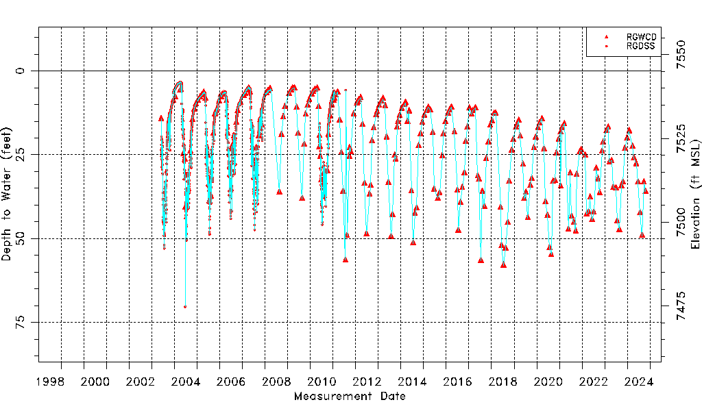
| Water-level Count | 2198 |
| Water-level Date Range | 06/02/2003 thru 03/16/2026 |
| Monitored within the last 18 months | Yes, most recently on 03/16/2026 |
| Depth-to-Water Range (ft) | 3.29 to 70.31 |
| Water Table Elevation Range (ft NAVD88) | 7474.81 to 7541.83 |
| Water-Level-Source:Number-of-Measurements | RGWCD:258 RGDSS:1940 |