| Well Information Table |
|---|
| Common Well ID | CC03007219AA |
| RGWCD Confined Aquifer Well ID | RGDSSP06 |
| USGS Site Use Information | Unknown |
| USGS Groundwater Use Information | Unknown |
| Data Source(s) | RGWCD |
| Location Data |
|---|
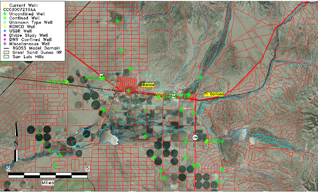
| TRS | CC03007219AA |
| Longitude/Latitude (NAD83) | -105.47296667 , 37.43003333 |
| Longitude/Latitude Data Source | RGDSS Piezometers (well completion reports) |
| RGDSS Longitude/Latitude (NAD83) | -105.472966666667 , 37.4300333333333 |
| Easting, Northing RGDSS-NAD83 (US ft) | 258377.15 , 158103.96 |
| Elevation and Depth Data |
|---|
| Ground Elevation (ft NAVD88) | 7817.11 |
| Elevation Data Source | RGDSS piezometer database |
| RGDSS Piezometer Database (ft NAVD88) | 7817.11 |
| 1/3-Arc Second NED Ground Elevation (ft NAVD88) | 7811.57 |
| 1-Arc Second NED Ground Elevation (ft NAVD88) | 7818.61 |
| SRTM Ground Elevation (ft NAVD88) | 7819.02 |
| Total Depth (ft) | 265.00 |
| Model Layer | 3 |
| Model Layer Source | RGDSS Piezometer |
| Depth of Bottom of Layer 1 | 497 |
| Depth of Bottom of Layer 2 | 597 |
| Depth of Bottom of Layer 3 | 706 |
| Depth of Bottom of Layer 4 | 1874 |
| Additional Well Information | NONE |
| Aquifer Information |
|---|
| Aquifer Type | Confined |
| Aquifer Type Source | RGDSS_AQFR |
| Water-level Database Information |
|---|
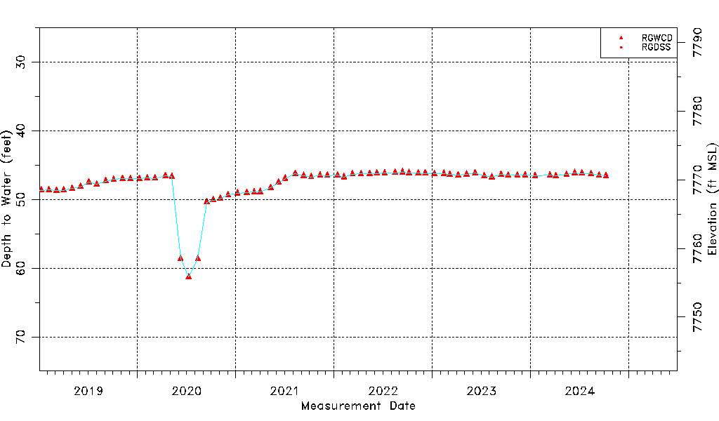
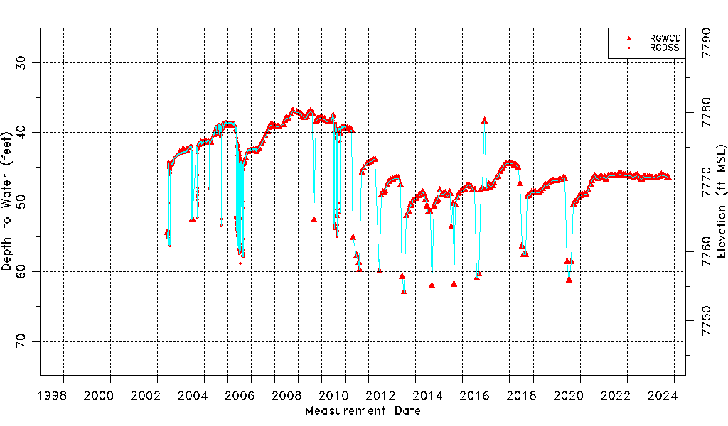
| Water-level Count | 1822 |
| Water-level Date Range | 06/02/2003 thru 03/04/2026 |
| Monitored within the last 18 months | Yes, most recently on 03/04/2026 |
| Depth-to-Water Range (ft) | 36.90 to 62.94 |
| Water Table Elevation Range (ft NAVD88) | 7754.17 to 7780.21 |
| Water-Level-Source:Number-of-Measurements | RGWCD:269 RGDSS:1553 |