| Well Information Table |
|---|
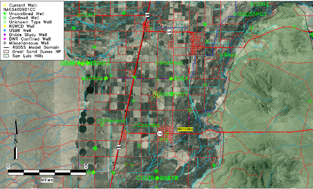
| Common Well ID | NA03400901CC |
| RGWCD Confined Aquifer Well ID | RGDSSP07 |
| USGS Site Use Information | Unknown |
| USGS Groundwater Use Information | Unknown |
| Data Source(s) | RGWCD |
| Location Data |
|---|
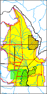
| TRS | NA03400901CC |
| Longitude/Latitude (NAD83) | -105.94731667 , 37.21016667 |
| Longitude/Latitude Data Source | RGDSS Piezometers (well completion reports) |
| RGDSS Longitude/Latitude (NAD83) | -105.947316666667 , 37.2101666666667 |
| Easting, Northing RGDSS-NAD83 (US ft) | 120451.60 , 78128.40 |
| Elevation and Depth Data |
|---|
| Ground Elevation (ft NAVD88) | 7651.12 |
| Elevation Data Source | RGDSS piezometer database |
| RGDSS Piezometer Database (ft NAVD88) | 7651.12 |
| 1/3-Arc Second NED Ground Elevation (ft NAVD88) | 7650.56 |
| 1-Arc Second NED Ground Elevation (ft NAVD88) | 7651.32 |
| SRTM Ground Elevation (ft NAVD88) | 7655.07 |
| Total Depth (ft) | 350.00 |
| Model Layer | 3 |
| Model Layer Source | RGDSS Piezometer |
| Depth of Bottom of Layer 1 | 35 |
| Depth of Bottom of Layer 2 | 281 |
| Depth of Bottom of Layer 3 | 544 |
| Depth of Bottom of Layer 4 | 1486 |
| Additional Well Information | NONE |
| Aquifer Information |
|---|
| Aquifer Type | Confined |
| Aquifer Type Source | RGDSS_AQFR |
| Water-level Database Information |
|---|
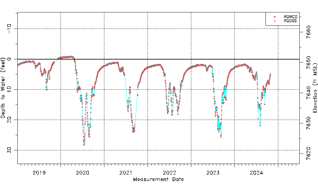
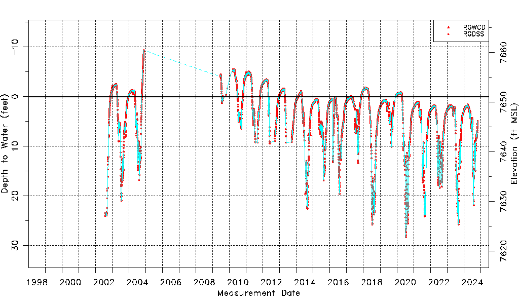
| Water-level Count | 5860 |
| Water-level Date Range | 07/31/2002 thru 10/28/2024 |
| Monitored within the last 18 months | No, most recently on 10/28/2024 |
| Depth-to-Water Range (ft) | -9.34 to 28.34 |
| Water Table Elevation Range (ft NAVD88) | 7622.78 to 7660.46 |
| Water-Level-Source:Number-of-Measurements | RGWCD:2 RGDSS:5858 |