| Well Information Table |
|---|
| Common Well ID | NA03900736DD |
| RGWCD Confined Aquifer Well ID | RGDSSP10 |
| USGS Site Use Information | Unknown |
| USGS Groundwater Use Information | Unknown |
| Data Source(s) | RGWCD |
| Location Data |
|---|
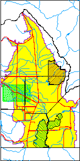
| TRS | NA03900736DD |
| Longitude/Latitude (NAD83) | -106.15055000 , 37.57490000 |
| Longitude/Latitude Data Source | RGDSS Piezometers (well completion reports) |
| RGDSS Longitude/Latitude (NAD83) | -106.150550000000 , 37.5749000000000 |
| Easting, Northing RGDSS-NAD83 (US ft) | 61956.04 , 211132.17 |
| Elevation and Depth Data |
|---|
| Ground Elevation (ft NAVD88) | 7662.95 |
| Elevation Data Source | RGDSS piezometer database |
| RGDSS Piezometer Database (ft NAVD88) | 7662.95 |
| 1/3-Arc Second NED Ground Elevation (ft NAVD88) | 7662.33 |
| 1-Arc Second NED Ground Elevation (ft NAVD88) | 7662.46 |
| SRTM Ground Elevation (ft NAVD88) | 7673.95 |
| Total Depth (ft) | 800.00 |
| Model Layer | 3 |
| Model Layer Source | RGDSS Piezometer |
| Depth of Bottom of Layer 1 | 46 |
| Depth of Bottom of Layer 2 | 193 |
| Depth of Bottom of Layer 3 | 791 |
| Depth of Bottom of Layer 4 | 1507 |
| Additional Well Information | NONE |
| Aquifer Information |
|---|
| Aquifer Type | Confined |
| Aquifer Type Source | RGDSS_AQFR |
| Water-level Database Information |
|---|
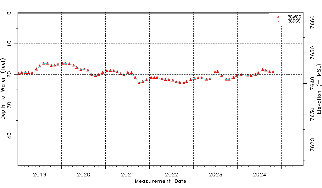
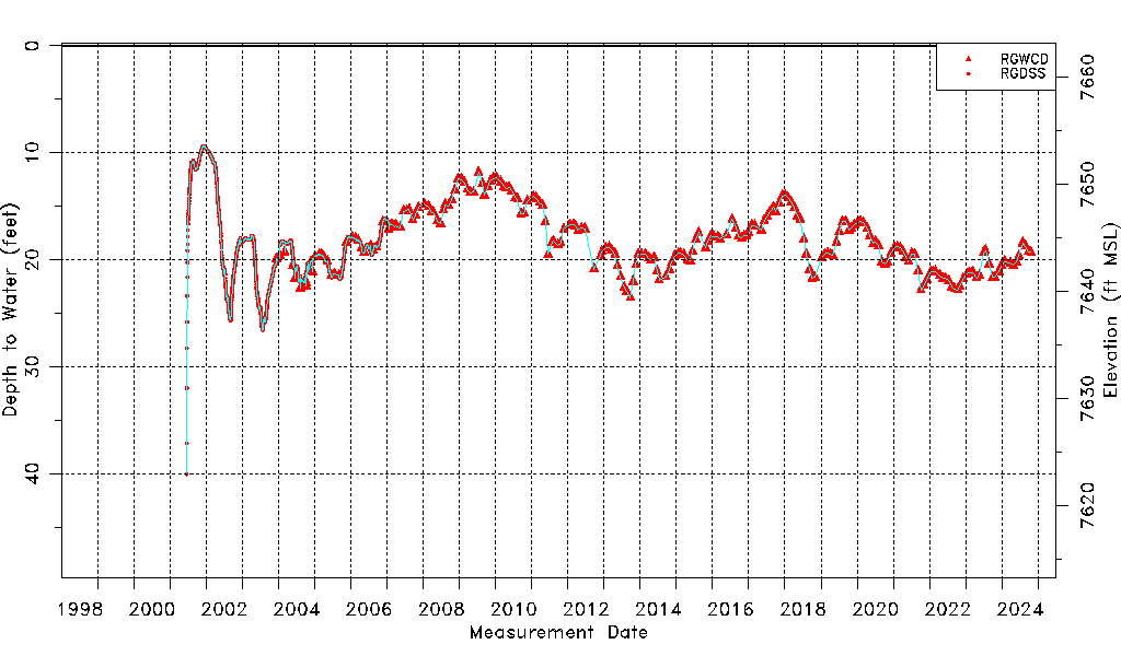
| Water-level Count | 2278 |
| Water-level Date Range | 06/19/2001 thru 03/06/2026 |
| Monitored within the last 18 months | Yes, most recently on 03/06/2026 |
| Depth-to-Water Range (ft) | 9.37 to 40.03 |
| Water Table Elevation Range (ft NAVD88) | 7622.92 to 7653.58 |
| Water-Level-Source:Number-of-Measurements | RGWCD:243 RGDSS:2035 |