| Well Information Table |
|---|
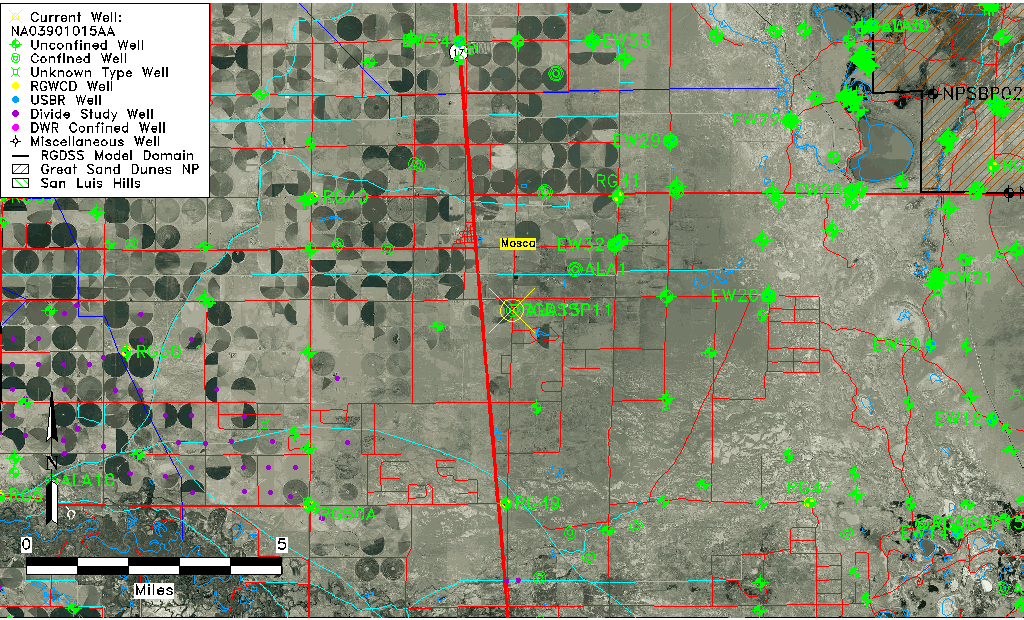
| Common Well ID | NA03901015AA |
| RGWCD Confined Aquifer Well ID | RGDSSP11 |
| USGS Site Use Information | Unknown |
| USGS Groundwater Use Information | Unknown |
| Data Source(s) | RGWCD |
| Location Data |
|---|
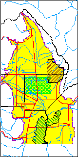
| TRS | NA03901015AA |
| Longitude/Latitude (NAD83) | -105.85643333 , 37.62996667 |
| Longitude/Latitude Data Source | RGDSS Piezometers (well completion reports) |
| RGDSS Longitude/Latitude (NAD83) | -105.856433333333 , 37.6299666666667 |
| Easting, Northing RGDSS-NAD83 (US ft) | 147210.38 , 230874.04 |
| Elevation and Depth Data |
|---|
| Ground Elevation (ft NAVD88) | 7556.00 |
| Elevation Data Source | RGDSS piezometer database |
| RGDSS Piezometer Database (ft NAVD88) | 7556.00 |
| 1/3-Arc Second NED Ground Elevation (ft NAVD88) | 7552.76 |
| 1-Arc Second NED Ground Elevation (ft NAVD88) | 7554.94 |
| SRTM Ground Elevation (ft NAVD88) | 7561.35 |
| Total Depth (ft) | 1040.00 |
| Model Layer | 3 |
| Model Layer Source | RGDSS Piezometer |
| Depth of Bottom of Layer 1 | 51 |
| Depth of Bottom of Layer 2 | 579 |
| Depth of Bottom of Layer 3 | 981 |
| Depth of Bottom of Layer 4 | 1850 |
| Additional Well Information | NONE |
| Aquifer Information |
|---|
| Aquifer Type | Confined |
| Aquifer Type Source | RGDSS_AQFR |
| Water-level Database Information |
|---|
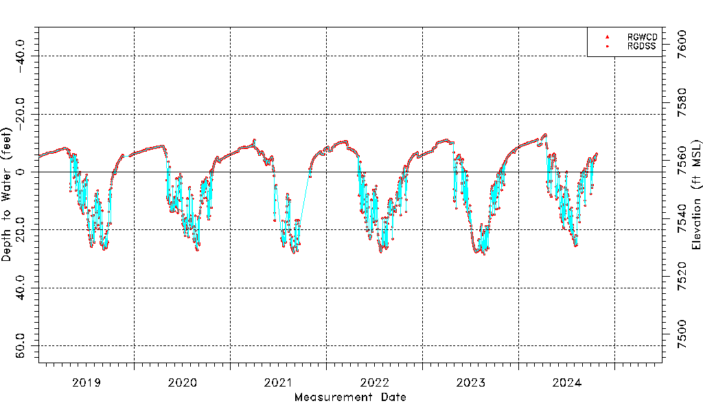
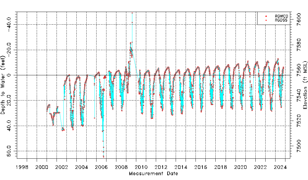
| Water-level Count | 7811 |
| Water-level Date Range | 01/12/2001 thru 10/24/2024 |
| Monitored within the last 18 months | No, most recently on 10/24/2024 |
| Depth-to-Water Range (ft) | -48.98 to 64.73 |
| Water Table Elevation Range (ft NAVD88) | 7491.27 to 7604.98 |
| Water-Level-Source:Number-of-Measurements | RGWCD:7 RGDSS:7805 |