| Well Information Table |
|---|
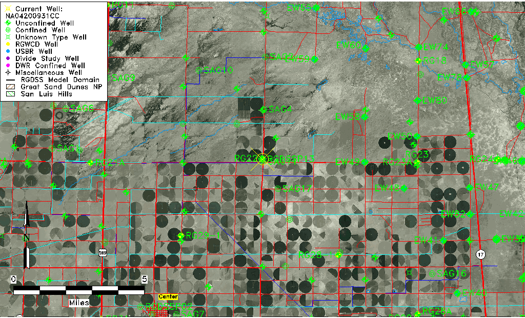
| Common Well ID | NA04200931CC |
| RGWCD Confined Aquifer Well ID | RGDSSP13 |
| USGS Site Use Information | Unknown |
| USGS Groundwater Use Information | Unknown |
| Data Source(s) | RGWCD |
| Location Data |
|---|
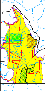
| TRS | NA04200931CC |
| Longitude/Latitude (NAD83) | -106.03673333 , 37.83746667 |
| Longitude/Latitude Data Source | RGDSS Piezometers (well completion reports) |
| RGDSS Longitude/Latitude (NAD83) | -106.036733333333 , 37.8374666666667 |
| Easting, Northing RGDSS-NAD83 (US ft) | 95309.66 , 306565.75 |
| Elevation and Depth Data |
|---|
| Ground Elevation (ft NAVD88) | 7581.00 |
| Elevation Data Source | RGDSS piezometer database |
| RGDSS Piezometer Database (ft NAVD88) | 7581.00 |
| 1/3-Arc Second NED Ground Elevation (ft NAVD88) | 7581.55 |
| 1-Arc Second NED Ground Elevation (ft NAVD88) | 7580.71 |
| SRTM Ground Elevation (ft NAVD88) | 7593.64 |
| Total Depth (ft) | 803.00 |
| Model Layer | 3 |
| Model Layer Source | RGDSS Piezometer |
| Depth of Bottom of Layer 1 | 103 |
| Depth of Bottom of Layer 2 | 219 |
| Depth of Bottom of Layer 3 | 674 |
| Depth of Bottom of Layer 4 | 2436 |
| Additional Well Information | NONE |
| Aquifer Information |
|---|
| Aquifer Type | Confined |
| Aquifer Type Source | RGDSS_AQFR |
| Water-level Database Information |
|---|
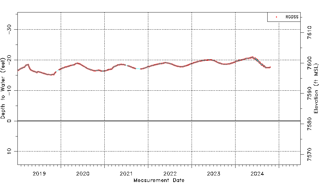
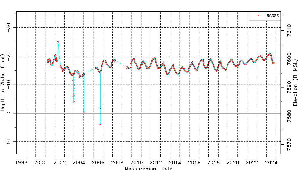
| Water-level Count | 7892 |
| Water-level Date Range | 03/29/2001 thru 05/12/2026 |
| Monitored within the last 18 months | Yes, most recently on 05/12/2026 |
| Depth-to-Water Range (ft) | -25.17 to 3.85 |
| Water Table Elevation Range (ft NAVD88) | 7577.15 to 7606.17 |
| Water-Level-Source:Number-of-Measurements | RGWCD:541 RGDSS:7351 |