| Well Information Table |
|---|
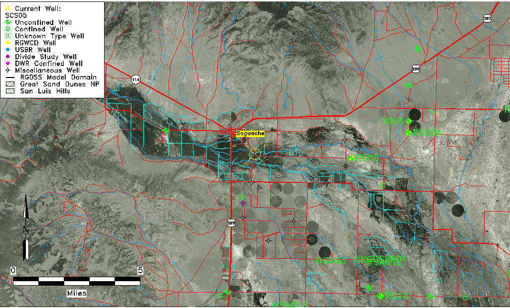
| Common Well ID | SCS05 |
| USGS Site Use Information | Unknown |
| USGS Groundwater Use Information | Unknown |
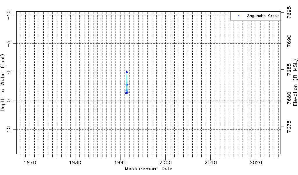
| Data Source(s) | Saguache Creek |
| Location Data |
|---|
| Longitude/Latitude (NAD83) | -106.12458587 , 38.07450398 |
| Longitude/Latitude Data Source | Saguach Ck Survey |
| Easting, Northing RGDSS-NAD83 (US ft) | 70372.79 , 392972.46 |
| Elevation and Depth Data |
|---|
| Ground Elevation (ft NAVD88) | 7684.53 |
| Elevation Data Source | Saguache Creek survey |
| 1/3-Arc Second NED Ground Elevation (ft NAVD88) | 7685.04 |
| 1-Arc Second NED Ground Elevation (ft NAVD88) | 7684.48 |
| SRTM Ground Elevation (ft NAVD88) | 7692.65 |
| Model Layer | 1 |
| Model Layer Source | Saguache Layer |
| Depth of Bottom of Layer 1 | 102 |
| Depth of Bottom of Layer 2 | 177 |
| Depth of Bottom of Layer 3 | 277 |
| Additional Well Information | NONE |
| Aquifer Information |
|---|
| Aquifer Type | Unconfined |
| Aquifer Type Source | TD Elevation/Model Layer |
| Water-level Database Information |
|---|
| Water-level Count | 5 |
| Water-level Date Range | 04/12/1991 thru 08/16/1991 |
| Monitored within the last 18 months | No, most recently on 08/16/1991 |
| Depth-to-Water Range (ft) | 0.00 to 3.66 |
| Water Table Elevation Range (ft NAVD88) | 7680.87 to 7684.53 |
| Water-Level-Source:Number-of-Measurements | Saguache Creek:5 |