| Well Information Table |
|---|
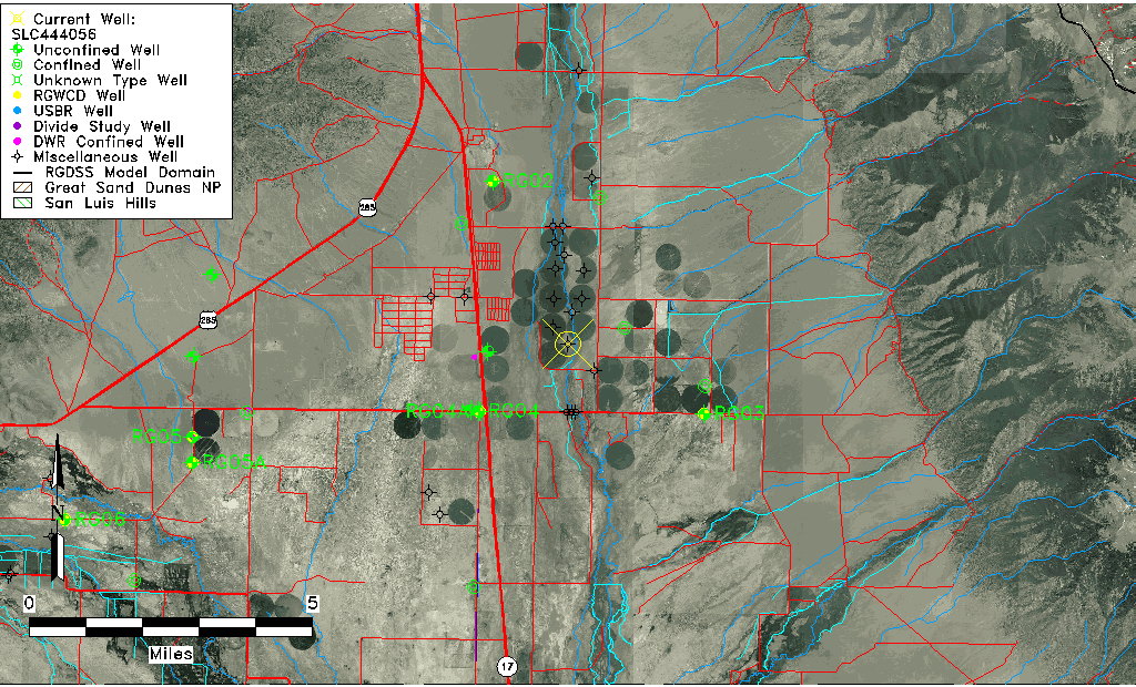
| Common Well ID | SLC444056 |
| USGS Site Use Information | Unknown |
| USGS Groundwater Use Information | Unknown |
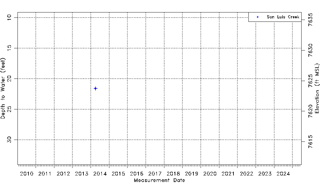
| Data Source(s) | San Luis Creek |
| Location Data |
|---|
| Longitude/Latitude (NAD83) | -105.89243570 , 38.11781260 |
| Longitude/Latitude Data Source | AdHoc wells from San Luis Ck (SLC) |
| Easting, Northing RGDSS-NAD83 (US ft) | 137220.78 , 408489.44 |
| Elevation and Depth Data |
|---|
| Ground Elevation (ft NAVD88) | 7645.34 |
| Elevation Data Source | NED3 data |
| 1/3-Arc Second NED Ground Elevation (ft NAVD88) | 7645.34 |
| 1-Arc Second NED Ground Elevation (ft NAVD88) | 7645.76 |
| SRTM Ground Elevation (ft NAVD88) | 7647.99 |
| Total Depth (ft) | 60.00 |
| Depth to Bottom of Screen (ft) | 60.00 |
| Model Layer | 1 |
| Model Layer Source | Well Depth |
| Depth of Bottom of Layer 1 | 97 |
| Depth of Bottom of Layer 2 | 151 |
| Depth of Bottom of Layer 3 | 439 |
| Depth of Bottom of Layer 4 | 3731 |
| Additional Well Information | NONE |
| Aquifer Information |
|---|
| Aquifer Type | Unconfined |
| Aquifer Type Source | TD Elevation/Model Layer |
| Water-level Database Information |
|---|
| Water-level Count | 1 |
| Water-level Date Range | 04/04/2014 thru 04/04/2014 |
| Monitored within the last 18 months | No, most recently on 04/04/2014 |
| Depth-to-Water Range (ft) | 21.60 to 21.60 |
| Water Table Elevation Range (ft NAVD88) | 7623.74 to 7623.74 |
| Water-Level-Source:Number-of-Measurements | San Luis Creek:1 |