| Well Information Table |
|---|
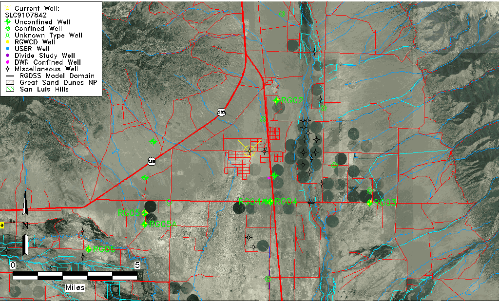
| Common Well ID | SLC9107842 |
| USGS Site Use Information | Unknown |
| USGS Groundwater Use Information | Unknown |
| Data Source(s) | San Luis Creek |
| Location Data |
|---|
| Longitude/Latitude (NAD83) | -105.93683517 , 38.12990425 |
| Longitude/Latitude Data Source | AdHoc wells from San Luis Ck (SLC) |
| Easting, Northing RGDSS-NAD83 (US ft) | 124464.20 , 412926.31 |
| Elevation and Depth Data |
|---|
| Ground Elevation (ft NAVD88) | 7659.79 |
| Elevation Data Source | NED3 data |
| 1/3-Arc Second NED Ground Elevation (ft NAVD88) | 7659.79 |
| 1-Arc Second NED Ground Elevation (ft NAVD88) | 7661.12 |
| SRTM Ground Elevation (ft NAVD88) | 7669.65 |
| Total Depth (ft) | 175.00 |
| Depth to Top of Screen (ft) | 100.0 |
| Depth to Bottom of Screen (ft) | 175.00 |
| Model Layer | 2 |
| Model Layer Source | Well Depth |
| Depth of Bottom of Layer 1 | 120 |
| Depth of Bottom of Layer 2 | 177 |
| Depth of Bottom of Layer 3 | 463 |
| Depth of Bottom of Layer 4 | 3062 |
| Additional Well Information | NONE |
| Aquifer Information |
|---|
| Aquifer Type | Confined |
| Aquifer Type Source | TD Elevation/Model Layer |
| Water-level Database Information |
|---|
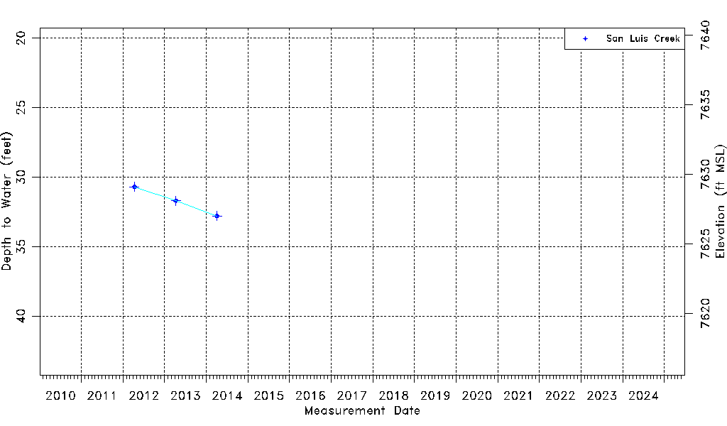
| Water-level Count | 3 |
| Water-level Date Range | 04/11/2012 thru 04/04/2014 |
| Monitored within the last 18 months | No, most recently on 04/04/2014 |
| Depth-to-Water Range (ft) | 30.70 to 32.80 |
| Water Table Elevation Range (ft NAVD88) | 7626.99 to 7629.09 |
| Water-Level-Source:Number-of-Measurements | San Luis Creek:3 |