| Well Information Table |
|---|
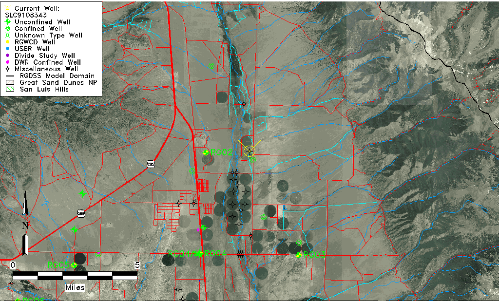
| Common Well ID | SLC9108343 |
| USGS Site Use Information | Unknown |
| USGS Groundwater Use Information | Unknown |
| Data Source(s) | San Luis Creek |
| Location Data |
|---|
| Longitude/Latitude (NAD83) | -105.88483555 , 38.16032422 |
| Longitude/Latitude Data Source | AdHoc wells from San Luis Ck (SLC) |
| Easting, Northing RGDSS-NAD83 (US ft) | 139444.03 , 423960.43 |
| Elevation and Depth Data |
|---|
| Ground Elevation (ft NAVD88) | 7724.19 |
| Elevation Data Source | NED3 data |
| 1/3-Arc Second NED Ground Elevation (ft NAVD88) | 7724.19 |
| 1-Arc Second NED Ground Elevation (ft NAVD88) | 7727.21 |
| SRTM Ground Elevation (ft NAVD88) | 7720.36 |
| Total Depth (ft) | 170.00 |
| Depth to Top of Screen (ft) | 110.0 |
| Depth to Bottom of Screen (ft) | 170.00 |
| Model Layer | 3 |
| Model Layer Source | Well Depth |
| Depth of Bottom of Layer 1 | 79 |
| Depth of Bottom of Layer 2 | 116 |
| Depth of Bottom of Layer 3 | 425 |
| Depth of Bottom of Layer 4 | 3277 |
| Additional Well Information | NONE |
| Aquifer Information |
|---|
| Aquifer Type | Confined |
| Aquifer Type Source | TD Elevation/Model Layer |
| Water-level Database Information |
|---|
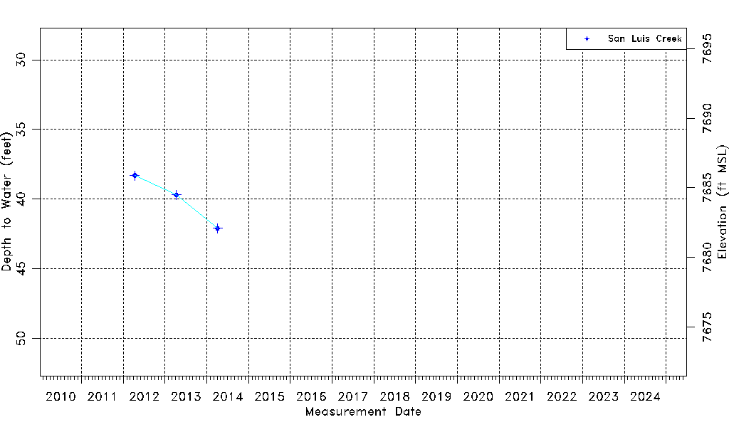
| Water-level Count | 3 |
| Water-level Date Range | 04/11/2012 thru 04/04/2014 |
| Monitored within the last 18 months | No, most recently on 04/04/2014 |
| Depth-to-Water Range (ft) | 38.30 to 42.10 |
| Water Table Elevation Range (ft NAVD88) | 7682.09 to 7685.89 |
| Water-Level-Source:Number-of-Measurements | San Luis Creek:3 |