| Well Information Table |
|---|
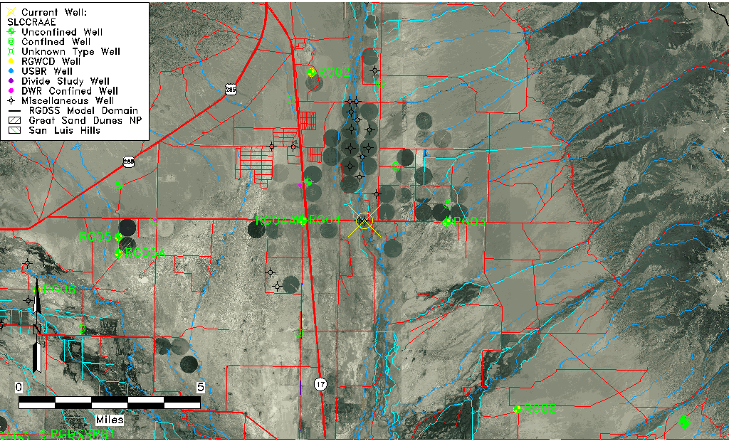
| Common Well ID | SLCCRAAE |
| USGS Site Use Information | Unknown |
| USGS Groundwater Use Information | Unknown |
| Data Source(s) | San Luis Creek |
| Location Data |
|---|
| Longitude/Latitude (NAD83) | -105.88990001 , 38.10036667 |
| Longitude/Latitude Data Source | AdHoc wells from San Luis Ck (SLC) |
| Easting, Northing RGDSS-NAD83 (US ft) | 137934.42 , 402136.47 |
| Elevation and Depth Data |
|---|
| Ground Elevation (ft NAVD88) | 7620.28 |
| Elevation Data Source | RIDGELINE 20120817 |
| 1/3-Arc Second NED Ground Elevation (ft NAVD88) | 7624.18 |
| 1-Arc Second NED Ground Elevation (ft NAVD88) | 7623.36 |
| SRTM Ground Elevation (ft NAVD88) | 7631.23 |
| Total Depth (ft) | 20.00 |
| Depth to Bottom of Screen (ft) | 20.00 |
| Model Layer | 1 |
| Model Layer Source | Well Depth |
| Depth of Bottom of Layer 1 | 89 |
| Depth of Bottom of Layer 2 | 167 |
| Depth of Bottom of Layer 3 | 418 |
| Depth of Bottom of Layer 4 | 3806 |
| Additional Well Information | NONE |
| Aquifer Information |
|---|
| Aquifer Type | Unconfined |
| Aquifer Type Source | TD Elevation/Model Layer |
| Water-level Database Information |
|---|
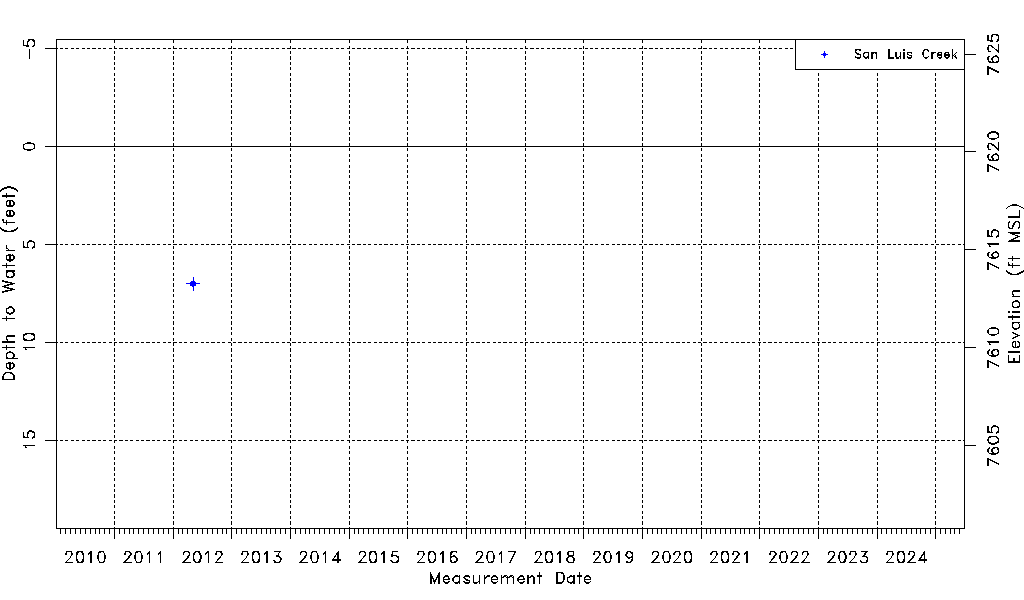
| Water-level Count | 1 |
| Water-level Date Range | 05/03/2012 thru 05/03/2012 |
| Monitored within the last 18 months | No, most recently on 05/03/2012 |
| Depth-to-Water Range (ft) | 7.01 to 7.01 |
| Water Table Elevation Range (ft NAVD88) | 7613.27 to 7613.27 |
| Water-Level-Source:Number-of-Measurements | San Luis Creek:1 |