| Well Information Table |
|---|
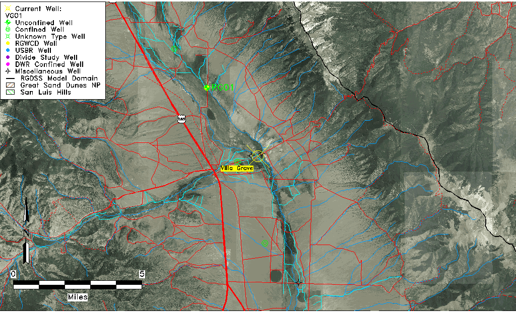
| Common Well ID | VG01 |
| USGS Site Use Information | Unknown |
| USGS Groundwater Use Information | Unknown |
| Data Source(s) | Villa Grove Study |
| Location Data |
|---|
| Longitude/Latitude (NAD83) | -105.91815902 , 38.25907860 |
| Longitude/Latitude Data Source | Villa Grove Hydro Study |
| Easting, Northing RGDSS-NAD83 (US ft) | 129965.81 , 459937.44 |
| Elevation and Depth Data |
|---|
| Ground Elevation (ft NAVD88) | 7880.96 |
| Elevation Data Source | Villa Grove Hydro Study |
| 1/3-Arc Second NED Ground Elevation (ft NAVD88) | 7884.60 |
| 1-Arc Second NED Ground Elevation (ft NAVD88) | 7881.77 |
| SRTM Ground Elevation (ft NAVD88) | 7883.21 |
| Total Depth (ft) | 3.50 |
| Model Layer | 1 |
| Model Layer Source | Aquifer Type |
| Depth of Bottom of Layer 1 | 29 |
| Depth of Bottom of Layer 2 | 49 |
| Depth of Bottom of Layer 3 | 76 |
| Depth of Bottom of Layer 4 | 1547 |
| Additional Well Information | NONE |
| Aquifer Information |
|---|
| Aquifer Type | Unconfined |
| Aquifer Type Source | VG_AQFR |
| Water-level Database Information |
|---|
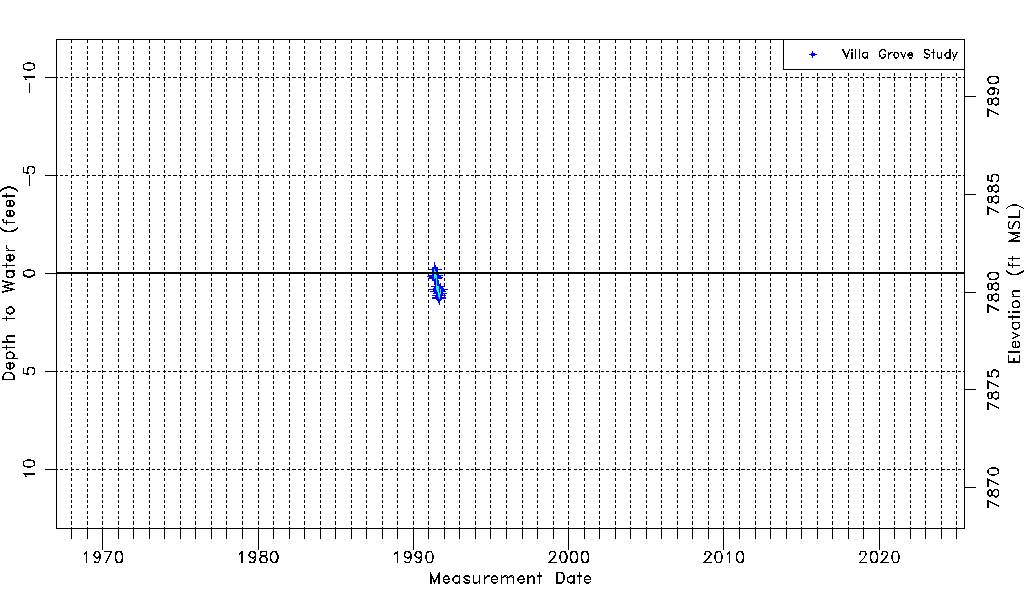
| Water-level Count | 19 |
| Water-level Date Range | 05/08/1991 thru 10/13/1991 |
| Monitored within the last 18 months | No, most recently on 10/13/1991 |
| Depth-to-Water Range (ft) | -0.20 to 1.27 |
| Water Table Elevation Range (ft NAVD88) | 7879.69 to 7881.16 |
| Water-Level-Source:Number-of-Measurements | Villa Grove Study:19 |