| Well Information Table |
|---|
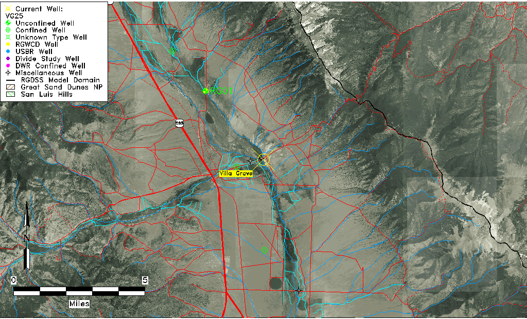
| Common Well ID | VG25 |
| USGS Site Use Information | Unknown |
| USGS Groundwater Use Information | Unknown |
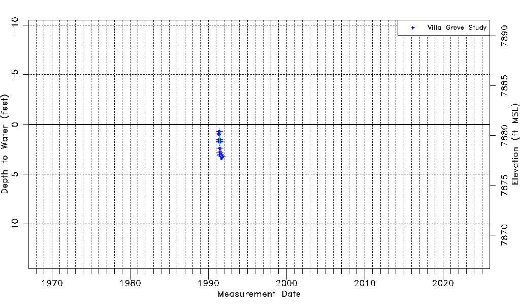
| Data Source(s) | Villa Grove Study |
| Location Data |
|---|
| Longitude/Latitude (NAD83) | -105.91399341 , 38.25988277 |
| Longitude/Latitude Data Source | Villa Grove Hydro Study |
| Easting, Northing RGDSS-NAD83 (US ft) | 131162.37 , 460226.88 |
| Elevation and Depth Data |
|---|
| Ground Elevation (ft NAVD88) | 7881.11 |
| Elevation Data Source | Villa Grove Hydro Study |
| 1/3-Arc Second NED Ground Elevation (ft NAVD88) | 7882.82 |
| 1-Arc Second NED Ground Elevation (ft NAVD88) | 7881.43 |
| SRTM Ground Elevation (ft NAVD88) | 7886.62 |
| Total Depth (ft) | 3.50 |
| Model Layer | 1 |
| Model Layer Source | Aquifer Type |
| Depth of Bottom of Layer 1 | 32 |
| Depth of Bottom of Layer 2 | 52 |
| Depth of Bottom of Layer 3 | 83 |
| Depth of Bottom of Layer 4 | 1563 |
| Additional Well Information | NONE |
| Aquifer Information |
|---|
| Aquifer Type | Unconfined |
| Aquifer Type Source | VG_AQFR |
| Water-level Database Information |
|---|
| Water-level Count | 15 |
| Water-level Date Range | 05/08/1991 thru 10/13/1991 |
| Monitored within the last 18 months | No, most recently on 10/13/1991 |
| Depth-to-Water Range (ft) | 0.72 to 3.25 |
| Water Table Elevation Range (ft NAVD88) | 7877.86 to 7880.39 |
| Water-Level-Source:Number-of-Measurements | Villa Grove Study:15 |