| Well Information Table |
|---|
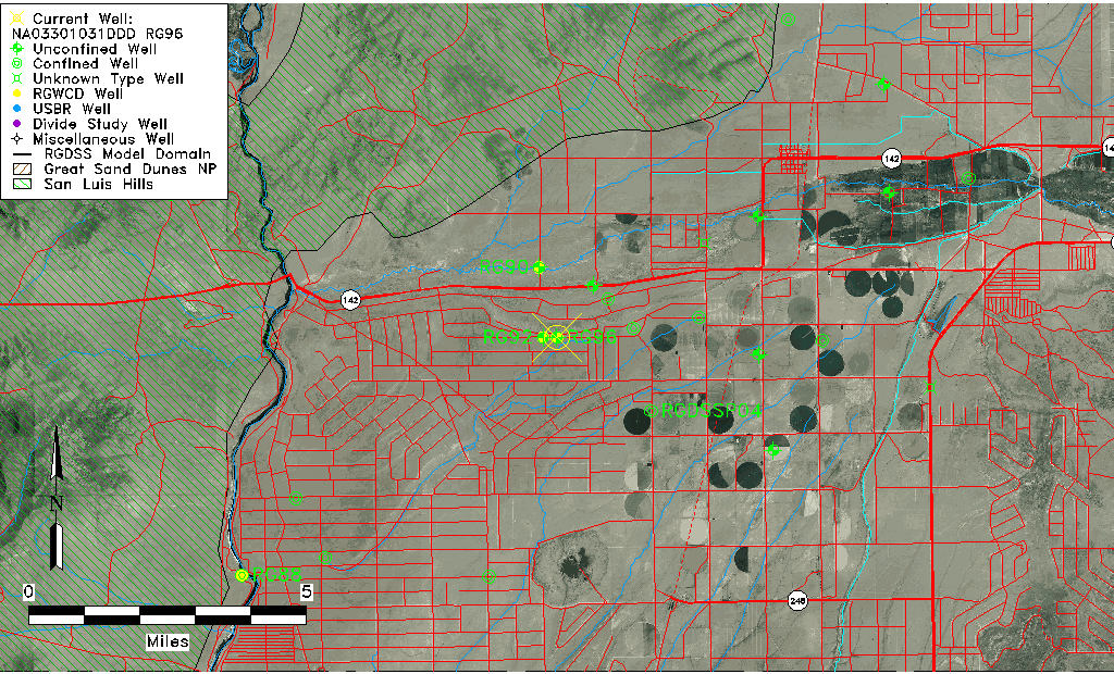
| Common Well ID | NA03301031DDD RG96 |
| USGS Well ID | 370300105544001 |
| USGS Station Name | NA03301031DDD RG96 |
| USGS Construction Date | 01/01/1974 |
| USGS Site Type | Well |
| USGS Site Use Information | Observation |
| USGS Groundwater Use Information | Unused |
| Data Source(s) | USGS |
| Location Data |
|---|
| TRS | NA03301031DDD RG96 |
| USGS TRS 1 | NA03301031DDD RG96 |
| USGS TRS | SESESES031T0033NR0010EN |
| Longitude/Latitude (NAD83) | -105.91168570 , 37.05001450 |
| Longitude/Latitude Data Source | GWSI decimal LAT/LONG field |
| USGS Longitude/Latitude (NAD83) | -105.911685700 , 37.050014500 |
| Easting, Northing RGDSS-NAD83 (US ft) | 130680.22 , 19806.75 |
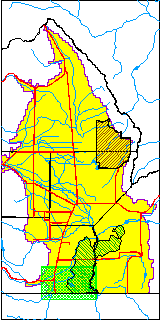
| USGS County | Conejos County |
| Elevation and Depth Data |
|---|
| Ground Elevation (ft NAVD88) | 7756.01 |
| Elevation Data Source | USGS GWSI database |
| USGS Ground Elevation (ft NGVD29) | 7752.00 |
| 1/3-Arc Second NED Ground Elevation (ft NAVD88) | 7753.99 |
| 1-Arc Second NED Ground Elevation (ft NAVD88) | 7753.31 |
| SRTM Ground Elevation (ft NAVD88) | 7759.12 |
| Total Depth (ft) | 47.00 |
| USGS Well Depth (ft) | 47.00 |
| Model Layer | 1 |
| Model Layer Source | Well Depth |
| Depth of Bottom of Layer 1 | 116 |
| Depth of Bottom of Layer 2 | 216 |
| Depth of Bottom of Layer 3 | 313 |
| Depth of Bottom of Layer 4 | 1603 |
| Additional Well Information | Geohydrology, Construction |
| Aquifer Information |
|---|
| Aquifer Type | Unconfined |
| Aquifer Type Source | TD Elevation/Model Layer |
| USGS Primary Aquifer | Alluvium,flood Plain |
| USGS Hydrologic Unit | Alamosa-Trinchera |
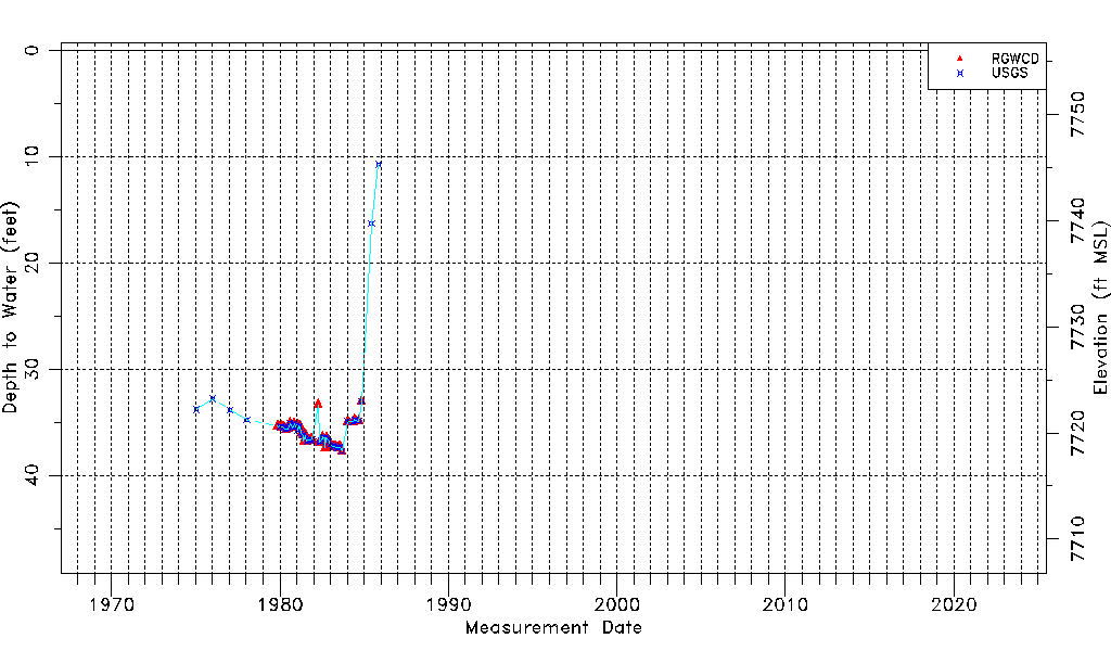
| USGS Data Available | Water-level (GW.LEV) |
| Water-level Database Information |
|---|
| Water-level Count | 61 |
| Water-level Date Range | 01/13/1975 thru 11/04/1985 |
| Monitored within the last 18 months | No, most recently on 11/04/1985 |
| Depth-to-Water Range (ft) | 10.73 to 37.73 |
| Water Table Elevation Range (ft NAVD88) | 7718.28 to 7745.28 |
| Water-Level-Source:Number-of-Measurements | RGWCD:48 USGS:54 |