| Well Information Table |
|---|
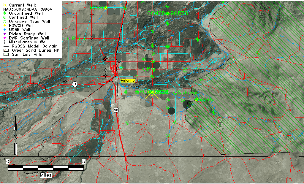
| Common Well ID | NA03300934DAA RG96A |
| RGWCD Well ID | RG96A |
| USGS Well ID | 370325105575201 |
| USGS Station Name | NA03300934DAA RG96A |
| USGS Construction Date | 01/01/1974 |
| USGS Site Type | Well |
| USGS Site Use Information | Observation |
| USGS Groundwater Use Information | Unused |
| Data Source(s) | USGS, RGWCD |
| Location Data |
|---|
| TRS | NA03300934DAA RG96A |
| RGWCD TRS | NA03300934DAA |
| USGS TRS 1 | NA03300934DAA RG96A |
| USGS TRS | NENESES034T0033NR0009EN |
| Longitude/Latitude (NAD83) | -105.96490833 , 37.05713611 |
| Longitude/Latitude Data Source | RGWCD/Davis Engineering |
| RGWCD Longitude/Latitude (NAD83) | -105:57:53.67 , 37:03:25.69 |
| USGS Longitude/Latitude (NAD83) | -105.965020400 , 37.056957900 |
| Easting, Northing RGDSS-NAD83 (US ft) | 115160.45 , 22441.56 |
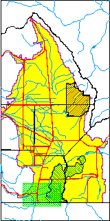
| USGS County | Conejos County |
| Elevation and Depth Data |
|---|
| Ground Elevation (ft NAVD88) | 7820.80 |
| Elevation Data Source | RGWCD well database |
| RGWCD Measuring Point Elevation (ft NAVD88) | 7822.800 |
| RGWCD Well Riser Height (ft) | 2.000 |
| RGWCD Ground Surface (ft NAVD88) | 7820.80 |
| USGS Ground Elevation (ft NGVD29) | 7815.00 |
| 1/3-Arc Second NED Ground Elevation (ft NAVD88) | 7819.31 |
| 1-Arc Second NED Ground Elevation (ft NAVD88) | 7819.79 |
| SRTM Ground Elevation (ft NAVD88) | 7825.89 |
| Total Depth (ft) | 30.00 |
| USGS Well Depth (ft) | 30.00 |
| Model Layer | 1 |
| Model Layer Source | RGWCD |
| Depth of Bottom of Layer 1 | 37 |
| Depth of Bottom of Layer 2 | 116 |
| Depth of Bottom of Layer 3 | 307 |
| Depth of Bottom of Layer 4 | 1615 |
| Additional Well Information | Geohydrology, Construction |
| Aquifer Information |
|---|
| Aquifer Type | Unconfined |
| Aquifer Type Source | RGWCD_AQ |
| USGS Primary Aquifer | Alluvium,flood Plain |
| USGS Hydrologic Unit | Alamosa-Trinchera |
| USGS Data Available | Water-level (GW.LEV) |
| Water-level Database Information |
|---|
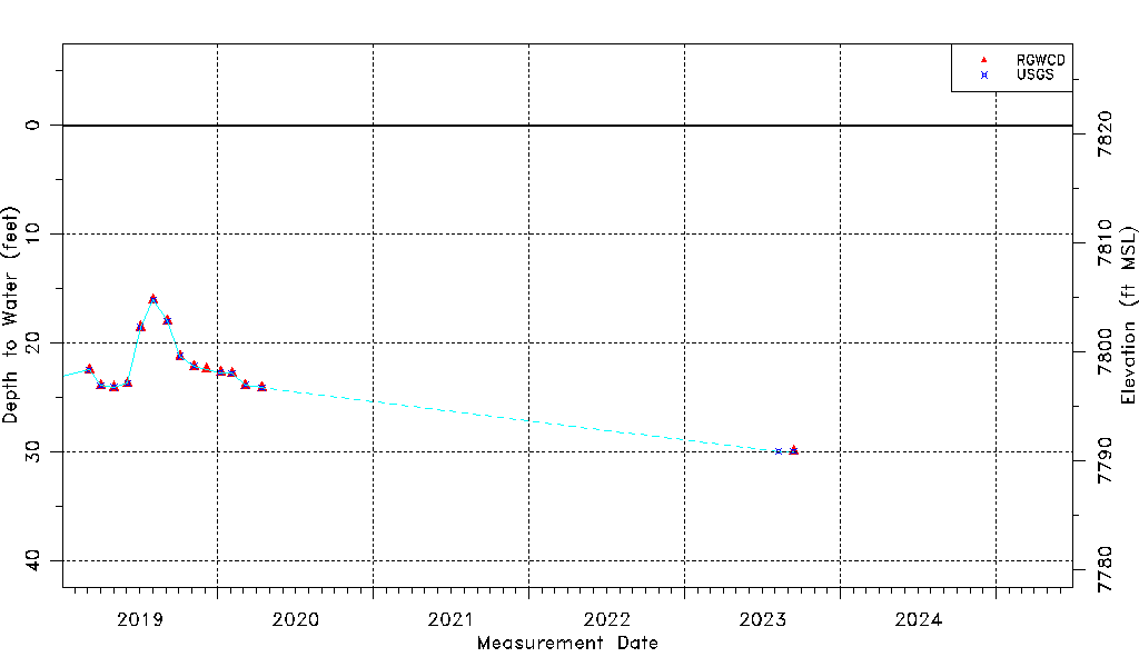
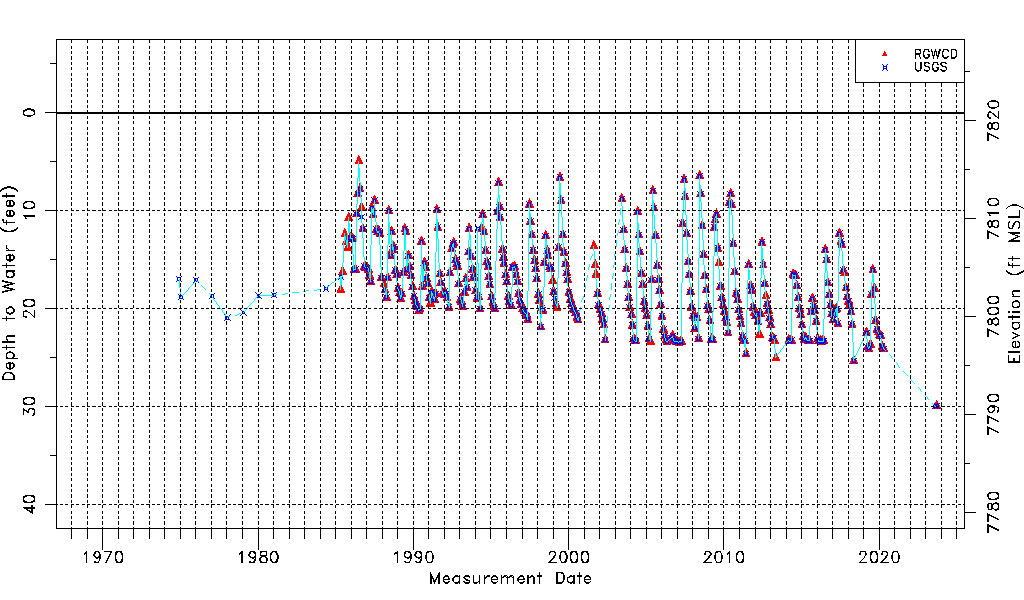
| Water-level Count | 468 |
| Water-level Date Range | 12/01/1974 thru 09/13/2023 |
| Monitored within the last 18 months | Yes, most recently on 09/13/2023 |
| Depth-to-Water Range (ft) | 4.95 to 29.99 |
| Water Table Elevation Range (ft NAVD88) | 7790.81 to 7815.85 |
| Water-Level-Source:Number-of-Measurements | RGWCD:449 USGS:361 |