| Well Information Table |
|---|
| Common Well ID | CB00307330DDA |
| USGS Well ID | 371130105355001 |
| USGS Station Name | CB00307330DDA |
| USGS Site Type | Well |
| USGS Site Use Information | Withdrawal of Water |
| USGS Groundwater Use Information | Irrigation |
| Data Source(s) | USGS |
| Location Data |
|---|
| TRS | CB00307330DDA |
| USGS TRS 1 | CB00307330DDA |
| USGS TRS | NESESES030T0003NR0073WC |
| Longitude/Latitude (NAD83) | -105.59468080 , 37.19156966 |
| Longitude/Latitude Data Source | GWSI decimal LAT/LONG field |
| USGS Longitude/Latitude (NAD83) | -105.594680800 , 37.191569660 |
| Easting, Northing RGDSS-NAD83 (US ft) | 223119.16 , 71255.21 |
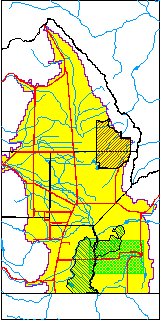
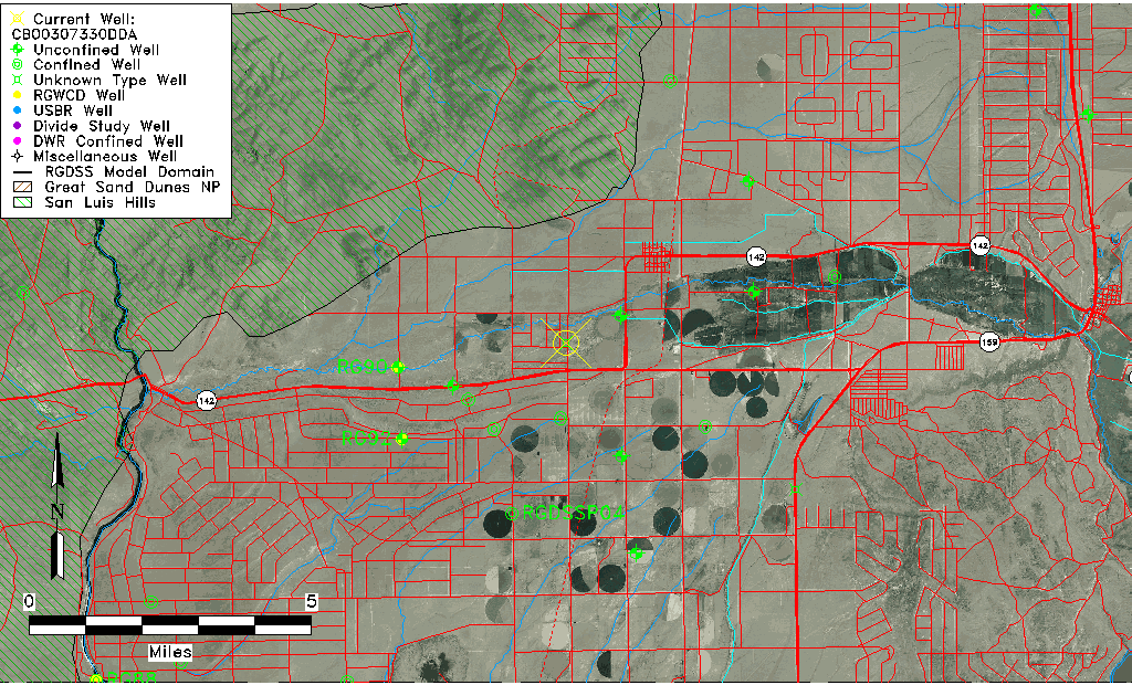
| USGS County | Costilla County |
| Elevation and Depth Data |
|---|
| Ground Elevation (ft NAVD88) | 7643.24 |
| Elevation Data Source | USGS GWSI database |
| USGS Ground Elevation (ft NGVD29) | 7639.00 |
| 1/3-Arc Second NED Ground Elevation (ft NAVD88) | 7647.37 |
| 1-Arc Second NED Ground Elevation (ft NAVD88) | 7649.07 |
| SRTM Ground Elevation (ft NAVD88) | 7652.56 |
| Depth of Bottom of Layer 1 | 205 |
| Depth of Bottom of Layer 2 | 305 |
| Depth of Bottom of Layer 3 | 696 |
| Depth of Bottom of Layer 4 | 1131 |
| Additional Well Information | Geohydrology, Construction |
| Aquifer Information |
|---|
| Aquifer Type | Unknown |
| Aquifer Type Source | None |
| USGS Primary Aquifer | Cenozoic Erathem |
| USGS Aquifer Type | Unconfined Single Aquifer |
| USGS Hydrologic Unit | Alamosa-Trinchera |
| USGS Data Available | Water-level (GW.LEV) |
| Water-level Database Information |
|---|
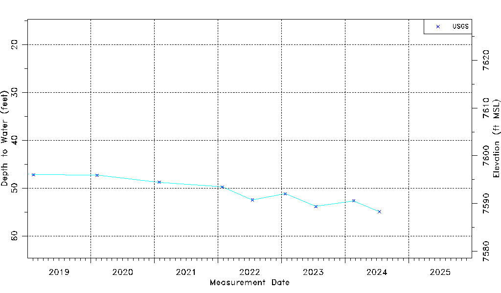
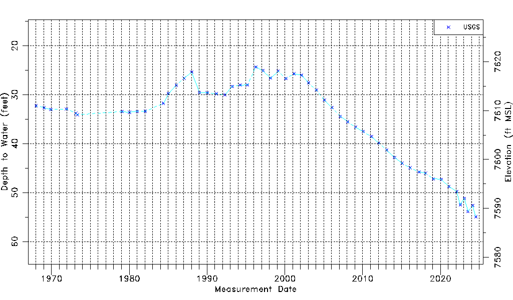
| Water-level Count | 54 |
| Water-level Date Range | 01/16/1968 thru 07/17/2024 |
| Monitored within the last 18 months | No, most recently on 07/17/2024 |
| Depth-to-Water Range (ft) | 24.33 to 54.95 |
| Water Table Elevation Range (ft NAVD88) | 7588.29 to 7618.91 |
| Water-Level-Source:Number-of-Measurements | USGS:54 |