| Well Information Table |
|---|
| Common Well ID | NA03400905ABA RG85A |
| RGWCD Well ID | RG85A |
| USGS Well ID | 371330106002101 |
| USGS Station Name | NA03400905ABA RG85A |
| USGS Construction Date | 02/26/1980 |
| USGS Site Type | Well |
| USGS Site Use Information | Observation |
| USGS Groundwater Use Information | Unused |
| Data Source(s) | USGS, RGWCD |
| Location Data |
|---|
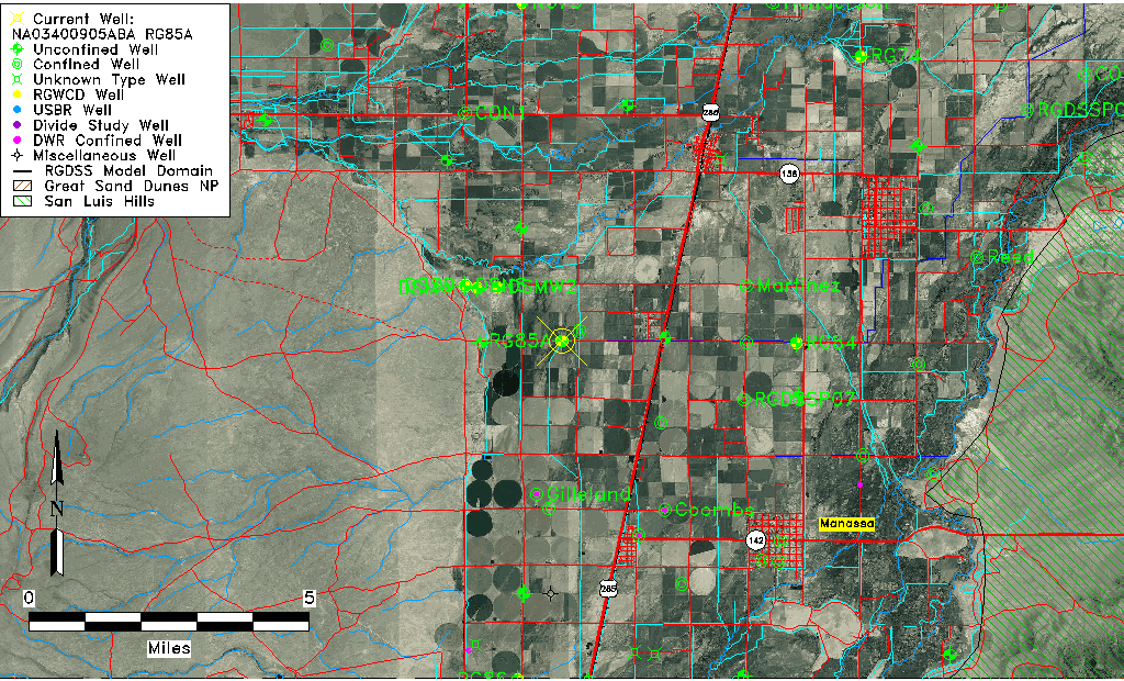
| TRS | NA03400905ABA RG85A |
| RGWCD TRS | NA03400905ABA |
| USGS TRS 1 | NA03400905ABA RG85A |
| USGS TRS | NENWNES005T0034NR0009EN |
| Longitude/Latitude (NAD83) | -106.00623333 , 37.22520556 |
| Longitude/Latitude Data Source | RGWCD/Davis Engineering |
| RGWCD Longitude/Latitude (NAD83) | -106:00:22.44 , 37:13:30.74 |
| USGS Longitude/Latitude (NAD83) | -106.001134900 , 37.225009170 |
| Easting, Northing RGDSS-NAD83 (US ft) | 103318.02 , 83657.25 |
| USGS Topography | Valley flat |
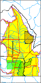
| USGS County | Conejos County |
| USGS Map Name | GOSHAWK DAM |
| USGS Map Scale | 24000 |
| Elevation and Depth Data |
|---|
| Ground Elevation (ft NAVD88) | 7660.60 |
| Elevation Data Source | RGWCD well database |
| RGWCD Measuring Point Elevation (ft NAVD88) | 7662.600 |
| RGWCD Well Riser Height (ft) | 2.000 |
| RGWCD Ground Surface (ft NAVD88) | 7660.60 |
| USGS Ground Elevation (ft NGVD29) | 7655.00 |
| 1/3-Arc Second NED Ground Elevation (ft NAVD88) | 7661.22 |
| 1-Arc Second NED Ground Elevation (ft NAVD88) | 7661.19 |
| SRTM Ground Elevation (ft NAVD88) | 7663.11 |
| Total Depth (ft) | 31.60 |
| USGS Well Depth (ft) | 31.60 |
| Model Layer | 1 |
| Model Layer Source | RGWCD |
| Depth of Bottom of Layer 1 | 42 |
| Depth of Bottom of Layer 2 | 113 |
| Depth of Bottom of Layer 3 | 216 |
| Depth of Bottom of Layer 4 | 1895 |
| Additional Well Information | Geohydrology, Construction |
| Aquifer Information |
|---|
| Aquifer Type | Unconfined |
| Aquifer Type Source | RGWCD_AQ |
| USGS Hydrologic Unit | Alamosa-Trinchera |
| USGS Data Available | Water-level (GW.LEV) |
| Water-level Database Information |
|---|
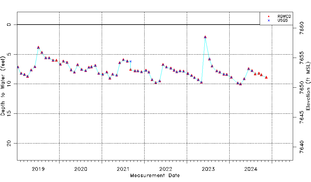
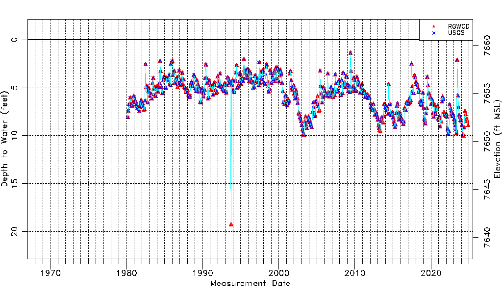
| Water-level Count | 558 |
| Water-level Date Range | 03/03/1980 thru 07/02/2026 |
| Monitored within the last 18 months | Yes, most recently on 07/02/2026 |
| Depth-to-Water Range (ft) | 1.40 to 19.29 |
| Water Table Elevation Range (ft NAVD88) | 7641.31 to 7659.20 |
| Water-Level-Source:Number-of-Measurements | RGWCD:547 USGS:515 |