| Well Information Table |
|---|
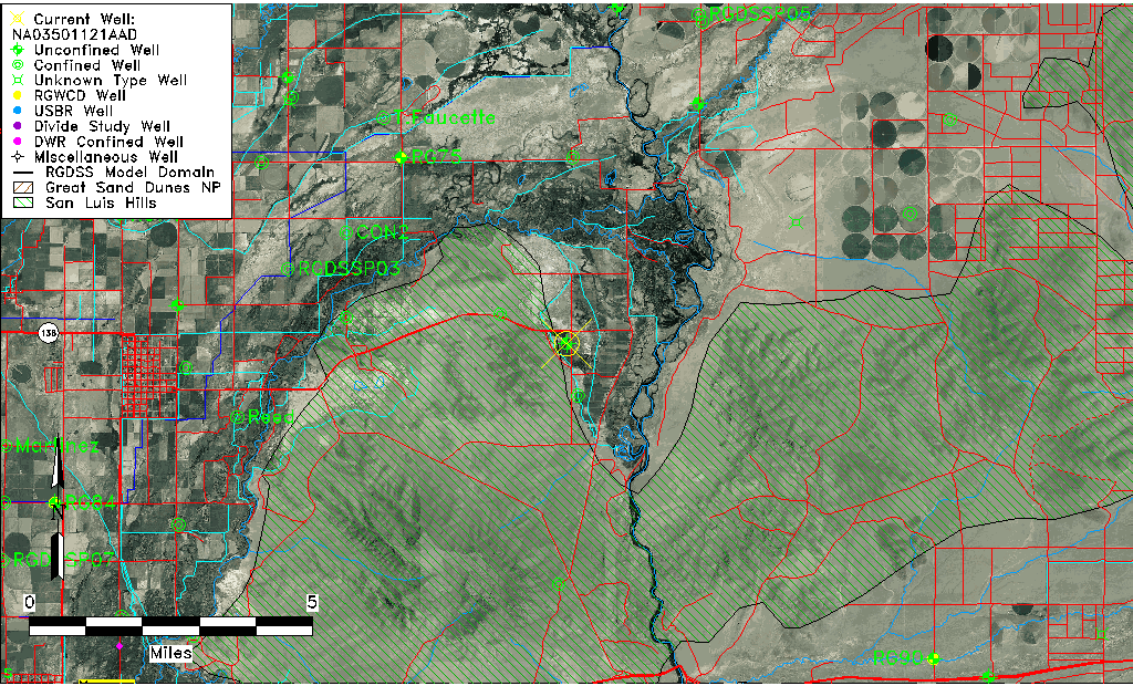
| Common Well ID | NA03501121AAD |
| USGS Well ID | 371539105460901 |
| USGS Station Name | NA03501121AAD |
| USGS Construction Date | 01/01/1966 |
| USGS Site Type | Well |
| USGS Site Use Information | Observation |
| USGS Groundwater Use Information | Unused |
| Data Source(s) | USGS |
| Location Data |
|---|
| TRS | NA03501121AAD |
| USGS TRS 1 | NA03501121AAD |
| USGS TRS | SENENES021T0035NR0011EN |
| Longitude/Latitude (NAD83) | -105.76640750 , 37.26612155 |
| Longitude/Latitude Data Source | GWSI decimal LAT/LONG field |
| USGS Longitude/Latitude (NAD83) | -105.766407500 , 37.266121550 |
| Easting, Northing RGDSS-NAD83 (US ft) | 173139.58 , 98394.11 |
| USGS Topography | Valley flat |
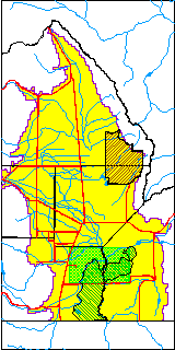
| USGS County | Conejos County |
| USGS Map Name | PIKES STOCKADE |
| USGS Map Scale | 24000 |
| Elevation and Depth Data |
|---|
| Ground Elevation (ft NAVD88) | 7507.96 |
| Elevation Data Source | USGS GWSI database |
| USGS Ground Elevation (ft NGVD29) | 7504.00 |
| 1/3-Arc Second NED Ground Elevation (ft NAVD88) | 7510.86 |
| 1-Arc Second NED Ground Elevation (ft NAVD88) | 7509.96 |
| SRTM Ground Elevation (ft NAVD88) | 7529.01 |
| Total Depth (ft) | 9.00 |
| USGS Well Depth (ft) | 9.00 |
| Model Layer | 1 |
| Model Layer Source | Well Depth |
| Depth of Bottom of Layer 1 | 27 |
| Depth of Bottom of Layer 2 | 113 |
| Depth of Bottom of Layer 3 | 393 |
| Depth of Bottom of Layer 4 | 1825 |
| Additional Well Information | Geohydrology, Construction |
| Aquifer Information |
|---|
| Aquifer Type | Unconfined |
| Aquifer Type Source | TD Elevation/Model Layer |
| USGS Primary Aquifer | Cenozoic Erathem |
| USGS Hydrologic Unit | Alamosa-Trinchera |
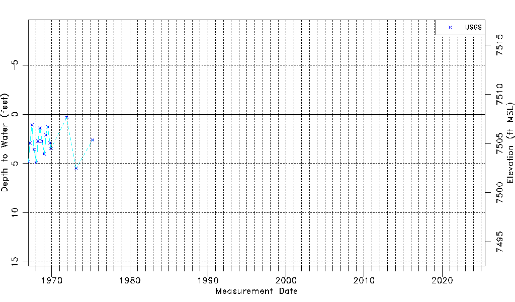
| USGS Data Available | Water-level (GW.LEV) |
| Water-level Database Information |
|---|
| Water-level Count | 16 |
| Water-level Date Range | 01/03/1967 thru 04/01/1975 |
| Monitored within the last 18 months | No, most recently on 04/01/1975 |
| Depth-to-Water Range (ft) | 0.30 to 5.49 |
| Water Table Elevation Range (ft NAVD88) | 7502.47 to 7507.66 |
| Water-Level-Source:Number-of-Measurements | USGS:16 |