| Well Information Table |
|---|
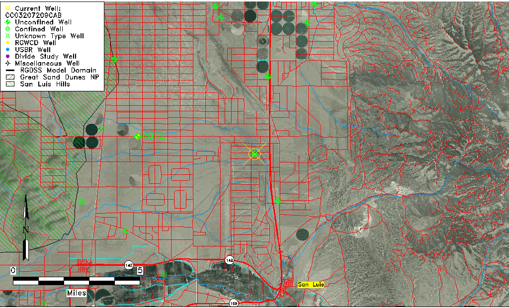
| Common Well ID | CC03207209CAB |
| USGS Well ID | 371637105263501 |
| USGS Station Name | CC03207209CAB |
| USGS Construction Date | 01/01/1966 |
| USGS Site Type | Well |
| USGS Site Use Information | Unused |
| USGS Groundwater Use Information | Unused |
| Data Source(s) | USGS |
| Location Data |
|---|
| TRS | CC03207209CAB |
| USGS TRS 1 | CC03207209CAB |
| USGS TRS | NWNESWS009T0032SR0072WS |
| Longitude/Latitude (NAD83) | -105.44362410 , 37.27695680 |
| Longitude/Latitude Data Source | GWSI decimal LAT/LONG field |
| USGS Longitude/Latitude (NAD83) | -105.443624100 , 37.276956800 |
| Easting, Northing RGDSS-NAD83 (US ft) | 267029.45 , 102406.24 |
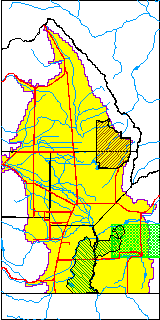
| USGS County | Costilla County |
| Elevation and Depth Data |
|---|
| Ground Elevation (ft NAVD88) | 8001.34 |
| Elevation Data Source | USGS GWSI database |
| USGS Ground Elevation (ft NGVD29) | 7997.00 |
| 1/3-Arc Second NED Ground Elevation (ft NAVD88) | 8006.09 |
| 1-Arc Second NED Ground Elevation (ft NAVD88) | 8009.08 |
| SRTM Ground Elevation (ft NAVD88) | 8002.11 |
| Total Depth (ft) | 190.00 |
| USGS Well Depth (ft) | 190.00 |
| Model Layer | 1 |
| Model Layer Source | Well Depth |
| Depth of Bottom of Layer 1 | 306 |
| Depth of Bottom of Layer 2 | 493 |
| Depth of Bottom of Layer 3 | 735 |
| Depth of Bottom of Layer 4 | 994 |
| Additional Well Information | Geohydrology, Construction |
| Aquifer Information |
|---|
| Aquifer Type | Unconfined |
| Aquifer Type Source | TD Elevation/Model Layer |
| USGS Primary Aquifer | Cenozoic Erathem |
| USGS Hydrologic Unit | Alamosa-Trinchera |
| USGS Data Available | Water-level (GW.LEV) |
| Water-level Database Information |
|---|
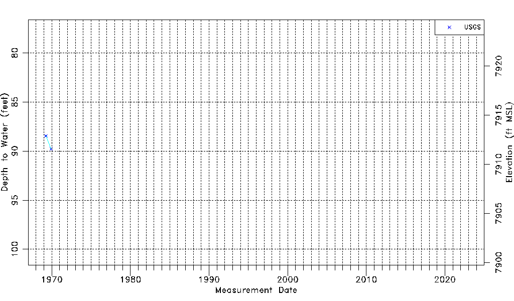
| Water-level Count | 2 |
| Water-level Date Range | 04/06/1969 thru 12/01/1969 |
| Monitored within the last 18 months | No, most recently on 12/01/1969 |
| Depth-to-Water Range (ft) | 88.45 to 89.77 |
| Water Table Elevation Range (ft NAVD88) | 7911.57 to 7912.89 |
| Water-Level-Source:Number-of-Measurements | USGS:2 |