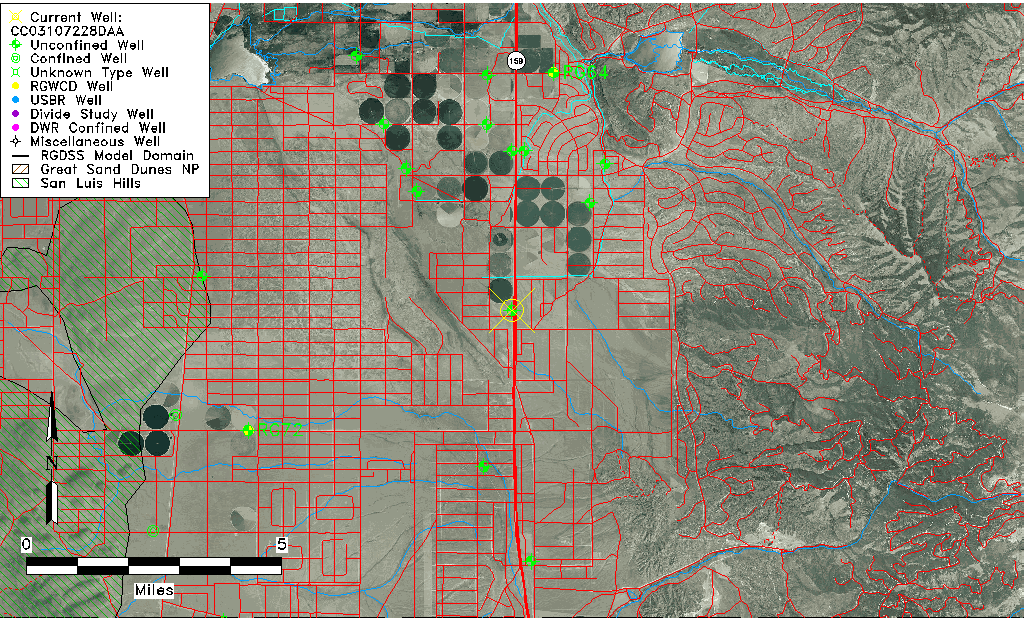
| Well Information Table |
|---|
| Common Well ID | CC03107228DAA |
| USGS Well ID | 371830105263201 |
| USGS Station Name | CC03107228DAA |
| USGS Construction Date | 01/01/1963 |
| USGS Site Type | Well |
| USGS Site Use Information | Withdrawal of Water |
| USGS Groundwater Use Information | Irrigation |
| Data Source(s) | USGS |
| Location Data |
|---|
| TRS | CC03107228DAA |
| USGS TRS 1 | CC03107228DAA |
| USGS TRS | NENESES028T0031SR0072WS |
| Longitude/Latitude (NAD83) | -105.43348470 , 37.32120570 |
| Longitude/Latitude Data Source | GWSI decimal LAT/LONG field |
| USGS Longitude/Latitude (NAD83) | -105.433484700 , 37.321205700 |
| Easting, Northing RGDSS-NAD83 (US ft) | 269937.71 , 118519.17 |
| USGS Topography | Flat Surface |
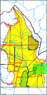
| USGS County | Costilla County |
| Elevation and Depth Data |
|---|
| Ground Elevation (ft NAVD88) | 7967.38 |
| Elevation Data Source | USGS GWSI database |
| USGS Ground Elevation (ft NGVD29) | 7963.00 |
| 1/3-Arc Second NED Ground Elevation (ft NAVD88) | 7968.41 |
| 1-Arc Second NED Ground Elevation (ft NAVD88) | 7970.51 |
| SRTM Ground Elevation (ft NAVD88) | 7969.77 |
| Total Depth (ft) | 356.00 |
| USGS Well Depth (ft) | 356.00 |
| Model Layer | 1 |
| Model Layer Source | Well Depth |
| Depth of Bottom of Layer 1 | 390 |
| Depth of Bottom of Layer 2 | 553 |
| Depth of Bottom of Layer 3 | 693 |
| Depth of Bottom of Layer 4 | 899 |
| Additional Well Information | Geohydrology, Construction |
| Aquifer Information |
|---|
| Aquifer Type | Unconfined |
| Aquifer Type Source | TD Elevation/Model Layer |
| USGS Primary Aquifer | Cenozoic Erathem |
| USGS Aquifer Type | Unconfined Single Aquifer |
| USGS Hydrologic Unit | Alamosa-Trinchera |
| USGS Data Available | Water-level (GW.LEV) |
| Water-level Database Information |
|---|
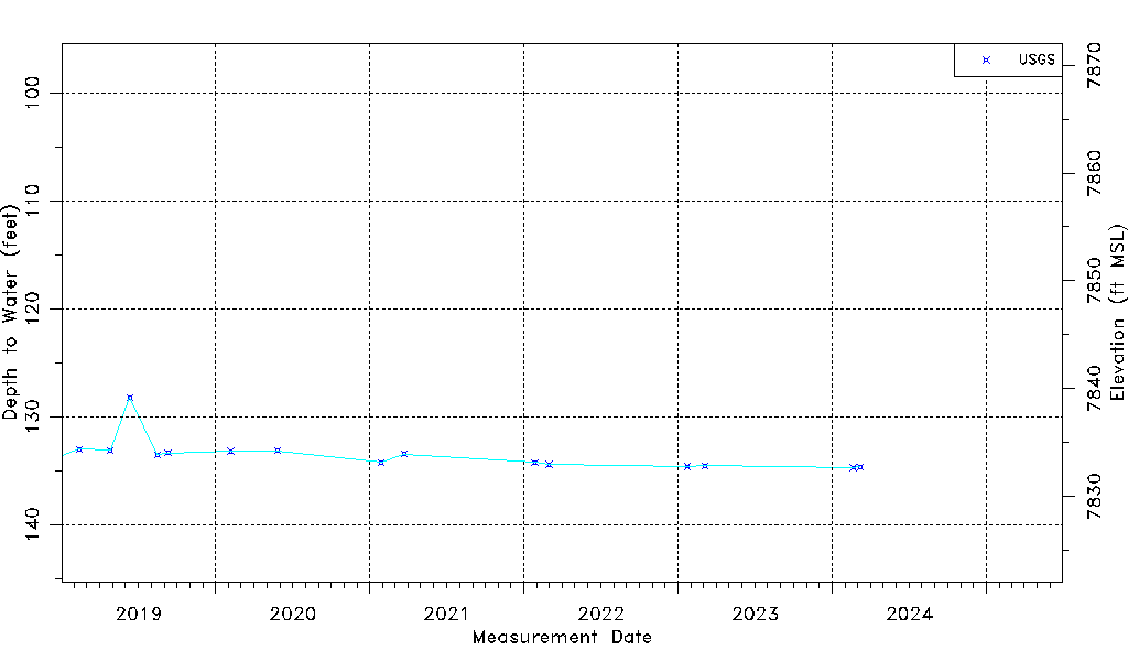
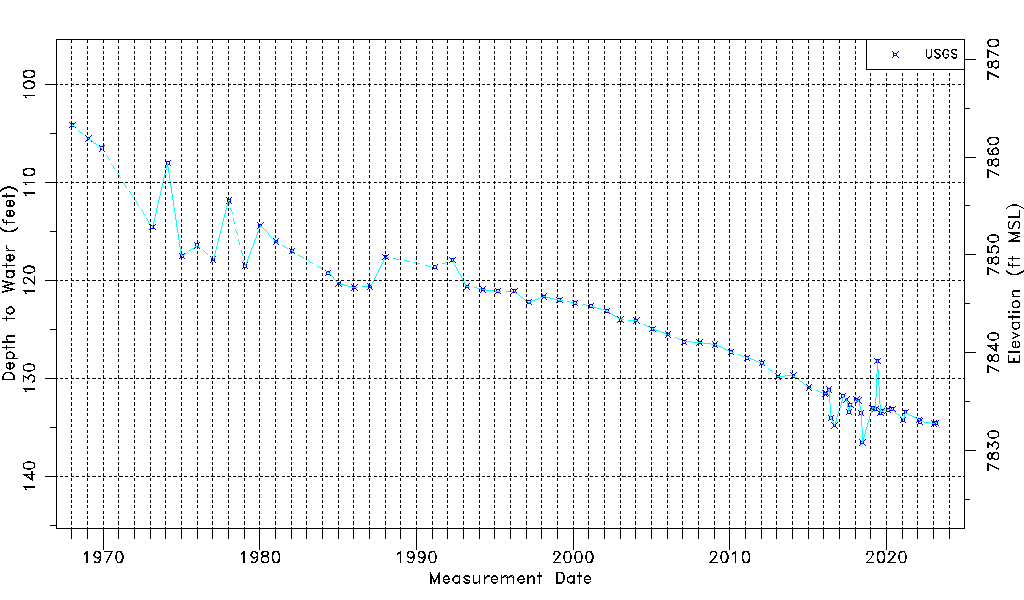
| Water-level Count | 72 |
| Water-level Date Range | 01/16/1968 thru 03/10/2025 |
| Monitored within the last 18 months | Yes, most recently on 03/10/2025 |
| Depth-to-Water Range (ft) | 104.10 to 136.55 |
| Water Table Elevation Range (ft NAVD88) | 7830.83 to 7863.28 |
| Water-Level-Source:Number-of-Measurements | USGS:72 |