| Well Information Table |
|---|
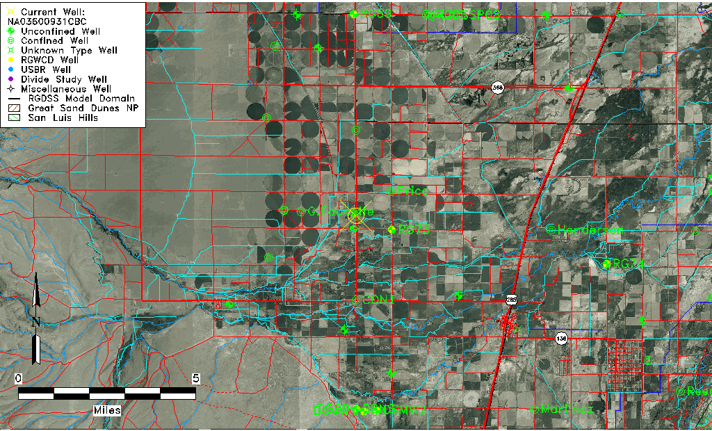
| Common Well ID | NA03600931CBC |
| USGS Well ID | 371840106021501 |
| USGS Station Name | NA03600931CBC |
| USGS Construction Date | 01/01/1944 |
| USGS Site Type | Well |
| USGS Site Use Information | Withdrawal of Water |
| USGS Groundwater Use Information | Irrigation |
| Data Source(s) | USGS |
| Location Data |
|---|
| TRS | NA03600931CBC |
| USGS TRS 1 | NA03600931CBC |
| USGS TRS | SWNWSWS031T0036NR0009EN |
| Longitude/Latitude (NAD83) | -106.03796990 , 37.31839586 |
| Longitude/Latitude Data Source | GWSI decimal LAT/LONG field |
| USGS Longitude/Latitude (NAD83) | -106.037969900 , 37.318395860 |
| Easting, Northing RGDSS-NAD83 (US ft) | 94210.73 , 117612.94 |
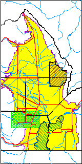
| USGS County | Conejos County |
| Elevation and Depth Data |
|---|
| Ground Elevation (ft NAVD88) | 7672.19 |
| Elevation Data Source | USGS GWSI database |
| USGS Ground Elevation (ft NGVD29) | 7668.00 |
| 1/3-Arc Second NED Ground Elevation (ft NAVD88) | 7670.10 |
| 1-Arc Second NED Ground Elevation (ft NAVD88) | 7668.94 |
| SRTM Ground Elevation (ft NAVD88) | 7669.35 |
| Total Depth (ft) | 195.00 |
| USGS Well Depth (ft) | 195.00 |
| Model Layer | 2 |
| Model Layer Source | Well Depth |
| Depth of Bottom of Layer 1 | 40 |
| Depth of Bottom of Layer 2 | 193 |
| Depth of Bottom of Layer 3 | 279 |
| Depth of Bottom of Layer 4 | 1803 |
| Additional Well Information | Geohydrology, Construction |
| Aquifer Information |
|---|
| Aquifer Type | Confined |
| Aquifer Type Source | TD Elevation/Model Layer |
| USGS Primary Aquifer | Cenozoic Erathem |
| USGS Aquifer Type | Confined Single Aquifer |
| USGS Hydrologic Unit | Alamosa-Trinchera |
| USGS Data Available | Water-level (GW.LEV) |
| Water-level Database Information |
|---|
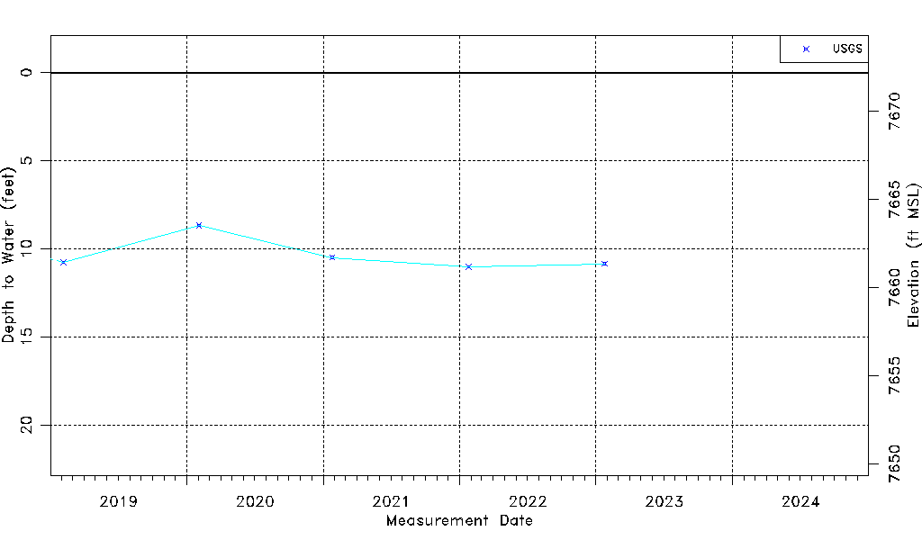
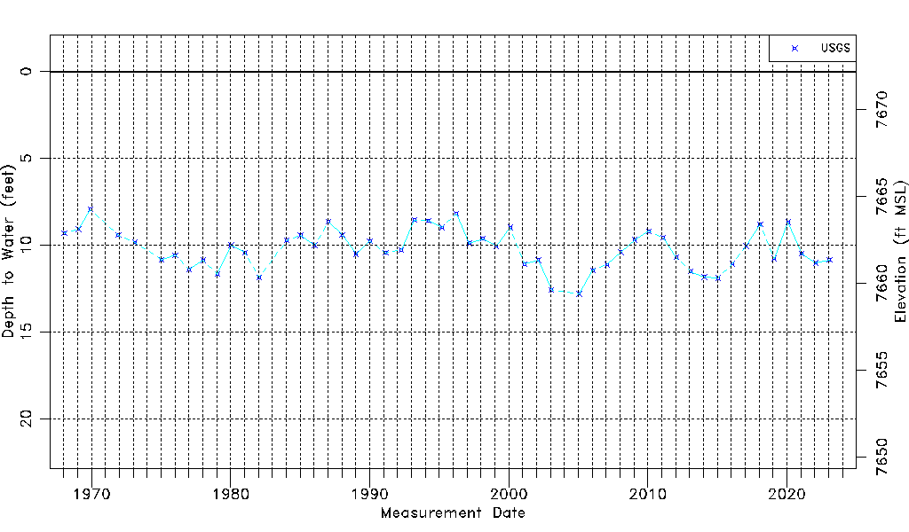
| Water-level Count | 53 |
| Water-level Date Range | 01/16/1968 thru 02/21/2024 |
| Monitored within the last 18 months | No, most recently on 02/21/2024 |
| Depth-to-Water Range (ft) | 7.94 to 12.80 |
| Water Table Elevation Range (ft NAVD88) | 7659.39 to 7664.25 |
| Water-Level-Source:Number-of-Measurements | USGS:53 |