| Well Information Table |
|---|
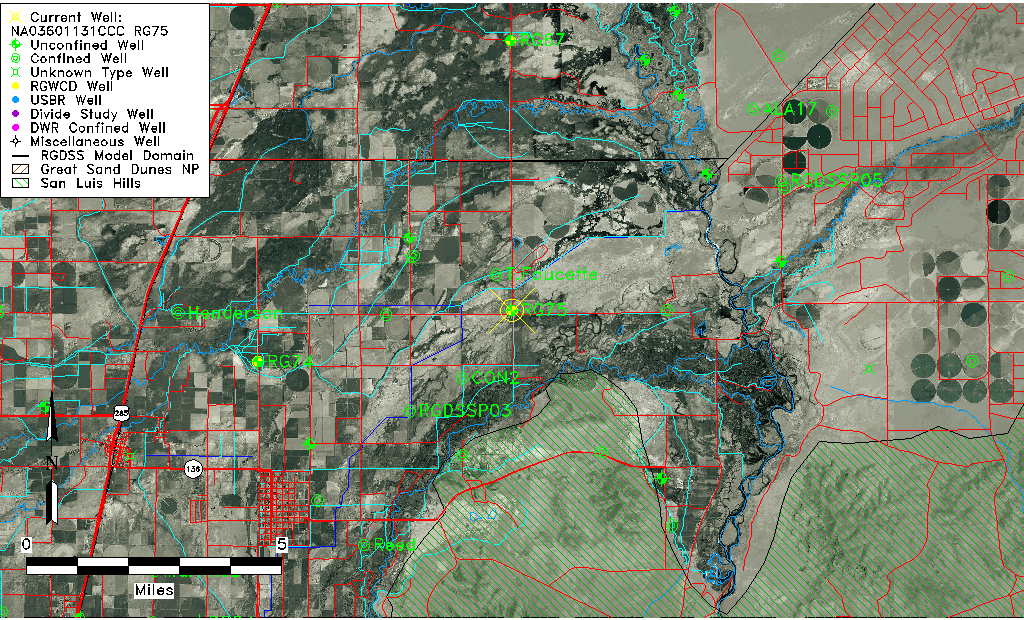
| Common Well ID | NA03601131CCC RG75 |
| RGWCD Well ID | RG75 |
| USGS Well ID | 371850105491301 |
| USGS Station Name | NA03601131CCC RG75 |
| USGS Construction Date | 01/01/1976 |
| USGS Site Type | Well |
| USGS Site Use Information | Observation |
| USGS Groundwater Use Information | Unused |
| Data Source(s) | USGS, RGWCD |
| Location Data |
|---|
| TRS | NA03601131CCC RG75 |
| RGWCD TRS | NA03601131CCC |
| USGS TRS 1 | NA03601131CCC RG75 |
| Longitude/Latitude (NAD83) | -105.81967500 , 37.31378333 |
| Longitude/Latitude Data Source | RGWCD/Davis Engineering |
| RGWCD Longitude/Latitude (NAD83) | -105:49:10.83 , 37:18:49.62 |
| USGS Longitude/Latitude (NAD83) | -105.820853400 , 37.313897680 |
| Easting, Northing RGDSS-NAD83 (US ft) | 157670.21 , 115762.25 |
| USGS Topography | Valley flat |
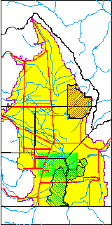
| USGS County | Conejos County |
| Elevation and Depth Data |
|---|
| Ground Elevation (ft NAVD88) | 7540.30 |
| Elevation Data Source | RGWCD well database |
| RGWCD Measuring Point Elevation (ft NAVD88) | 7541.600 |
| RGWCD Well Riser Height (ft) | 1.300 |
| RGWCD Ground Surface (ft NAVD88) | 7540.30 |
| USGS Ground Elevation (ft NGVD29) | 7532.00 |
| 1/3-Arc Second NED Ground Elevation (ft NAVD88) | 7538.66 |
| 1-Arc Second NED Ground Elevation (ft NAVD88) | 7538.94 |
| SRTM Ground Elevation (ft NAVD88) | 7538.47 |
| Total Depth (ft) | 30.00 |
| USGS Well Depth (ft) | 30.00 |
| Model Layer | 1 |
| Model Layer Source | RGWCD |
| Depth of Bottom of Layer 1 | 22 |
| Depth of Bottom of Layer 2 | 352 |
| Depth of Bottom of Layer 3 | 593 |
| Depth of Bottom of Layer 4 | 1969 |
| Additional Well Information | Logs, Geohydrology, Construction |
| Aquifer Information |
|---|
| Aquifer Type | Unconfined |
| Aquifer Type Source | RGWCD_AQ |
| USGS Primary Aquifer | Cenozoic Erathem |
| USGS Aquifer Type | Unconfined Single Aquifer |
| USGS Hydrologic Unit | Alamosa-Trinchera |
| USGS Data Available | Water-level (GW.LEV) |
| Water-level Database Information |
|---|
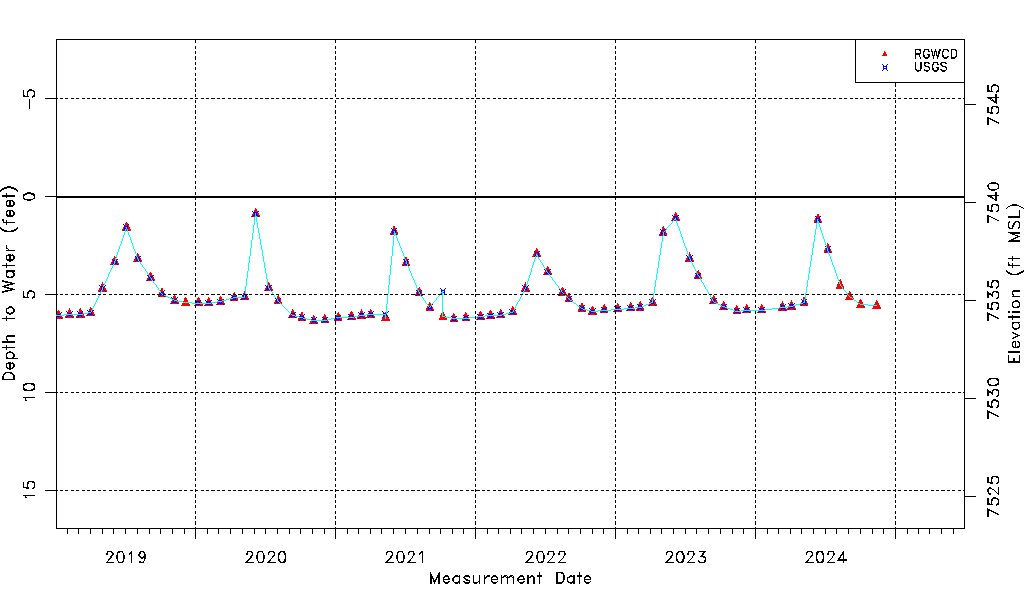
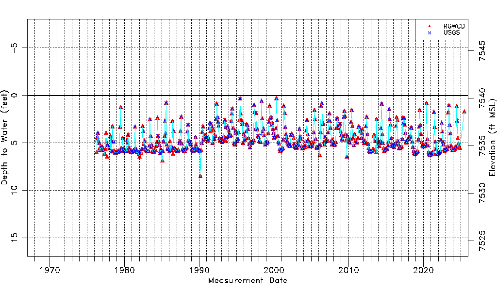
| Water-level Count | 622 |
| Water-level Date Range | 04/15/1976 thru 07/02/2026 |
| Monitored within the last 18 months | Yes, most recently on 07/02/2026 |
| Depth-to-Water Range (ft) | 0.34 to 8.55 |
| Water Table Elevation Range (ft NAVD88) | 7531.75 to 7539.96 |
| Water-Level-Source:Number-of-Measurements | RGWCD:596 USGS:560 |