| Well Information Table |
|---|
| Common Well ID | NA03601026CBB |
| USGS Well ID | 372003105511501 |
| USGS Station Name | NA03601026CBB |
| USGS Construction Date | 01/01/1968 |
| USGS Site Type | Well |
| USGS Site Use Information | Observation |
| USGS Groundwater Use Information | Unused |
| Data Source(s) | USGS |
| Location Data |
|---|
| TRS | NA03601026CBB |
| USGS TRS 1 | NA03601026CBB |
| USGS TRS | NWNWSWS026T0036NR0010EN |
| Longitude/Latitude (NAD83) | -105.85620980 , 37.33435523 |
| Longitude/Latitude Data Source | Davis Engineering Survey |
| USGS Longitude/Latitude (NAD83) | -105.856215400 , 37.334341340 |
| Easting, Northing RGDSS-NAD83 (US ft) | 147062.93 , 123268.92 |
| USGS Topography | Valley flat |
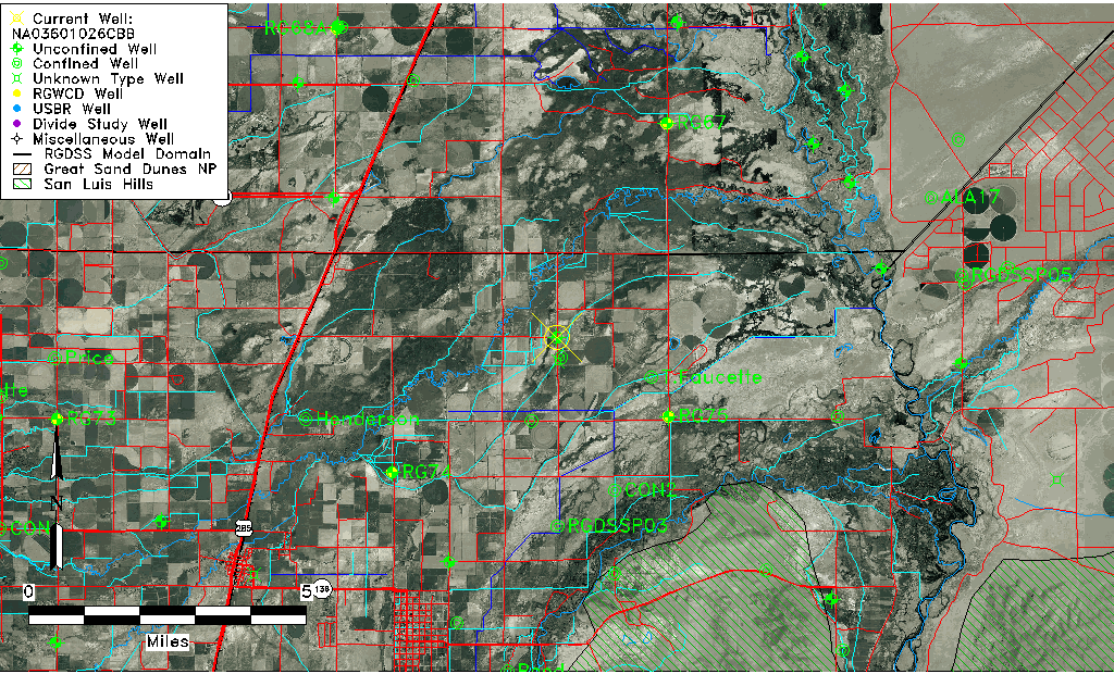
| USGS County | Conejos County |
| USGS Map Name | PIKES STOCKADE |
| USGS Map Scale | 24000 |
| Elevation and Depth Data |
|---|
| Ground Elevation (ft NAVD88) | 7553.76 |
| Elevation Data Source | Davis Engineering Survey |
| USGS Ground Elevation (ft NGVD29) | 7552.00 |
| 1/3-Arc Second NED Ground Elevation (ft NAVD88) | 7553.97 |
| 1-Arc Second NED Ground Elevation (ft NAVD88) | 7554.55 |
| SRTM Ground Elevation (ft NAVD88) | 7550.27 |
| Total Depth (ft) | 14.00 |
| USGS Well Depth (ft) | 14.00 |
| Model Layer | 1 |
| Model Layer Source | Well Depth |
| Depth of Bottom of Layer 1 | 41 |
| Depth of Bottom of Layer 2 | 435 |
| Depth of Bottom of Layer 3 | 685 |
| Depth of Bottom of Layer 4 | 2124 |
| Additional Well Information | Geohydrology, Construction |
| Aquifer Information |
|---|
| Aquifer Type | Unconfined |
| Aquifer Type Source | TD Elevation/Model Layer |
| USGS Primary Aquifer | Cenozoic Erathem |
| USGS Aquifer Type | Unconfined Single Aquifer |
| USGS Hydrologic Unit | Alamosa-Trinchera |
| USGS Data Available | Water-level (GW.LEV) |
| Water-level Database Information |
|---|
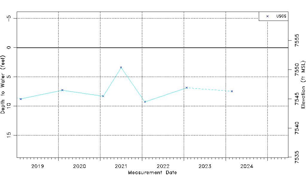
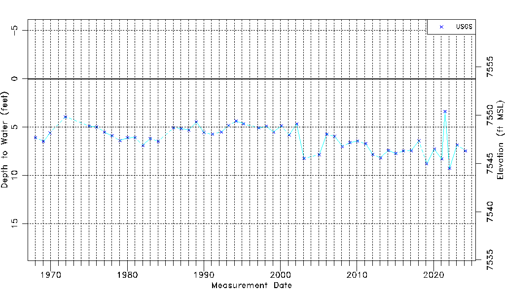
| Water-level Count | 52 |
| Water-level Date Range | 01/16/1968 thru 02/23/2024 |
| Monitored within the last 18 months | No, most recently on 02/23/2024 |
| Depth-to-Water Range (ft) | 3.40 to 9.27 |
| Water Table Elevation Range (ft NAVD88) | 7544.49 to 7550.36 |
| Water-Level-Source:Number-of-Measurements | USGS:52 |