| Well Information Table |
|---|
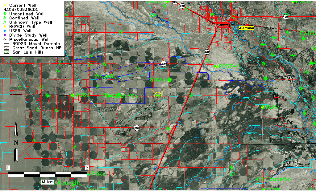
| Common Well ID | NA03700936CDC |
| USGS Well ID | 372401105563001 |
| USGS Station Name | NA03700936CDC |
| USGS Construction Date | 08/13/1993 |
| USGS Site Type | Well |
| USGS Site Use Information | Observation |
| USGS Groundwater Use Information | Unused |
| Data Source(s) | USGS |
| Location Data |
|---|
| TRS | NA03700936CDC |
| USGS TRS 1 | NA03700936CDC |
| USGS TRS | SWSESWS 36T 37NR 9E |
| Longitude/Latitude (NAD83) | -105.94117220 , 37.40068330 |
| Longitude/Latitude Data Source | GWSI decimal LAT/LONG field |
| USGS Longitude/Latitude (NAD83) | -105.941172200 , 37.400683300 |
| Easting, Northing RGDSS-NAD83 (US ft) | 122437.00 , 147471.76 |
| USGS Topography | Valley flat |
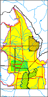
| USGS County | Alamosa County |
| USGS Map Name | ALAMOSA WEST |
| USGS Map Scale | 2400 |
| Elevation and Depth Data |
|---|
| Ground Elevation (ft NAVD88) | 7562.00 |
| Elevation Data Source | USGS GWSI database |
| USGS Ground Elevation (ft NAVD88) | 7562.00 |
| 1/3-Arc Second NED Ground Elevation (ft NAVD88) | 7563.07 |
| 1-Arc Second NED Ground Elevation (ft NAVD88) | 7560.73 |
| SRTM Ground Elevation (ft NAVD88) | 7565.23 |
| Total Depth (ft) | 14.70 |
| USGS Hole Depth (ft) | 15.00 |
| USGS Well Depth (ft) | 14.70 |
| Model Layer | 1 |
| Model Layer Source | Well Depth |
| Depth of Bottom of Layer 1 | 38 |
| Depth of Bottom of Layer 2 | 314 |
| Depth of Bottom of Layer 3 | 672 |
| Depth of Bottom of Layer 4 | 2177 |
| Additional Well Information | Logs, Geohydrology, Construction, Aquifer |
| Aquifer Information |
|---|
| Aquifer Type | Unconfined |
| Aquifer Type Source | TD Elevation/Model Layer |
| USGS Primary Aquifer | 112ALMS |
| USGS Aquifer Type | Unconfined Single Aquifer |
| USGS Hydrologic Unit | Alamosa-Trinchera |
| USGS Data Available | Water-level (GW.LEV) |
| Water-level Database Information |
|---|
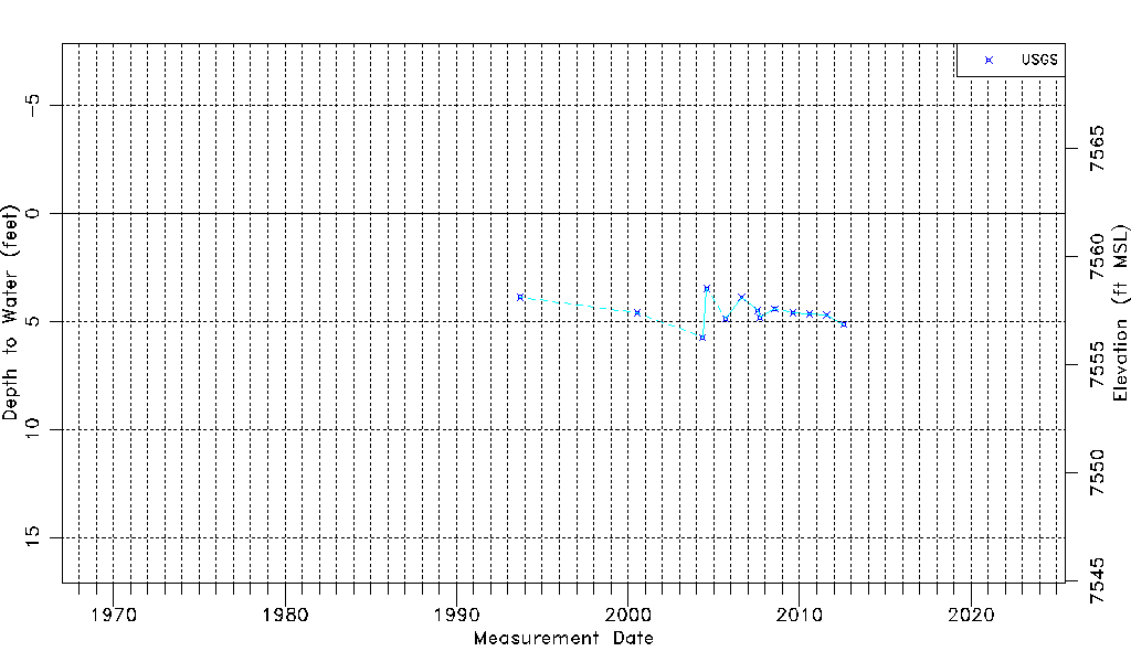
| Water-level Count | 13 |
| Water-level Date Range | 09/16/1993 thru 07/27/2012 |
| Monitored within the last 18 months | No, most recently on 07/27/2012 |
| Depth-to-Water Range (ft) | 3.49 to 5.74 |
| Water Table Elevation Range (ft NAVD88) | 7556.26 to 7558.51 |
| Water-Level-Source:Number-of-Measurements | USGS:13 |