| Well Information Table |
|---|
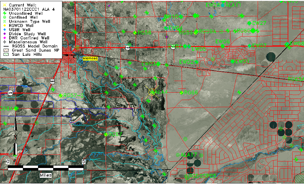
| Common Well ID | NA03701122CCC1 ALA 4 |
| RGWCD Confined Aquifer Well ID | ALA4 |
| USGS Well ID | 372550105455001 |
| USGS Station Name | NA03701122CCC1 ALA 4 |
| USGS Construction Date | 01/01/1957 |
| USGS Site Type | Well |
| USGS Site Use Information | Withdrawal of Water |
| USGS Groundwater Use Information | Other |
| Data Source(s) | USGS |
| Location Data |
|---|
| TRS | NA03701122CCC1 ALA 4 |
| USGS TRS 1 | NA03701122CCC1 ALA 4 |
| USGS TRS | SWSWSWS022T0037NR0011EN |
| Longitude/Latitude (NAD83) | -105.76506195 , 37.43097467 |
| Longitude/Latitude Data Source | Davis Engineering Survey |
| USGS Longitude/Latitude (NAD83) | -105.765194400 , 37.430972200 |
| Easting, Northing RGDSS-NAD83 (US ft) | 173589.75 , 158399.50 |
| USGS Topography | Valley flat |
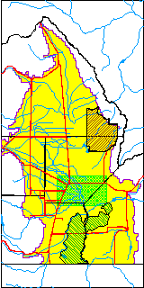
| USGS County | Alamosa County |
| USGS Map Name | ALAMOSA EAST |
| USGS Map Scale | 24000 |
| Elevation and Depth Data |
|---|
| Ground Elevation (ft NAVD88) | 7524.09 |
| Elevation Data Source | Davis Engineering Survey |
| USGS Ground Elevation (ft NAVD88) | 7524.09 |
| 1/3-Arc Second NED Ground Elevation (ft NAVD88) | 7521.54 |
| 1-Arc Second NED Ground Elevation (ft NAVD88) | 7522.09 |
| SRTM Ground Elevation (ft NAVD88) | 7523.02 |
| Total Depth (ft) | 2062.00 |
| USGS Well Depth (ft) | 2062.00 |
| Model Layer | 4 |
| Model Layer Source | Well Depth |
| Depth of Bottom of Layer 1 | 44 |
| Depth of Bottom of Layer 2 | 153 |
| Depth of Bottom of Layer 3 | 592 |
| Depth of Bottom of Layer 4 | 2162 |
| Additional Well Information | Logs, Geohydrology, Construction |
| Aquifer Information |
|---|
| Aquifer Type | Confined |
| Aquifer Type Source | RGWCD_AQ |
| USGS Primary Aquifer | Cenozoic Erathem |
| USGS Aquifer Type | Confined Single Aquifer |
| USGS Hydrologic Unit | Alamosa-Trinchera |
| USGS Data Available | Water-level (GW.LEV) |
| Water-level Database Information |
|---|
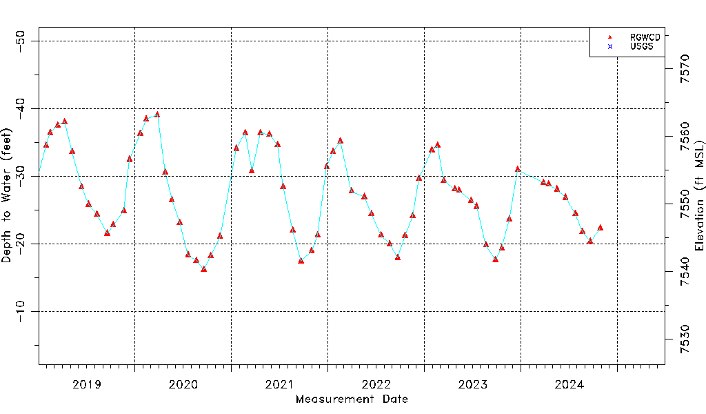
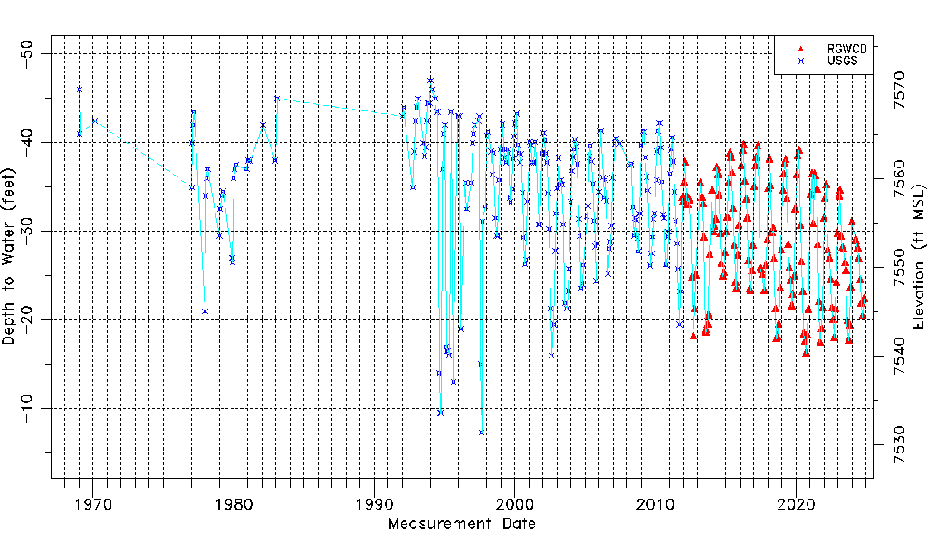
| Water-level Count | 363 |
| Water-level Date Range | 01/20/1969 thru 03/23/2026 |
| Monitored within the last 18 months | Yes, most recently on 03/23/2026 |
| Depth-to-Water Range (ft) | -47.00 to -7.27 |
| Water Table Elevation Range (ft NAVD88) | 7531.36 to 7571.09 |
| Water-Level-Source:Number-of-Measurements | RGWCD:151 USGS:212 |