| Well Information Table |
|---|
| Common Well ID | NA03701122CCC-ANWR-P8 |
| USGS Well ID | 372550105455002 |
| USGS Station Name | NA03701122CCC-ANWR-P8 |
| USGS Construction Date | 02/22/1994 |
| USGS Site Type | Well |
| USGS Site Use Information | Observation |
| USGS Groundwater Use Information | Unused |
| Data Source(s) | USGS |
| Location Data |
|---|
| TRS | NA03701122CCC-ANWR-P8 |
| USGS TRS 1 | NA03701122CCC-ANWR-P8 |
| USGS TRS | SWSWSWS22 T37N R11E N |
| Longitude/Latitude (NAD83) | -105.76390780 , 37.43056198 |
| Longitude/Latitude Data Source | GWSI decimal LAT/LONG field |
| USGS Longitude/Latitude (NAD83) | -105.763907800 , 37.430561980 |
| Easting, Northing RGDSS-NAD83 (US ft) | 173924.63 , 158248.95 |
| USGS Topography | Alluvial or Marine Terrace |
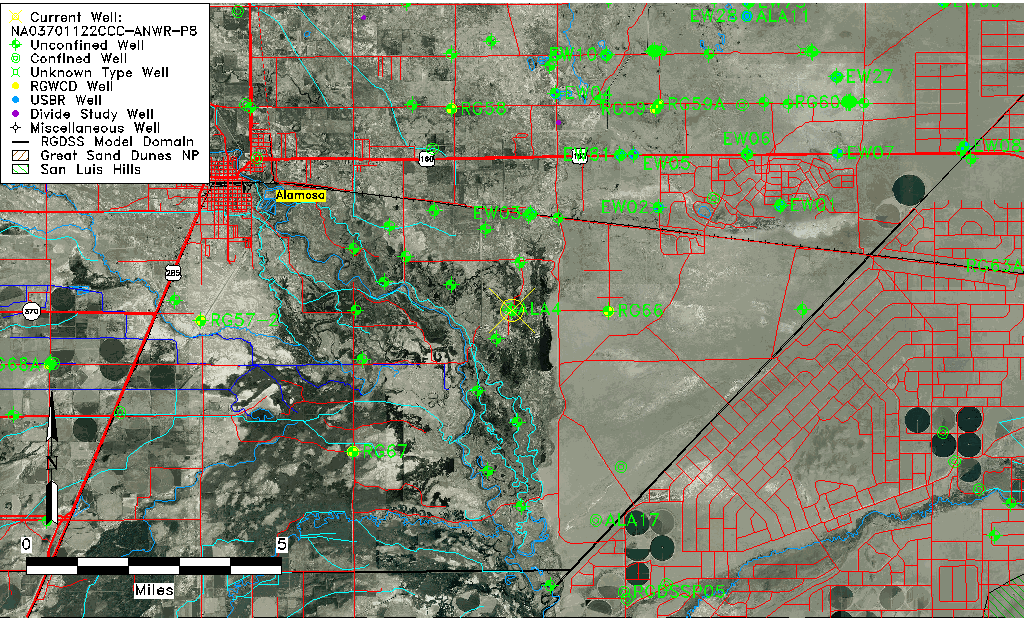
| USGS County | Alamosa County |
| USGS Map Name | ALAMOSA EAST |
| USGS Map Scale | 24000 |
| Elevation and Depth Data |
|---|
| Ground Elevation (ft NAVD88) | 7523.41 |
| Elevation Data Source | USGS GWSI database |
| USGS Ground Elevation (ft NGVD29) | 7519.41 |
| 1/3-Arc Second NED Ground Elevation (ft NAVD88) | 7521.33 |
| 1-Arc Second NED Ground Elevation (ft NAVD88) | 7521.06 |
| SRTM Ground Elevation (ft NAVD88) | 7522.67 |
| Total Depth (ft) | 15.00 |
| USGS Hole Depth (ft) | 15.00 |
| USGS Well Depth (ft) | 15.00 |
| Model Layer | 1 |
| Model Layer Source | Well Depth |
| Depth of Bottom of Layer 1 | 44 |
| Depth of Bottom of Layer 2 | 152 |
| Depth of Bottom of Layer 3 | 589 |
| Depth of Bottom of Layer 4 | 2154 |
| Additional Well Information | Geohydrology, Construction |
| Aquifer Information |
|---|
| Aquifer Type | Unconfined |
| Aquifer Type Source | TD Elevation/Model Layer |
| USGS Primary Aquifer | Cenozoic Erathem |
| USGS Aquifer Type | Unconfined Single Aquifer |
| USGS Hydrologic Unit | Alamosa-Trinchera |
| USGS Data Available | Water-level (GW.LEV) |
| Water-level Database Information |
|---|
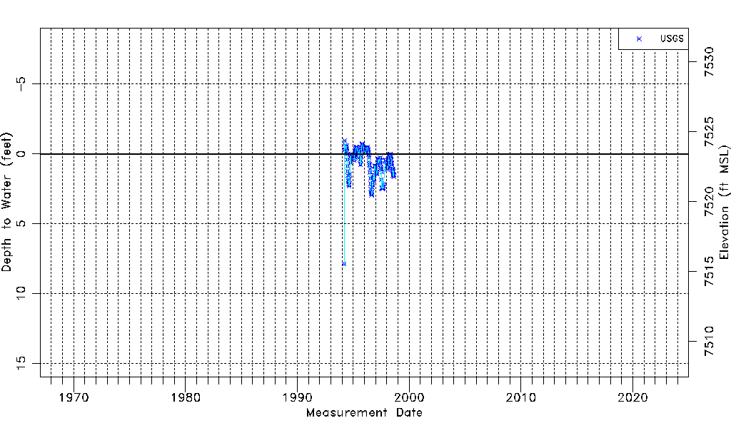
| Water-level Count | 195 |
| Water-level Date Range | 03/15/1994 thru 08/27/1998 |
| Monitored within the last 18 months | No, most recently on 08/27/1998 |
| Depth-to-Water Range (ft) | -0.94 to 7.88 |
| Water Table Elevation Range (ft NAVD88) | 7515.53 to 7524.35 |
| Water-Level-Source:Number-of-Measurements | USGS:195 |