| Well Information Table |
|---|
| Common Well ID | CC03007318ADA RG63A |
| RGWCD Well ID | RG63A |
| USGS Well ID | 372610105345501 |
| USGS Station Name | CC03007318ADA RG63A |
| USGS Construction Date | 01/01/1954 |
| USGS Site Type | Well |
| USGS Site Use Information | Unused |
| USGS Groundwater Use Information | Unused |
| Data Source(s) | USGS, RGWCD |
| Location Data |
|---|
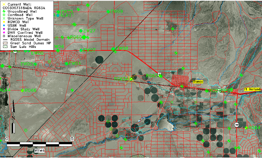
| TRS | CC03007318ADA RG63A |
| RGWCD TRS | CC03007318ADA |
| USGS TRS 1 | CC03007318ADA RG63A |
| USGS TRS | NESENES018T0030SR0073WS |
| Longitude/Latitude (NAD83) | -105.57861667 , 37.44311389 |
| Longitude/Latitude Data Source | RGWCD/Davis Engineering |
| RGWCD Longitude/Latitude (NAD83) | -105:34:43.02 , 37:26:35.21 |
| USGS Longitude/Latitude (NAD83) | -105.582514300 , 37.436118460 |
| Easting, Northing RGDSS-NAD83 (US ft) | 227705.35 , 162817.81 |
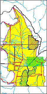
| USGS County | Costilla County |
| Elevation and Depth Data |
|---|
| Ground Elevation (ft NAVD88) | 7672.50 |
| Elevation Data Source | RGWCD well database |
| RGWCD Measuring Point Elevation (ft NAVD88) | 7673.000 |
| RGWCD Well Riser Height (ft) | 0.500 |
| RGWCD Ground Surface (ft NAVD88) | 7672.50 |
| USGS Ground Elevation (ft NGVD29) | 7670.00 |
| 1/3-Arc Second NED Ground Elevation (ft NAVD88) | 7672.07 |
| 1-Arc Second NED Ground Elevation (ft NAVD88) | 7672.44 |
| SRTM Ground Elevation (ft NAVD88) | 7677.10 |
| Total Depth (ft) | 193.00 |
| USGS Well Depth (ft) | 193.00 |
| Model Layer | 1 |
| Model Layer Source | RGWCD |
| Depth of Bottom of Layer 1 | 280 |
| Depth of Bottom of Layer 2 | 380 |
| Depth of Bottom of Layer 3 | 588 |
| Depth of Bottom of Layer 4 | 1699 |
| Additional Well Information | Geohydrology, Construction |
| Aquifer Information |
|---|
| Aquifer Type | Unconfined |
| Aquifer Type Source | RGWCD_AQ |
| USGS Primary Aquifer | Cenozoic Erathem |
| USGS Aquifer Type | Unconfined Single Aquifer |
| USGS Hydrologic Unit | Alamosa-Trinchera |
| USGS Data Available | Water-level (GW.LEV) |
| Water-level Database Information |
|---|
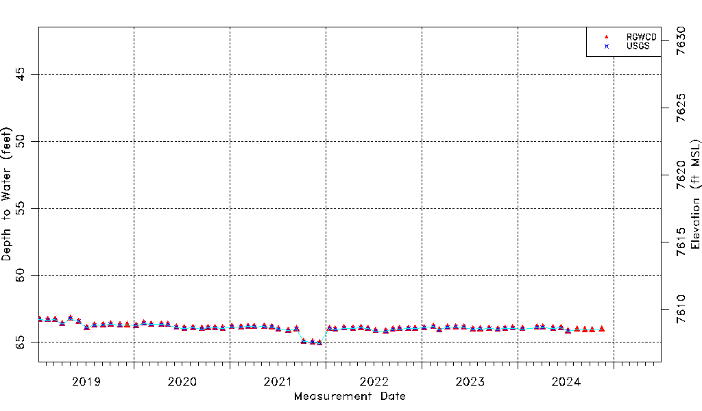
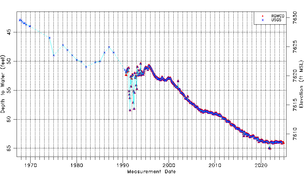
| Water-level Count | 465 |
| Water-level Date Range | 09/01/1967 thru 06/11/2026 |
| Monitored within the last 18 months | Yes, most recently on 06/11/2026 |
| Depth-to-Water Range (ft) | 42.85 to 65.06 |
| Water Table Elevation Range (ft NAVD88) | 7607.44 to 7629.65 |
| Water-Level-Source:Number-of-Measurements | RGWCD:423 USGS:415 |