| Well Information Table |
|---|
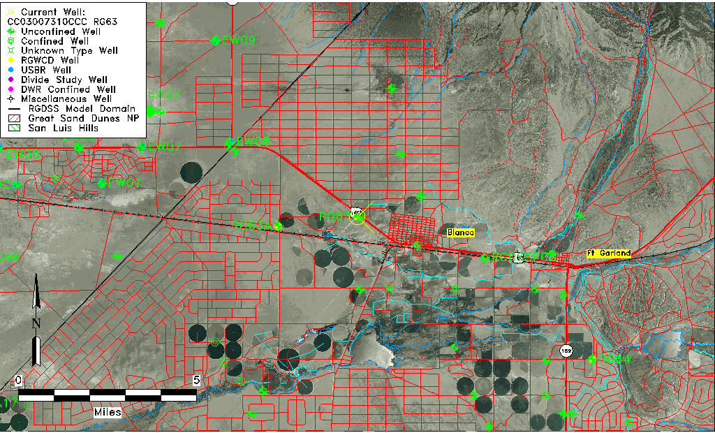
| Common Well ID | CC03007310CCC RG63 |
| RGWCD Well ID | RG63 |
| USGS Well ID | 372648105321501 |
| USGS Station Name | CC03007310CCC RG63 |
| USGS Site Type | Well |
| USGS Site Use Information | Observation |
| USGS Groundwater Use Information | Unused |
| Data Source(s) | USGS, RGWCD |
| Location Data |
|---|
| TRS | CC03007310CCC RG63 |
| RGWCD TRS | CC03007310CCC |
| USGS TRS 1 | CC03007310CCC RG63 |
| USGS TRS | SWSWSWS010T0030SR0073WS |
| Longitude/Latitude (NAD83) | -105.53806870 , 37.44667399 |
| Longitude/Latitude Data Source | GWSI decimal LAT/LONG field |
| USGS Longitude/Latitude (NAD83) | -105.538068700 , 37.446673990 |
| Easting, Northing RGDSS-NAD83 (US ft) | 239471.41 , 164127.74 |
| USGS Topography | Valley flat |
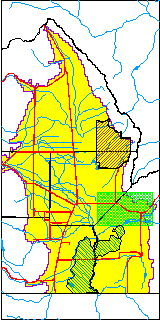
| USGS County | Costilla County |
| Elevation and Depth Data |
|---|
| Ground Elevation (ft NAVD88) | 7727.38 |
| Elevation Data Source | USGS GWSI database |
| RGWCD Measuring Point Elevation (ft NGVD29) | 0.000 |
| RGWCD Well Riser Height (ft) | 0.000 |
| USGS Ground Elevation (ft NGVD29) | 7723.00 |
| 1/3-Arc Second NED Ground Elevation (ft NAVD88) | 7724.85 |
| 1-Arc Second NED Ground Elevation (ft NAVD88) | 7724.26 |
| SRTM Ground Elevation (ft NAVD88) | 7732.70 |
| Total Depth (ft) | 19.00 |
| USGS Well Depth (ft) | 19.00 |
| Model Layer | 1 |
| Model Layer Source | RGWCD |
| Depth of Bottom of Layer 1 | 408 |
| Depth of Bottom of Layer 2 | 508 |
| Depth of Bottom of Layer 3 | 700 |
| Depth of Bottom of Layer 4 | 1842 |
| Additional Well Information | Geohydrology, Construction |
| Aquifer Information |
|---|
| Aquifer Type | Unconfined |
| Aquifer Type Source | RGWCD_AQ |
| USGS Primary Aquifer | Cenozoic Erathem |
| USGS Hydrologic Unit | Alamosa-Trinchera |
| USGS Data Available | Water-level (GW.LEV) |
| Water-level Database Information |
|---|
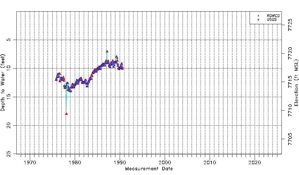
| Water-level Count | 179 |
| Water-level Date Range | 11/05/1975 thru 07/31/1990 |
| Monitored within the last 18 months | No, most recently on 07/31/1990 |
| Depth-to-Water Range (ft) | 7.05 to 18.00 |
| Water Table Elevation Range (ft NAVD88) | 7709.38 to 7720.33 |
| Water-Level-Source:Number-of-Measurements | RGWCD:176 USGS:168 |